Category:Rail transport maps of Maryland
States of the United States: Alaska · Arizona · California · Colorado · Connecticut · Delaware · Florida · Georgia · Idaho · Illinois · Indiana · Iowa · Kentucky · Maine · Maryland · Massachusetts · Michigan · Minnesota · Mississippi · Missouri · Nevada · New Hampshire · New Jersey · New Mexico · New York · North Dakota · Ohio · Oregon · Pennsylvania · Rhode Island · Texas · Utah · Vermont · Virginia · Washington · Wisconsin – Washington, D.C.
Subcategories
This category has the following 4 subcategories, out of 4 total.
M
- Maps of Baltimore Light Rail (7 F)
- Maps of Baltimore Metro (5 F)
- Maps of Conrail (10 F)
T
Media in category "Rail transport maps of Maryland"
The following 23 files are in this category, out of 23 total.
-
 1839 Gettysburg RR Map planned.jpg 10,075 × 3,819; 17.46 MB
-
 1883 Washington Atlantic RR with wicomico rr.jpg 1,528 × 1,081; 561 KB
-
 1890s Philadelphia, Wilmington and Baltimore map.jpg 1,000 × 1,393; 920 KB
-
 1916 PRR Val map for Central of Maryland - map key.png 3,082 × 1,285; 5.22 MB
-
 1918 ICC YHF system map.png 1,891 × 1,614; 2.06 MB
-
 Annapolis and Elk Ridge Railroad on 1895 map.jpg 287 × 218; 48 KB
-
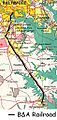 B&A Map.JPG 244 × 512; 44 KB
-
 B&O Royal Blue map.png 1,091 × 729; 1.29 MB
-
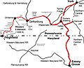
 Bachman Valley Railroad map.jpg 662 × 720; 432 KB
-
 Baltimore & Harrisburg Rwy map.jpg 1,244 × 1,001; 261 KB
-
 Baltimore Rail Plan.svg 3,600 × 3,200; 160 KB
-
 C&PD RR map 1895.jpg 593 × 712; 553 KB
-
 Canton RR map.jpg 351 × 380; 77 KB
-

-
 Frederick and Pennsylvania Line railroad from 1873 map.png 603 × 459; 480 KB
-
 Index Map of the Maryland and Pennsylvania Railroad - NARA - 124451353.jpg 3,296 × 5,100; 2 MB
-
 LO&S RR map 1895.jpg 960 × 720; 205 KB
-
 Map scan082.jpg 3,467 × 2,340; 2.43 MB
-

-
 United Railways map of Baltimore 1910.jpg 8,495 × 4,670; 14.15 MB
-
 Washington, Baltimore and Annapolis Railroad line map.jpg 800 × 800; 59 KB
-
 Western Maryland Railway 1950s.svg 990 × 765; 42 KB
-
 William Rich Hutton Metropolitan Railroad Map.png 4,500 × 2,975; 18.7 MB


.jpg)


