Category:Rail transport maps of Nord
Media in category "Rail transport maps of Nord"
The following 7 files are in this category, out of 7 total.
-
 Railway map of France - 59 - 1880 - fr - small.svg 740 × 1,180; 9.83 MB
-
 Railway map of France - 59 - 1900 - fr - small.svg 740 × 1,180; 10.3 MB
-
 Railway map of France - 59 - 1913 - fr - small.svg 740 × 1,180; 10.64 MB
-
 Railway map of France - 59 - 1930 - fr - small.svg 740 × 1,180; 10.65 MB
-
 Railway map of France - 59 - 1950 - fr - small.svg 740 × 1,180; 10.56 MB
-
 Railway map of France - 59 - 1980 - fr - small.svg 740 × 1,180; 10.47 MB
-
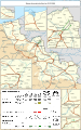
 Railway map of France - 59 - 2020 - fr - small.svg 740 × 1,180; 10.38 MB


