Category:Railings in Nottinghamshire
Ceremonial counties of England: Bedfordshire · Berkshire · Buckinghamshire · Cambridgeshire · Cheshire · Cornwall · Cumbria · Derbyshire · Devon · Dorset · Durham · East Riding of Yorkshire · East Sussex · Essex · Gloucestershire · Greater London · Greater Manchester · Hampshire · Herefordshire · Hertfordshire · Isle of Wight · Kent · Lancashire · Leicestershire · Lincolnshire · Merseyside · Norfolk · North Yorkshire · Northamptonshire · Northumberland · Nottinghamshire · Oxfordshire · Shropshire · Somerset · South Yorkshire · Staffordshire · Suffolk · Surrey · Tyne and Wear · Warwickshire · West Midlands · West Sussex · West Yorkshire · Wiltshire · Worcestershire
City-counties: Bristol · City of London
Former historic counties:
Other former counties:
City-counties: Bristol · City of London
Former historic counties:
Other former counties:
Media in category "Railings in Nottinghamshire"
The following 65 files are in this category, out of 65 total.
-
 A row of laurels at the south of Woodyard at west of Wollaton Hall, Nottingham, England.jpg 5,472 × 3,648; 13.64 MB
-

-

-
 A fence and tree line from the Stable Block at Wollaton Park, Nottingham, England.jpg 5,472 × 3,648; 12.89 MB
-
 Abbey Gates Lodge, Nottingham.jpg 4,032 × 3,024; 5.56 MB
-
-
 At the Hemlock Stone - geograph.org.uk - 622261.jpg 480 × 640; 84 KB
-
 All Saints' church - geograph.org.uk - 732085.jpg 640 × 427; 67 KB
-
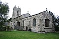 All Saints' church - geograph.org.uk - 732088.jpg 640 × 427; 70 KB
-
 St Margaret's Church, Bilsthorpe (geograph 4313136).jpg 428 × 602; 144 KB
-

-
 Bird box, trees, fence and Stable Block from Woodyard at Wollaton Park, Nottingham, England.jpg 5,472 × 3,648; 13.61 MB
-
 Bus on Bewcastle Road - geograph.org.uk - 3007968.jpg 1,024 × 768; 141 KB
-
 Bus Stop - geograph.org.uk - 673445.jpg 640 × 430; 47 KB
-
 Carrington Street Bridge - geograph.org.uk - 318454.jpg 640 × 427; 100 KB
-

-
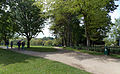
 Central Park, Clifton - geograph.org.uk - 1317787.jpg 640 × 479; 190 KB
-
 Grave of Rev.Harries - geograph.org.uk - 1152451.jpg 640 × 426; 63 KB
-
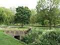
 Green link - geograph.org.uk - 1317823.jpg 640 × 479; 198 KB
-
 Rivergreen Medical Centre - geograph.org.uk - 1317810.jpg 640 × 472; 101 KB
-
 The Nethergate Stream - geograph.org.uk - 1317783.jpg 466 × 640; 148 KB
-
 The Peacock - geograph.org.uk - 1317756.jpg 640 × 479; 116 KB
-
 United Reformed Church, Clifton - geograph.org.uk - 1317750.jpg 640 × 479; 88 KB
-
 Clifton Library - geograph.org.uk - 1317769.jpg 640 × 479; 213 KB
-
 Collingham Cross - geograph.org.uk - 57400.jpg 640 × 480; 156 KB
-

-
 Elston Chapel - geograph.org.uk - 374002.jpg 640 × 427; 67 KB
-
 Entrance to Lime Tree Avenue, Wollaton Park - geograph.org.uk - 3852462.jpg 1,280 × 960; 395 KB
-
 Entrance to Woodyard looking north-west at Wollaton Park, Nottingham, England.jpg 4,608 × 2,844; 9.67 MB
-
 Entrance to Woodyard looking south at Wollaton Park, Nottingham, England.jpg 4,608 × 2,898; 8.68 MB
-

-
 All Saint's church, Harby, Notts. - geograph.org.uk - 42534.jpg 480 × 640; 101 KB
-
 Holme Lock, River Trent - geograph.org.uk - 227752.jpg 640 × 480; 83 KB
-
 St Luke's - geograph.org.uk - 141059.jpg 640 × 480; 96 KB
-
 Lock 55, Forest Locks - geograph.org.uk - 453821.jpg 640 × 480; 92 KB
-
 Lock near marina at Shireoaks - geograph.org.uk - 426955.jpg 640 × 480; 101 KB
-
 Trinity Methodist Church, High St, Mansfield Woodhouse (4).jpg 3,036 × 4,048; 3.98 MB
-
 Bridge Street Methodist Church, Bridge Street, Mansfield (3).jpg 3,036 × 4,048; 4.09 MB
-
 The Old meeting house from below.jpg 4,048 × 3,036; 5.25 MB
-
 Saint Peter's Church, Mansfield - geograph.org.uk - 11063.jpg 640 × 493; 96 KB
-
 Room with a view - geograph.org.uk - 320246.jpg 427 × 640; 54 KB
-
 Newark Nether Lock - geograph.org.uk - 500591.jpg 640 × 416; 57 KB
-
 Nottingham (2021-05-28) 06.jpg 5,568 × 3,712; 14.88 MB
-
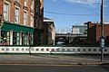
 Nottingham CarringtonSt MidlandRailway GoodsOffice.jpg 1,280 × 668; 503 KB
-
 Nottingham Eastcroft Light Maintenance Depot MMB 05 156XXX 153374 153321.jpg 3,630 × 2,463; 2.74 MB
-
 St Gabriel Church, Bathley Street - geograph.org.uk - 948761.jpg 640 × 480; 81 KB
-

-
 Nottingham, NG1 - The Park - geograph.org.uk - 3220302.jpg 3,663 × 2,719; 2.16 MB
-
 University Park MMB «D3 Tower Building.jpg 4,065 × 2,301; 2.51 MB
-
 Paddle gear on Gunthorpe lock - geograph.org.uk - 652504.jpg 433 × 640; 101 KB
-
 Parish church (3) - geograph.org.uk - 5344227.jpg 4,320 × 3,240; 4.07 MB
-
 Park Estate steps 2.jpg 2,592 × 3,872; 1.86 MB
-
 St Johns Church (geograph 4265666).jpg 3,648 × 2,736; 3.72 MB
-
 Church of St Chad, Church Lane, Pleasley Vale, Nottinghamshire (1).jpg 4,048 × 3,036; 4.71 MB
-
 Railings and Wall, Wellington Circus, Nottingham.jpg 1,280 × 960; 491 KB
-
 Red Hill lock - geograph.org.uk - 687354.jpg 640 × 480; 82 KB
-
 Stoke Lock - geograph.org.uk - 43284.jpg 640 × 480; 122 KB
-
 The Hemlock Stone - geograph.org.uk - 17658.jpg 640 × 423; 81 KB
-
 The Hemlock Stone - geograph.org.uk - 622248.jpg 640 × 480; 90 KB
-
 The Navigation, Wilford Street - geograph.org.uk - 678709.jpg 640 × 480; 91 KB
-

-
 Town Lock, Newark on Trent - geograph.org.uk - 278260.jpg 640 × 480; 99 KB
-
 Wall and Railings, Hollowstone, Nottingham.jpg 1,280 × 960; 352 KB
-
 Walls and Railings, Castle Grove, Nottingham.jpg 960 × 1,280; 431 KB
-
 Wilford Street Canal Bridge - geograph.org.uk - 318480.jpg 640 × 427; 120 KB


.jpg)


.jpg)
.jpg)


_06.jpg)


_-_geograph.org.uk_-_5344227.jpg)

.jpg)
.jpg)


