Category:Railings in the London Borough of Barnet

Media in category "Railings in the London Borough of Barnet"
The following 24 files are in this category, out of 24 total.
-
 Avenue House Grounds playground.JPG 3,648 × 2,736; 3.5 MB
-
 Bailey bridge over River Brent - geograph.org.uk - 5983488.jpg 1,024 × 768; 425 KB
-
 Brent Bridge, Hendon - geograph.org.uk - 5522712.jpg 3,264 × 2,448; 2.99 MB
-
 Bridge over Mutton Brook - geograph.org.uk - 452950.jpg 640 × 480; 211 KB
-
 Bridge over Mutton Brook, Northway Gardens - geograph.org.uk - 2665871.jpg 1,600 × 1,200; 463 KB
-
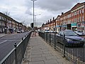
 Bridge over the River Brent - geograph.org.uk - 898056.jpg 640 × 407; 173 KB
-
 Bridge over the River Brent, Hendon - geograph.org.uk - 4378779.jpg 2,304 × 1,728; 834 KB
-
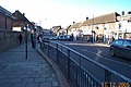 Burnt Oak, Watling Avenue - geograph.org.uk - 92087.jpg 640 × 425; 80 KB
-
 Church End Gardens - geograph.org.uk - 871407.jpg 640 × 427; 233 KB
-
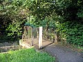
 Footbridge over Dollis Brook - geograph.org.uk - 870908.jpg 427 × 640; 263 KB
-
 Footbridge over the River Brent - geograph.org.uk - 898084.jpg 640 × 427; 255 KB
-
 Golders Hill (149251485).jpeg 2,048 × 1,536; 532 KB
-

-
 Market Place, Hampstead Garden Suburb - geograph.org.uk - 2456625.jpg 1,600 × 1,200; 829 KB
-
 St pauls mill hill 2009.JPG 2,048 × 1,536; 814 KB
-
 New fence on Hampstead Heath Extension - geograph.org.uk - 3813901.jpg 2,304 × 1,728; 1.85 MB
-
 Railings and Bell Lane - geograph.org.uk - 1082343.jpg 427 × 640; 181 KB
-
 River Brent at Mutton Bridge - geograph.org.uk - 2285627.jpg 640 × 480; 106 KB
-
 St John the Apostle, Whetstone - geograph.org.uk - 4743965.jpg 561 × 900; 322 KB
-
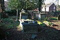
 St Mary-at-Finchley, Hendon Lane - Churchyard - geograph.org.uk - 2260646.jpg 1,000 × 694; 234 KB
-
 St Mary-at-Finchley, Hendon Lane - Churchyard - geograph.org.uk - 2260649.jpg 1,000 × 666; 243 KB
-
 St. Pauls, Long Lane - geograph.org.uk - 655642.jpg 640 × 433; 145 KB
-
 Victoria Park, Finchley 23 July 2017 09.jpg 4,608 × 3,456; 1.89 MB
-
 Victoria Recreation Ground drinking fountain.jpg 2,816 × 2,112; 2 MB


.jpeg)


