Category:Railway bridges in County Armagh
Subcategories
This category has the following 3 subcategories, out of 3 total.
Media in category "Railway bridges in County Armagh"
The following 14 files are in this category, out of 14 total.
-
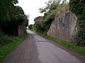
 Cannagola Road Railway Bridge - geograph.org.uk - 568829.jpg 640 × 480; 114 KB
-
 Clantilew Road Railway Bridge - geograph.org.uk - 568827.jpg 480 × 640; 159 KB
-
 Country Crossing - geograph.org.uk - 568823.jpg 640 × 480; 153 KB
-
 Disused Railway Bridge - geograph.org.uk - 547221.jpg 640 × 480; 133 KB
-
 Drumnevan Road - Dismantled Bridge - geograph.org.uk - 568731.jpg 640 × 480; 96 KB
-
 Egyptian Arch - geograph.org.uk - 334328.jpg 426 × 640; 110 KB
-
 Kilnasaggart Railway Bridge - geograph.org.uk - 315170.jpg 640 × 426; 114 KB
-
 Newry Canal at Poyntzpass - geograph.org.uk - 1342820.jpg 640 × 480; 94 KB
-

-
 Railway Bridge over the Drumantine Road - geograph.org.uk - 535845.jpg 640 × 480; 164 KB
-
-

-
 The River Bann - geograph.org.uk - 787456.jpg 640 × 480; 81 KB
-
 Enagh Townland - geograph.org.uk - 618212.jpg 640 × 479; 68 KB


