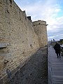
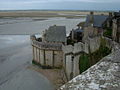
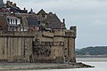
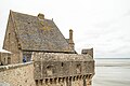
Category:Ramparts of Mont Saint-Michel
| Object location | | View all coordinates using: OpenStreetMap |
|---|
|
This building is classé au titre des monuments historiques de la France. It is indexed in the base Mérimée, a database of architectural heritage maintained by the French Ministry of Culture, under the reference PA00110514
|
 Les remparts vus du ciel. | |||||
| Upload media | |||||
| Instance of | |||||
|---|---|---|---|---|---|
| Location | Le Mont-Saint-Michel, Manche, Normandy, Metropolitan France, France | ||||
| Owned by |
| ||||
| Has part(s) | |||||
| Heritage designation |
| ||||
 | |||||
Subcategories
This category has the following 4 subcategories, out of 4 total.
Media in category "Ramparts of Mont Saint-Michel"
The following 199 files are in this category, out of 199 total.
-
 107 Les remparts du Mont Saint Michel. Jpeg.jpg 5,184 × 3,456; 14.43 MB
-
 200506 - Mont Saint-Michel 30 - Ramparts.JPG 1,600 × 1,200; 290 KB
-
 200506 - Mont Saint-Michel 31 - Ramparts.JPG 1,600 × 1,200; 275 KB
-
 200506 - Mont Saint-Michel 33 - Ramparts.JPG 1,600 × 1,200; 282 KB
-
 2017-04 Mont Saint-Michel 12.jpg 6,000 × 4,000; 11.67 MB
-
 2017-04 Mont Saint-Michel 13.jpg 6,000 × 3,375; 10.63 MB
-
 2017-04 Mont Saint-Michel 14.jpg 5,757 × 3,838; 11.72 MB
-
 2017-04 Mont Saint-Michel 22.jpg 4,000 × 6,000; 16.15 MB
-
 3682 - Frankreichtour 2016 - Mont Saint Michel (24124038108).jpg 8,094 × 5,241; 24.64 MB
-
 3683 - Frankreichtour 2016 - Mont Saint Michel (37975116041).jpg 4,866 × 3,226; 5.68 MB
-
 50170 Mont Saint-Michel, France - panoramio.jpg 4,000 × 3,000; 1.97 MB
-

-
 Arkadeturm in Mont-Saint-Michel.jpg 1,688 × 2,650; 1.79 MB
-
 Bastillon de la Tour Boucle (Le Mont-Saint-Michel, Manche, France).jpg 3,456 × 5,184; 6.34 MB
-
 En attente de la marée.JPG 2,112 × 2,816; 2.64 MB
-
 Chemin de ronde Mont Saint-Michel.jpg 1,167 × 768; 376 KB
-

-
 Coucher du soleil sur le Mont Saint Michel.JPG 3,472 × 2,604; 1.72 MB
-
 Courtines et tours de l'enceinte.jpg 3,072 × 2,304; 2.54 MB
-
 Echauguette.Mont.Saint.Michel.en.Mer.png 612 × 744; 147 KB
-
 Fontaine Saint-Symphorien (Le Mont-Saint-Michel, Manche, France).jpg 3,317 × 4,975; 11.05 MB
-
 FranceNormandieLeMontSaintMichelPorteDuRoiHaut.jpg 1,979 × 2,737; 4.13 MB
-
 Gezicht op vervallen gebouwen en een toren van Mont Saint-Michel, RP-F-F01142-DI.jpg 4,838 × 3,664; 2.01 MB
-
 Königsturm in Mont-Saint-Michel.jpg 2,108 × 3,033; 2.26 MB
-
 Le Mont entre mer et terre.jpg 1,781 × 1,336; 425 KB
-
 Le Mont Saint Michel et sa baie 06.jpg 3,000 × 4,000; 1.97 MB
-
 Le Mont Saint Michel et sa baie 07.jpg 3,000 × 4,000; 1.98 MB
-
 Le mont st michel - panoramio - chisloup (20).jpg 4,000 × 3,000; 1.97 MB
-
 Le mont st michel - panoramio - chisloup (21).jpg 4,000 × 3,000; 1.96 MB
-
 Le mont st michel - panoramio - chisloup (22).jpg 3,000 × 4,000; 1.97 MB
-
 Le Mont-Saint-Michel (Vue sur la baie).JPG 3,840 × 2,160; 824 KB
-
 Le Mont-Saint-Michel 20171015 12.jpg 4,128 × 3,096; 3.7 MB
-
 Le Mont-Saint-Michel 20171015 40.jpg 3,096 × 4,128; 3.77 MB
-
 Le Mont-Saint-Michel 20171015 49.jpg 3,096 × 4,128; 4.92 MB
-
 Le Mont-Saint-Michel 20171015 50.jpg 4,128 × 3,096; 3.54 MB
-
 Le Mont-Saint-Michel 20171015 51.jpg 4,128 × 3,096; 3.62 MB
-
 Le Mont-Saint-Michel 20171015 55.jpg 3,096 × 4,128; 3.7 MB
-
 Le Mont-Saint-Michel 20171015 60.jpg 4,128 × 3,096; 4 MB
-
 Le Mont-Saint-Michel Remparts 1.jpg 4,569 × 3,032; 5.45 MB
-
 Le Mont-Saint-Michel Remparts 2.jpg 4,554 × 2,697; 4.07 MB
-
 Le Mont-Saint-Michel Remparts 3.jpg 4,559 × 2,879; 4.33 MB
-
 Le Mont-Saint-Michel Remparts 4.jpg 4,586 × 3,268; 5.1 MB
-
 Le Mont-Saint-Michel Remparts 5.jpg 4,586 × 3,117; 4.75 MB
-
 Le Mont-Saint-Michel Remparts 6.jpg 4,589 × 2,870; 5.34 MB
-
 Le Mont-Saint-Michel Remparts 7.jpg 3,189 × 4,415; 6.11 MB
-
 Le Mont-Saint-Michel, Normandie, travel France.jpg 2,136 × 3,216; 1.44 MB
-
 Le Mont-Saint-Michel, travel France.jpg 3,216 × 2,136; 1.33 MB
-
 Le Mont-Saint-Michel-PM 38544.jpg 709 × 473; 222 KB
-
 Le Mont-Saint-Michel-PM 38548.jpg 473 × 709; 306 KB
-
 Le Mont-Saint-Michel-PM 38550.jpg 709 × 473; 278 KB
-
 Le Mont-Saint-Michel-PM 38570.jpg 709 × 1,064; 723 KB
-
 Le rempart est (Mont Saint-Michel) (7198149560).jpg 1,365 × 1,024; 686 KB
-
 Les "jardins" du mont st michel - panoramio.jpg 3,000 × 4,000; 1.89 MB
-
 Les remparts du mont st michel - panoramio - chisloup.jpg 3,000 × 4,000; 1.99 MB
-
 Les remparts du mont st michel - panoramio.jpg 4,000 × 3,000; 1.98 MB
-
 Lungo le mura esterne - panoramio.jpg 4,608 × 3,456; 6.12 MB
-
 Maison Mont-Saint-Michel rempart.jpg 3,072 × 2,304; 2.69 MB
-
 Maison à Mont Saint Michel.jpg 3,000 × 4,000; 4.29 MB
-
 Mont Saint Michel 12-6-2008 - panoramio.jpg 850 × 638; 257 KB
-
 Mont Saint Michel 2019 14.jpg 5,184 × 3,888; 7.26 MB
-
 Mont Saint Michel 2019 15.jpg 5,184 × 3,888; 7.53 MB
-
 Mont Saint Michel 2019 16.jpg 5,184 × 3,888; 6.99 MB
-
 Mont Saint Michel F PM 038570.jpg 419 × 600; 249 KB
-
 Mont Saint Michel, France - panoramio - MARELBU (10).jpg 2,150 × 1,612; 1.52 MB
-
 Mont Saint Michel, France - panoramio - MARELBU (11).jpg 2,304 × 3,072; 2.1 MB
-
 Mont Saint Michel, France - panoramio - MARELBU (29).jpg 1,612 × 2,150; 1.58 MB
-
 Mont Saint Michel, France - panoramio - MARELBU (31).jpg 2,193 × 2,961; 2.81 MB
-
 Mont Saint Michel, France - panoramio - MARELBU (32).jpg 1,612 × 2,150; 1.17 MB
-
 Mont Saint Michel, France - panoramio - MARELBU (33).jpg 3,072 × 2,304; 2.1 MB
-
 Mont Saint Michel, France - panoramio - MARELBU (34).jpg 2,150 × 1,612; 1.68 MB
-
 Mont Saint Michel, France - panoramio - MARELBU (6).jpg 1,731 × 2,141; 1.65 MB
-
 Mont Saint Michel, France - panoramio - MARELBU (9).jpg 1,612 × 2,150; 1.48 MB
-
 Mont Saint Michel, France - panoramio.jpg 2,304 × 3,072; 1.38 MB
-
 Mont Saint-Michel (3).jpg 4,608 × 3,456; 4.26 MB
-
 Mont Saint-Michel (4).jpg 4,608 × 3,456; 3.9 MB
-
 Mont Saint-Michel (5).jpg 4,608 × 3,456; 3.75 MB
-
 Mont Saint-Michel - remparts.jpg 2,496 × 1,664; 1.87 MB
-
 Mont Saint-Michel - Tombelaine.jpg 1,664 × 2,496; 1.92 MB
-
 Mont Saint-Michel 03.jpg 2,496 × 1,664; 1.53 MB
-
 Mont Saint-Michel hdsr IMG 3699.jpg 3,264 × 2,448; 4.67 MB
-
 Mont Saint-Michel hdsr IMG 3704.jpg 3,264 × 2,448; 5.13 MB
-
 Mont Saint-Michel hdsr IMG 3709.jpg 3,264 × 2,448; 5.48 MB
-
 Mont Saint-Michel hdsr IMG 3711.jpg 3,184 × 2,388; 4.96 MB
-
 Mont Saint-Michel hdsr IMG 3715.jpg 2,448 × 3,264; 6.3 MB
-
 Mont Saint-Michel hdsr IMG 3725.jpg 3,264 × 2,448; 4.91 MB
-
 Mont Saint-Michel hdsr IMG 3731.jpg 3,264 × 2,448; 5.41 MB
-
 Mont Saint-Michel hdsr IMG 3732.jpg 2,448 × 3,264; 5.69 MB
-
 Mont Saint-Michel hdsr IMG 3743.jpg 3,264 × 2,448; 4.85 MB
-
 Mont Saint-Michel hdsr IMG 3745.jpg 2,448 × 3,264; 6.18 MB
-
 Mont Saint-Michel hdsr IMG 3747.jpg 2,357 × 3,143; 5.77 MB
-
 Mont Saint-Michel hdsr IMG 3749.jpg 2,278 × 3,037; 4.38 MB
-
 Mont Saint-Michel hdsr IMG 3751.jpg 3,264 × 2,448; 5.72 MB
-
 Mont Saint-Michel hdsr IMG 3770.jpg 3,264 × 2,448; 4.91 MB
-
 Mont Saint-Michel hdsr IMG 3772.jpg 3,264 × 2,448; 4.89 MB
-
 Mont Saint-michel Normandie (30256708078).jpg 5,472 × 3,648; 3.07 MB
-
 Mont Saint-michel Normandie (42315540890).jpg 5,472 × 3,141; 2.03 MB
-
 Mont Saint-Michel, gate and bridge.jpg 1,284 × 1,920; 789 KB
-
 Mont st michel , entrée - panoramio.jpg 4,000 × 3,000; 2 MB
-
 Mont st michel - panoramio - chisloup (10).jpg 4,000 × 3,000; 2.01 MB
-
 Mont st michel - panoramio - chisloup (11).jpg 4,000 × 3,000; 1.98 MB
-
 Mont st michel - panoramio - chisloup (2).jpg 4,000 × 3,000; 2.02 MB
-
 Mont st michel - panoramio - chisloup (3).jpg 3,000 × 4,000; 2.06 MB
-
 Mont st michel - panoramio - chisloup (4).jpg 3,000 × 4,000; 1.92 MB
-
 Mont st michel - panoramio - chisloup (5).jpg 3,000 × 4,000; 1.93 MB
-
 Mont st michel - panoramio - chisloup (8).jpg 4,000 × 3,000; 2.01 MB
-
 Mont st michel - panoramio - chisloup (9).jpg 4,000 × 3,000; 2.01 MB
-
 200506 - Mont Saint-Michel 11.JPG 1,600 × 1,200; 291 KB
-
 200506 - Mont Saint-Michel 12.JPG 1,600 × 1,200; 292 KB
-
 200506 - Mont Saint-Michel 32 - Ramparts.JPG 1,600 × 1,200; 308 KB
-
 200506 - Mont Saint-Michel 34.JPG 1,600 × 1,200; 301 KB
-
 200506 - Mont Saint-Michel 35.JPG 1,600 × 1,200; 305 KB
-
 Mont-Saint-Michel - Novembre 2011 (16).jpg 1,600 × 1,200; 496 KB
-
 Mont-Saint-Michel - Novembre 2011 (18).jpg 1,600 × 1,200; 429 KB
-
 Mont-Saint-Michel - Novembre 2011 (25).jpg 1,600 × 1,200; 386 KB
-
 Mont-Saint-Michel - Novembre 2011 (27).jpg 1,600 × 1,200; 355 KB
-
 Mont-Saint-Michel - Novembre 2011 (29).jpg 1,600 × 1,200; 549 KB
-
 Mont-Saint-Michel - Novembre 2011 (30).jpg 1,200 × 1,600; 494 KB
-
 Mont-Saint-Michel 2008 PD 06.JPG 1,704 × 2,272; 636 KB
-
 Mont-Saint-Michel 2008 PD 07.JPG 2,272 × 1,704; 837 KB
-
 Mont-Saint-Michel 2008 PD 103.JPG 2,272 × 1,704; 848 KB
-
 Mont-Saint-Michel 2008 PD 110.JPG 2,272 × 1,704; 855 KB
-
 Mont-Saint-Michel 2008 PD 111.JPG 2,272 × 1,704; 841 KB
-
 Mont-Saint-Michel 2008 PD 135.JPG 1,704 × 2,272; 494 KB
-
 Mont-Saint-Michel 2008 PD 136.JPG 2,272 × 1,704; 850 KB
-
 Mont-Saint-Michel 2008 PD 138.JPG 1,704 × 2,272; 853 KB
-
 Mont-Saint-Michel 2008 PD 14.JPG 1,704 × 2,272; 738 KB
-
 Mont-Saint-Michel 2008 PD 19.JPG 2,272 × 1,704; 840 KB
-
 Mont-Saint-Michel 2008 PD 20.JPG 2,272 × 1,704; 846 KB
-
 Mont-Saint-Michel 2008 PD 30.JPG 1,704 × 2,272; 555 KB
-
 MONT-ST-MICHEL (235) 07.jpg 3,662 × 2,655; 13.73 MB
-
 Monte-charge prison - Mont-Saint-Michel -2009-10-30 01.JPG 2,304 × 3,456; 4.51 MB
-
 Montsaintmicheloutlook.jpg 800 × 600; 85 KB
-
 Montsaintmicheloutlook2.jpg 2,304 × 1,728; 1.62 MB
-
 Mt st canon.JPG 3,000 × 4,000; 2.51 MB
-
 Mt ST michel 09.JPG 1,536 × 2,048; 1.07 MB
-
 Porte du Roy i Mont-Saint-Michel - TEK - TEKA0117911.tif 2,487 × 3,543; 16.84 MB
-
 Procházka po hradbách - panoramio.jpg 5,760 × 3,840; 6.69 MB
-
 Rampart of Mont Saint-Michel - France.JPG 3,672 × 4,896; 5.85 MB
-
 Ramparts and parking area of Mont Saint-Michel - P1000138.jpg 1,920 × 1,284; 1.26 MB
-
 Ramparts and trees of Mont Saint-Michel - P1000183.jpg 1,284 × 1,920; 1.29 MB
-
 Ramparts of Le Mont-Saint-Michel.jpg 4,000 × 6,016; 3.19 MB
-
 Ramparts of Mont Saint-Michel - P1000125.jpg 1,920 × 1,284; 1.04 MB
-
 Ramparts of Mont Saint-Michel 01.jpg 2,848 × 4,272; 1.98 MB
-
 Ramparts of Mont Saint-Michel 02.jpg 2,848 × 4,272; 1.85 MB
-
 Ramparts of Mont Saint-Michel 03.jpg 2,848 × 4,272; 1.99 MB
-
 Ramparts of Mont Saint-Michel 04.jpg 4,272 × 2,848; 1.46 MB
-
 Ramparts of Mont Saint-Michel 05.jpg 4,272 × 2,848; 1.3 MB
-
 Ramparts of Mont Saint-Michel 06.jpg 2,848 × 4,272; 1.32 MB
-
 Ramparts of Mont Saint-Michel 07.jpg 4,272 × 2,848; 1.77 MB
-
 Ramparts of Mont Saint-Michel 08.jpg 2,848 × 4,272; 2.75 MB
-
 Ramparts of Mont Saint-Michel 09.jpg 2,848 × 4,272; 2.04 MB
-
 Ramparts of Mont Saint-Michel 10.jpg 2,848 × 4,272; 2.08 MB
-
 Ramparts of Mont Saint-Michel 11.jpg 2,848 × 4,272; 1.58 MB
-
 Ramparts of Mont Saint-Michel 12.jpg 2,848 × 4,272; 1.42 MB
-
 Ramparts of Mont Saint-Michel 13.jpg 4,272 × 2,848; 1.31 MB
-
 Ramparts of Mont Saint-Michel 14.jpg 4,272 × 2,848; 1.24 MB
-
 Ramparts of Mont Saint-Michel 15.jpg 4,272 × 2,848; 1.26 MB
-
 Ramparts of Mont Saint-Michel 16.jpg 4,272 × 2,848; 1.32 MB
-
 Ramparts of Mont Saint-Michel 17.jpg 4,272 × 2,848; 1.14 MB
-
 Ramparts of Mont Saint-Michel 18.jpg 4,272 × 2,848; 1.35 MB
-
 Ramparts of Mont Saint-Michel 19.jpg 4,272 × 2,848; 1.32 MB
-
 Ramparts of Mont Saint-Michel 20.jpg 4,272 × 2,848; 1.44 MB
-
 Ramparts of Mont Saint-Michel 21.jpg 4,272 × 2,848; 2.57 MB
-
 Ramparts of Mont Saint-Michel 22.jpg 2,848 × 4,272; 1.57 MB
-
 Ramparts of Mont Saint-Michel 23.jpg 2,848 × 4,272; 1.66 MB
-
 Ramparts of Mont Saint-Michel 24.jpg 4,272 × 2,848; 1.12 MB
-
 Ramparts of Mont Saint-Michel 25.jpg 2,848 × 4,272; 1.95 MB
-
 Ramparts of Mont Saint-Michel 26.jpg 2,848 × 4,272; 1.83 MB
-
 Ramparts of Mont Saint-Michel 27.jpg 4,272 × 2,848; 1.22 MB
-
 Ramparts of Mont Saint-Michel 28.jpg 2,848 × 4,272; 1.93 MB
-
 Ramparts of Mont Saint-Michel 29.jpg 4,272 × 2,848; 1.54 MB
-
 Ramparts of the Mont Saint Michel (France).JPG 3,672 × 4,896; 4.55 MB
-
 Rempart du mont st michel - panoramio.jpg 3,000 × 4,000; 1.97 MB
-

-

-
 Remparts du mont st michel - panoramio - chisloup (1).jpg 3,000 × 4,000; 2.04 MB
-
 Remparts du mont st michel - panoramio - chisloup.jpg 3,000 × 4,000; 1.99 MB
-
 Remparts du mont st michel - panoramio.jpg 4,000 × 3,000; 1.96 MB
-

-

-
 St. Michel West Wing.jpg 640 × 480; 135 KB
-
-
 Tour Boucle and the coast.jpg 5,303 × 3,526; 1.21 MB
-
 Tour Boucle.jpg 5,830 × 3,876; 2.18 MB
-
 Tour de l'Arcade (Le Mont-Saint-Michel, Manche, France).jpg 3,456 × 5,184; 6.69 MB
-
 Tour de la Liberté (Le Mont-Saint-Michel, Manche, France).jpg 3,456 × 5,184; 8.43 MB
-
 Tour du Roy (Le Mont-Saint-Michel, Manche, France).jpg 3,456 × 5,184; 6.8 MB
-
 Turm Basse 01.jpg 3,174 × 2,575; 2.44 MB
-
 Turm Basse 02.jpg 1,078 × 782; 257 KB
-
 Turm Boucle in Mont-Saint-Michel.jpg 2,242 × 3,514; 2.04 MB
-
 Turm Denis in Mont-Saint-Michel.jpg 844 × 669; 262 KB
-
 View from Le Mont-Saint-Michel.jpg 3,805 × 5,722; 2.53 MB
-
 View on Le Mont-Saint-Michel.jpg 3,216 × 2,136; 1.03 MB
-
 Walls of Mont-Saint-Michel 01.jpg 5,888 × 3,925; 10.76 MB
-
 Walls of Mont-Saint-Michel 02.jpg 5,863 × 3,909; 9.9 MB
-
 Échauguette du Nord (Le Mont-Saint-Michel, Manche, France).jpg 3,432 × 5,148; 6.13 MB
-
 Королевская башня и дом «Аркады» - panoramio.jpg 5,184 × 3,456; 7.84 MB
-
 Ле Мон-Сен-Мишель - panoramio (37).jpg 4,000 × 3,000; 3.6 MB
-
 Мон-сен-Мишель.Монастырские сады.jpg 3,648 × 2,736; 10.27 MB


.jpg)
.jpg)

_-_M%C3%A9diath%C3%A8que_de_l%27architecture_et_du_patrimoine_-_APMH00001794.jpg)

.jpg)


_(Le_Mont-Saint-Michel,_Manche,_France).jpg)


.jpg)


.jpg)
.jpg)
.jpg)
.JPG)


_(7198149560).jpg)


.jpg)
.jpg)
.jpg)
.jpg)
.jpg)
.jpg)
.jpg)
.jpg)
.jpg)

.jpg)
.jpg)
.jpg)


.jpg)
.jpg)


.jpg)
.jpg)
.jpg)
.jpg)
.jpg)
.jpg)
.jpg)
.jpg)


.jpg)
.jpg)
.jpg)
.jpg)
.jpg)
.jpg)


_07.jpg)


.JPG)

_-_M%C3%A9diath%C3%A8que_de_l%27architecture_et_du_patrimoine_-_APMH00001795.jpg)
_-_M%C3%A9diath%C3%A8que_de_l%27architecture_et_du_patrimoine_-_APMH00012086.jpg)
.jpg)


_-_M%C3%A9diath%C3%A8que_de_l%27architecture_et_du_patrimoine_-_APMH00014990.jpg)
_-_M%C3%A9diath%C3%A8que_de_l%27architecture_et_du_patrimoine_-_APMH00014991.jpg)

.jpg)


.jpg)
.jpg)
.jpg)


.jpg)

.jpg)
