<nowiki>Rathaus Glarus; Rathaus; administrative building in the town of Glarus in the canton of the same name, Switzerland; Verwaltungsgebäude in der Stadt Glarus im gleichnamigen Kanton, Schweiz; bouwwerk in Glarus, Zwitserland; Rathaus (1864)</nowiki>
Rathaus
administrative building in the town of Glarus in the canton of the same name, Switzerland


 Der Glarner Landrat tagt im Landraatsaal des Rathauses in Glarus, Kanton Glarus.jpg 13,027 × 4,125; 52.83 MB
 Glarus rathaus 2005-07-22.jpg 2,638 × 1,758; 3.43 MB
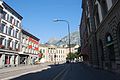 Glaruso chefstrato kaj preghejo 202.jpg 3,872 × 2,592; 829 KB
 Picswiss GL-13-02.jpg 500 × 331; 55 KB
 Rathaus im Kantonshauptort Glarus, Kanton Glarus.jpg 7,360 × 4,912; 34.81 MB

