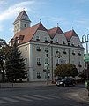
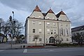
Category:Rathaus Gänserndorf
| Object location | | View all coordinates using: OpenStreetMap |
|---|
building in Gänserndorf, Austria  | |||||
| Upload media | |||||
| Instance of | |||||
|---|---|---|---|---|---|
| Location | Gänserndorf, Gänserndorf District, Lower Austria, Austria | ||||
| Street address |
| ||||
| Heritage designation | |||||
 | |||||
Gänserndorf, Rathaus
Media in category "Rathaus Gänserndorf"
The following 5 files are in this category, out of 5 total.
-
 GF-Rathaus.jpg 503 × 600; 70 KB
-
 Gänserndorf - Rathaus.JPG 4,724 × 3,149; 10.51 MB
-
 Gänserndorf,Rathaus.JPG 4,256 × 2,832; 1.24 MB
-
 Rathaus-gaenserndorf.jpg 800 × 506; 309 KB
-
 Townhall of Gänserndorf.jpg 1,024 × 663; 549 KB


