Category:Ravenfield
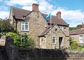
English: Ravenfield is a small village and civil parish in South Yorkshire, England. It is located in the Metropolitan Borough of Rotherham, east of the town of Rotherham. The older part is a former farming village and over recent years has become a pretty rural community; it has been particularly successful in the Britain in Bloom competitions. It has a population of 2,018.
Nederlands: Ravenfield is een dorp (village) en civil parish in het bestuurlijke gebied Rotherham, in het Engelse graafschap South Yorkshire. De civil parish telt
village and civil parish in South Yorkshire, UK | |||||
| Upload media | |||||
| Instance of | |||||
|---|---|---|---|---|---|
| Location | Rotherham, South Yorkshire, Yorkshire and the Humber, England | ||||
 | |||||
Subcategories
This category has only the following subcategory.
R
- St James' Church, Ravenfield (5 F)
Media in category "Ravenfield"
The following 110 files are in this category, out of 110 total.
-
 2-14 Main Street, Ravenfield.jpg 3,874 × 2,826; 1.81 MB
-
 Arbour Lane towards Garden Lane - geograph.org.uk - 5912456.jpg 1,600 × 1,064; 890 KB
-
 Arbour Lane towards Garden Lane - geograph.org.uk - 5912457.jpg 1,600 × 1,064; 586 KB
-
 Autumn Colours - geograph.org.uk - 3224982.jpg 1,024 × 768; 388 KB
-
 Braithwell Road - geograph.org.uk - 3732867.jpg 1,600 × 1,200; 636 KB
-
 Braithwell Road heading east - geograph.org.uk - 2583054.jpg 640 × 480; 71 KB
-

-
 Bridge over the M18 - geograph.org.uk - 2040603.jpg 640 × 480; 50 KB
-
 Bus shelter on Hollings Lane - geograph.org.uk - 1268052.jpg 640 × 480; 50 KB
-
 Conisbrough Grange Farm - geograph.org.uk - 2583062.jpg 1,600 × 1,200; 272 KB
-
 Crop Field near Ravenfield - geograph.org.uk - 5417838.jpg 3,264 × 2,448; 2.74 MB
-
 Derelict building near Moorside Farm - geograph.org.uk - 4850329.jpg 1,024 × 768; 138 KB
-
 Disused water treatment works - geograph.org.uk - 795677.jpg 640 × 439; 98 KB
-
 Entrance Door to Demolished Hall - geograph.org.uk - 3588637.jpg 3,958 × 2,944; 3.02 MB
-
 Entrance to Ravenfield Park - geograph.org.uk - 4849721.jpg 1,024 × 768; 278 KB
-
 Entrance to Ravenfield Park.jpg 1,024 × 768; 192 KB
-
 Farmland off Hellaby Lane - geograph.org.uk - 2583093.jpg 1,600 × 1,200; 464 KB
-
 Farmland Viewed from Hellaby Lane - geograph.org.uk - 5419006.jpg 3,264 × 2,448; 4.25 MB
-

-
 Fingerpost on Garden Lane, Ravenfield - geograph.org.uk - 5912473.jpg 1,600 × 1,064; 568 KB
-
 Fly tipping on Thrybergh Lane - geograph.org.uk - 4850313.jpg 1,024 × 768; 271 KB
-

-
 Footpath off Common Lane - geograph.org.uk - 2583057.jpg 1,600 × 1,200; 518 KB
-
 Footpath off Pingle Lane, Ravenfield - geograph.org.uk - 5912483.jpg 1,600 × 1,064; 603 KB
-
 Footpath through the rape to Ravenfield - geograph.org.uk - 3527555.jpg 3,571 × 2,688; 2.05 MB
-
 Footpath to Ravenfield Grange - geograph.org.uk - 4849687.jpg 1,024 × 768; 202 KB
-
 Footpath to Ravenfield. - geograph.org.uk - 4080872.jpg 640 × 480; 57 KB
-
 Footpath towards Church Farm, Ravenfield - geograph.org.uk - 3732839.jpg 1,600 × 1,200; 489 KB
-
 Footpath towards Gulling Wood - geograph.org.uk - 5912507.jpg 1,600 × 1,064; 649 KB
-
 Footpath towards Gulling Wood - geograph.org.uk - 5912508.jpg 1,600 × 1,064; 526 KB
-
 Footpath towards Ravenfield - geograph.org.uk - 3732825.jpg 1,600 × 1,200; 648 KB
-
 Former rail bridge on Arbour Lane - geograph.org.uk - 5912459.jpg 1,600 × 1,064; 688 KB
-
 Former Stable Block, Ravenfield Hall.jpg 640 × 480; 80 KB
-
 Fringes of Ravenfield Common - geograph.org.uk - 5418994.jpg 3,264 × 2,448; 3.12 MB
-
 Frozen pond at Ravenfied park - geograph.org.uk - 1658266.jpg 640 × 480; 51 KB
-
 Garden Lane, Ravenfield - geograph.org.uk - 5912472.jpg 1,600 × 1,064; 743 KB
-
 Green Bank Drive, Sunnyside - geograph.org.uk - 5912551.jpg 1,600 × 1,064; 500 KB
-
 Gulling Wood - geograph.org.uk - 2583050.jpg 1,600 × 1,200; 829 KB
-
 Gulling Wood - geograph.org.uk - 3588595.jpg 4,000 × 3,000; 2.31 MB
-
 Gulling Wood towards Silver Wood - geograph.org.uk - 5912510.jpg 1,600 × 1,064; 1,012 KB
-
 Gulling Wood towards Silver Wood - geograph.org.uk - 5912522.jpg 1,600 × 1,047; 885 KB
-
 Hall Mews, Ravenfield.jpg 1,024 × 768; 188 KB
-
 Harvested Crop Field near Hooton Roberts - geograph.org.uk - 5083758.jpg 4,608 × 3,456; 4.52 MB
-
 Hellaby Lane heading south - geograph.org.uk - 2583096.jpg 1,600 × 1,200; 595 KB
-
 Holingswood Way, Sunnyside - geograph.org.uk - 5912563.jpg 1,600 × 1,064; 555 KB
-
 Holling's Lane - geograph.org.uk - 3528153.jpg 3,648 × 2,736; 2.2 MB
-
 Holling's Lane, Silverwood - geograph.org.uk - 5912529.jpg 1,600 × 1,064; 673 KB
-
 Hollingswood Way, Sunnyside - geograph.org.uk - 5912558.jpg 1,600 × 1,064; 423 KB
-
 House on Church Lane, Ravenfield - geograph.org.uk - 3527214.jpg 3,451 × 2,465; 1.76 MB
-
 Houses on Braithwell Road - geograph.org.uk - 2583053.jpg 1,600 × 1,200; 381 KB
-
 Houses on Main Street, Ravenfield - geograph.org.uk - 5912477.jpg 1,600 × 1,064; 537 KB
-
 Howson Close, Ravenfield Common - geograph.org.uk - 4233720.jpg 4,937 × 3,527; 4.39 MB
-
 In case of emergency - geograph.org.uk - 795691.jpg 550 × 640; 76 KB
-
 Keeping guard - geograph.org.uk - 795684.jpg 640 × 496; 147 KB
-
 M18 nears Common Lane overbridge - geograph.org.uk - 6125689.jpg 1,024 × 769; 82 KB
-
 Main Street, Ravenfield - geograph.org.uk - 5912474.jpg 1,600 × 1,064; 538 KB
-
 Main Street, Ravenfield - geograph.org.uk - 5912475.jpg 1,600 × 1,064; 618 KB
-
 Meadow View Drive - geograph.org.uk - 920462.jpg 640 × 401; 55 KB
-
 Moor Lane North - geograph.org.uk - 785743.jpg 640 × 480; 50 KB
-
 Moorside Farm - geograph.org.uk - 4850323.jpg 1,024 × 768; 145 KB
-
 Motorway bridge. - geograph.org.uk - 4080874.jpg 640 × 480; 32 KB
-
 On the dam at Firsby - geograph.org.uk - 3732820.jpg 1,600 × 1,200; 755 KB
-
 Overflow from Firsby Reservoir - geograph.org.uk - 4849753.jpg 1,024 × 768; 310 KB
-
 Overlooking Arbour Lane - geograph.org.uk - 3588667.jpg 4,000 × 3,000; 2.17 MB
-

-
 Partly infilled overbridge - geograph.org.uk - 4850306.jpg 1,024 × 768; 310 KB
-
 Pasture at Ravenfield - geograph.org.uk - 2896896.jpg 2,848 × 2,144; 1.49 MB
-
 Path east of Thrybergh Reservoir - geograph.org.uk - 3527394.jpg 3,572 × 2,552; 1.79 MB
-
 Path enters Gulling Wood - geograph.org.uk - 5912509.jpg 1,600 × 1,064; 839 KB
-
 Path in Gulling Wood - geograph.org.uk - 2583047.jpg 1,600 × 1,200; 780 KB
-
 Path leading to Hollin's Lane - geograph.org.uk - 5912528.jpg 1,600 × 1,064; 974 KB
-
 Path near Green Bank Drive, Sunnyside - geograph.org.uk - 5912541.jpg 1,600 × 1,064; 491 KB
-
 Path north of Ravenfield Common - geograph.org.uk - 4233735.jpg 5,008 × 3,700; 4.92 MB
-
 Path through the sugar beet to Ravenfield - geograph.org.uk - 3528137.jpg 2,519 × 3,526; 1.78 MB
-
 Pingle Lane off Main Street, Ravenfield - geograph.org.uk - 5912476.jpg 1,600 × 1,064; 808 KB
-
 Pingle Lane towards Gulling Wood - geograph.org.uk - 5912488.jpg 1,600 × 1,064; 687 KB
-
 Pingle Lane towards Gulling Wood - geograph.org.uk - 5912489.jpg 1,600 × 1,064; 609 KB
-
 Pond at Ravenfield Grange - geograph.org.uk - 3732862.jpg 1,600 × 1,200; 728 KB
-
 Power cables in a sea of yellow - geograph.org.uk - 795681.jpg 640 × 550; 116 KB
-
 Pub and post office Ravenfield Common - geograph.org.uk - 920460.jpg 640 × 333; 45 KB
-
 Pylon and bonfire - geograph.org.uk - 4842783.jpg 1,024 × 768; 99 KB
-
 Railway remains - geograph.org.uk - 4849784.jpg 1,024 × 768; 282 KB
-
 Ravenfield Arms on Holling's Lane - geograph.org.uk - 5912531.jpg 1,600 × 1,064; 695 KB
-
 Ravenfield Arms on Holling's Lane - geograph.org.uk - 5912536.jpg 1,064 × 1,600; 591 KB
-
 Ravenfield Common - geograph.org.uk - 5418940.jpg 3,264 × 2,448; 3.04 MB
-
 Ravenfield from Garden Lane - geograph.org.uk - 5912470.jpg 1,600 × 1,064; 590 KB
-
 Ravenfield Grange - geograph.org.uk - 2583060.jpg 1,600 × 1,200; 487 KB
-
 Ravenfield Grange - geograph.org.uk - 4233754.jpg 4,971 × 3,669; 4.65 MB
-
 Ravenfield Park - geograph.org.uk - 4849797.jpg 1,024 × 768; 170 KB
-
 Ravenfield Ponds - geograph.org.uk - 2850140.jpg 3,264 × 2,448; 4.25 MB
-
 Ravenfield Ponds - geograph.org.uk - 5418499.jpg 1,024 × 683; 296 KB
-
 Ravenfield post box - geograph.org.uk - 785738.jpg 640 × 425; 67 KB
-
 Silver Wood - beech wood north of Sunnyside - geograph.org.uk - 3527547.jpg 3,646 × 2,604; 1.96 MB
-
 Silver Wood towards Holling's Lane - geograph.org.uk - 5912527.jpg 1,600 × 1,064; 1.01 MB
-
 Silverwood electricity sub-station - geograph.org.uk - 3527532.jpg 3,556 × 2,540; 1.99 MB
-
 St. James church, Ravenfield - geograph.org.uk - 4849769.jpg 1,024 × 768; 177 KB
-
 St. James church, Ravenfield from the north-east - geograph.org.uk - 4849779.jpg 1,024 × 768; 207 KB
-
 St.James' Church, Ravenfield - geograph.org.uk - 5418486.jpg 1,024 × 604; 198 KB
-

-
 The line of the former railway - geograph.org.uk - 4850310.jpg 1,024 × 768; 136 KB
-
 The M18 from Lidget Lane - geograph.org.uk - 4234339.jpg 5,184 × 3,737; 5.87 MB
-
 Thrybergh Reservoir - geograph.org.uk - 4849890.jpg 1,024 × 768; 210 KB
-
 Thrybergh reservoir. - geograph.org.uk - 4080870.jpg 480 × 640; 71 KB
-
 Towards Church Farm, Ravenfield - geograph.org.uk - 3732844.jpg 1,600 × 1,200; 530 KB
-
 Track off Moor Lane North - geograph.org.uk - 4842744.jpg 1,024 × 768; 198 KB
-
 View towards Conisbrough Parks - geograph.org.uk - 4849695.jpg 1,024 × 768; 133 KB
-
 View towards Kilnhurst Road - geograph.org.uk - 4849823.jpg 1,024 × 740; 148 KB
-
 WWII Inscription at Ravenfield - geograph.org.uk - 3588657.jpg 4,000 × 3,000; 3.44 MB
-
 Across the cow field - geograph.org.uk - 447995.jpg 640 × 480; 78 KB
-
 The Cavalier - geograph.org.uk - 210256.jpg 640 × 427; 77 KB


