Category:Rayners Lane (road)
street in the London Borough of Harrow, England, UK  | |||||
| Upload media | |||||
| Instance of | |||||
|---|---|---|---|---|---|
| Location | Rayners Lane, London Borough of Harrow, Greater London, London, England | ||||
 | |||||
Subcategories
This category has only the following subcategory.
R
Media in category "Rayners Lane (road)"
The following 19 files are in this category, out of 19 total.
-
 Noodle hut Rayners Lane.jpg 2,048 × 1,536; 278 KB
-
 Pedestrian Crossing, Rayners Lane - geograph.org.uk - 3154271.jpg 640 × 480; 109 KB
-
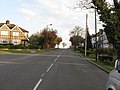 Pinner - Rayners Lane at The Ridgeway - geograph.org.uk - 2881183.jpg 640 × 480; 180 KB
-
 Pinner - The Ridgeway from Rayners Lane - geograph.org.uk - 2881181.jpg 640 × 480; 163 KB
-
 Pinner, Rayners Lane - geograph.org.uk - 81904.jpg 640 × 480; 123 KB
-
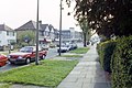
 Rayner's Lane, West Harrow - geograph.org.uk - 2212826.jpg 1,600 × 1,200; 592 KB
-
 Rayners Lane - geograph.org.uk - 3405205.jpg 2,592 × 1,728; 1.14 MB
-
 Rayners Lane - geograph.org.uk - 3751112.jpg 2,304 × 1,728; 847 KB
-
 Rayners Lane - geograph.org.uk - 4927242.jpg 4,608 × 3,456; 3.34 MB
-
 Rayners Lane - geograph.org.uk - 4927326.jpg 4,608 × 3,456; 3.36 MB
-
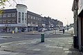 Rayners Lane shops - geograph.org.uk - 3405209.jpg 2,592 × 1,728; 965 KB
-
 Rayners Lane west side - geograph.org.uk - 3405222.jpg 2,592 × 1,728; 971 KB
-
 Rayners Lane, West Harrow - geograph.org.uk - 3751012.jpg 2,304 × 1,728; 847 KB
-
 Roundabout at the end of Rayners Lane - geograph.org.uk - 3751126.jpg 2,304 × 1,728; 845 KB
-
 Roundabout on Rayners Lane - geograph.org.uk - 4927330.jpg 4,608 × 3,456; 3.36 MB
-
 Shops at the end of Rayners Lane - geograph.org.uk - 3405215.jpg 2,592 × 1,728; 1.13 MB
-
 Shops on junction of Rayners Lane and Village Way - geograph.org.uk 2716276.jpg 1,600 × 1,200; 352 KB
-
 Village Inn, Rayners Lane, HA5 (3438330603).jpg 1,989 × 2,652; 2.4 MB
-
 Woolworths store in Harrow London (closing down Dec 2008).jpg 1,632 × 1,224; 545 KB


.jpg)
.jpg)