Category:Rehetobel farmhouse
| Object location | | View all coordinates using: OpenStreetMap |
|---|
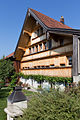
farmhouse in Rehetobel in the canton of Appenzell Ausserrhoden, Switzerland  | |||||
| Upload media | |||||
| Instance of | |||||
|---|---|---|---|---|---|
| Part of | |||||
| Location |
| ||||
| Street address |
| ||||
| Heritage designation | |||||
 | |||||
Media in category "Rehetobel farmhouse"
The following 2 files are in this category, out of 2 total.
-
 2015-Rehetobel-Michlenberg-3.jpg 1,000 × 1,500; 1.79 MB
-
 Michlenberg 3.jpg 2,856 × 1,606; 5.07 MB
