Category:Rekreační lesy Podhůra
 | |||||
| Upload media | |||||
| Instance of | |||||
|---|---|---|---|---|---|
| Location | Chrudim III, Chrudim, Chrudim District, Pardubice Region, Czechia | ||||
 | |||||
Subcategories
This category has the following 5 subcategories, out of 5 total.
Media in category "Rekreační lesy Podhůra"
The following 16 files are in this category, out of 16 total.
-
 13.8.20 3 Walk via Swiss Cottage, Cat's Castle and Bara Tower 02 (50233888528).jpg 5,472 × 3,648; 6.44 MB
-
 13.8.20 3 Walk via Swiss Cottage, Cat's Castle and Bara Tower 31 (50233897068).jpg 3,648 × 5,472; 3.62 MB
-
 13.8.20 3 Walk via Swiss Cottage, Cat's Castle and Bara Tower 32 (50234553161).jpg 3,648 × 5,472; 4.69 MB
-
 13.8.20 3 Walk via Swiss Cottage, Cat's Castle and Bara Tower 33 (50234767112).jpg 3,648 × 5,472; 7.39 MB
-
 13.8.20 3 Walk via Swiss Cottage, Cat's Castle and Bara Tower 34 (50234553666).jpg 5,472 × 3,648; 7.7 MB
-
 13.8.20 3 Walk via Swiss Cottage, Cat's Castle and Bara Tower 36 (50234768137).jpg 3,648 × 5,472; 9.68 MB
-
 13.8.20 3 Walk via Swiss Cottage, Cat's Castle and Bara Tower 37 (50234768342).jpg 3,648 × 5,472; 4.25 MB
-
 13.8.20 3 Walk via Swiss Cottage, Cat's Castle and Bara Tower 39 (50234769002).jpg 3,648 × 5,472; 6.26 MB
-
 13.8.20 3 Walk via Swiss Cottage, Cat's Castle and Bara Tower 40 (50234555651).jpg 5,472 × 3,648; 8.66 MB
-
 13.8.20 3 Walk via Swiss Cottage, Cat's Castle and Bara Tower 41 (50234555926).jpg 3,648 × 5,472; 7.51 MB
-
 13.8.20 3 Walk via Swiss Cottage, Cat's Castle and Bara Tower 43 (50233900463).jpg 5,472 × 3,648; 8.77 MB
-
 13.8.20 3 Walk via Swiss Cottage, Cat's Castle and Bara Tower 47 (50234771067).jpg 5,472 × 3,648; 6.18 MB
-
 13.8.20 3 Walk via Swiss Cottage, Cat's Castle and Bara Tower 48 (50234557611).jpg 5,472 × 3,648; 6.48 MB
-
 13.8.20 3 Walk via Swiss Cottage, Cat's Castle and Bara Tower 60 (50233905008).jpg 5,472 × 3,648; 6.61 MB
-
 Chrudim-městské-lesy--skalka-u-lanového-parku2014m.jpg 4,288 × 2,848; 6.11 MB
-
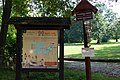
 Chrudim-městské-lesy2014cedule.jpg 2,848 × 4,288; 6.77 MB
.jpg)
.jpg)
.jpg)
.jpg)
.jpg)
.jpg)
.jpg)
.jpg)
.jpg)
.jpg)
.jpg)
.jpg)
.jpg)
.jpg)

