Category:Remote views of Ferrybridge Power Station
Media in category "Remote views of Ferrybridge Power Station"
The following 105 files are in this category, out of 105 total.
-
 A cold redundant power station in the cold light of day - geograph.org.uk - 5647100.jpg 4,608 × 3,072; 2.46 MB
-

-
 A walk from Glass Houghton ^16 - geograph.org.uk - 1996679.jpg 800 × 600; 177 KB
-
 A1(M) northbound - geograph.org.uk - 4827617.jpg 640 × 428; 94 KB
-
 A1(M) northbound - geograph.org.uk - 4827635.jpg 640 × 428; 89 KB
-
 A1(M) northbound - geograph.org.uk - 4827648.jpg 640 × 428; 87 KB
-
 A1(M) northbound - geograph.org.uk - 4827660.jpg 640 × 428; 95 KB
-

-
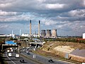 A1M motorway and derelict power station - geograph.org.uk - 6304140.jpg 4,288 × 3,216; 1.52 MB
-
 Aire and Calder Navigation and Fryston lake - geograph.org.uk - 3028392.jpg 3,216 × 4,288; 2.78 MB
-
 Banks of the River Aire - geograph.org.uk - 3731165.jpg 640 × 480; 80 KB
-
 Beechnut Lane football ground, Pontefract (1st June 2020) 001.jpg 3,872 × 2,176; 2.53 MB
-
 Beechnut Lane football ground, Pontefract (1st June 2020) 002.jpg 3,872 × 2,176; 2.75 MB
-
 Beechnut Lane football ground, Pontefract (1st June 2020) 003.jpg 3,872 × 2,176; 2.66 MB
-
 Bridleway at field edge - geograph.org.uk - 3869290.jpg 1,500 × 971; 1.1 MB
-
 Bringing in the harvest - geograph.org.uk - 6304159.jpg 4,608 × 3,072; 3.6 MB
-
-
 Cooling Reflections - geograph.org.uk - 5652370.jpg 4,608 × 3,456; 3.77 MB
-
 Dawn over power - geograph.org.uk - 2789118.jpg 3,872 × 2,592; 957 KB
-

-
 Eight minus five equals three - geograph.org.uk - 6304138.jpg 3,562 × 2,139; 875 KB
-
 Eskdale barge moored at Ferrybridge - geograph.org.uk - 6304180.jpg 4,608 × 3,072; 1.93 MB
-
 Farmland near Pontefract - geograph.org.uk - 100424.jpg 640 × 427; 95 KB
-
 Farmland south-east of Knottingley - geograph.org.uk - 4303568.jpg 1,024 × 768; 121 KB
-
 Ferrybridge and power station - geograph.org.uk - 5220874.jpg 640 × 480; 79 KB
-
 Ferrybridge C from Baghill - geograph.org.uk - 6289302.jpg 4,288 × 2,031; 2.07 MB
-
 Ferrybridge C from the Keep of Pontefract Castle - geograph.org.uk - 6222030.jpg 3,264 × 1,832; 2.65 MB
-
 Ferrybridge C wide angle view - geograph.org.uk - 6176223.jpg 3,200 × 1,800; 1.8 MB
-
 Ferrybridge Flood Lock, Aire ^ Calder Navigation - geograph.org.uk - 4557723.jpg 1,024 × 768; 111 KB
-
 Ferrybridge Hill - geograph.org.uk - 224210.jpg 640 × 407; 46 KB
-
 Ferrybridge power station - geograph.org.uk - 4021977.jpg 3,435 × 2,535; 1.64 MB
-
 Ferrybridge Power Station - geograph.org.uk - 4118497.jpg 1,600 × 1,064; 532 KB
-
 Ferrybridge power station - geograph.org.uk - 5112188.jpg 6,313 × 3,185; 7.29 MB
-
 Ferrybridge Power Station - geograph.org.uk - 5649855.jpg 4,154 × 2,788; 2.31 MB
-
 Ferrybridge Power Station Christmas Day 2018 - geograph.org.uk - 6378196.jpg 3,264 × 1,290; 2.07 MB
-
 Ferrybridge power station golf course - geograph.org.uk - 5655642.jpg 4,608 × 3,456; 3.75 MB
-
 Ferrybridge power station minus one cooling tower - geograph.org.uk - 6239019.jpg 4,037 × 2,742; 1.9 MB
-

-
 Ferrybridge power station seen from Pontefract Castle (2nd October 2022) 001.jpg 5,152 × 3,864; 5.38 MB
-
 Ferrybridge Power Station viewed from Fryston Wood - geograph.org.uk - 2729180.jpg 1,600 × 1,200; 344 KB
-
 Ferrybridge power station viewed from Pontefract - geograph.org.uk - 6342659.jpg 4,288 × 3,216; 3.21 MB
-
 Ferrybridge power stations - geograph.org.uk - 5220879.jpg 1,024 × 768; 108 KB
-
-
 Field of Wheat off Fairy Hill Lane - geograph.org.uk - 3533894.jpg 4,608 × 3,456; 3.05 MB
-
 Footpath between canal and river Aire at Ferrybridge - geograph.org.uk - 6148029.jpg 3,889 × 2,876; 3.7 MB
-
 Frosty Ferrybridge Power Station - geograph.org.uk - 3257135.jpg 4,288 × 3,216; 1.89 MB
-
 Fryston Park and Ferrybridge Power Station. - geograph.org.uk - 2762340.jpg 4,288 × 3,216; 2.48 MB
-
 Fryston Park ^ Ferrybridge Power Station - geograph.org.uk - 2730551.jpg 1,600 × 1,200; 537 KB
-
 Greavefield Closes Pontefract - geograph.org.uk - 6342663.jpg 4,288 × 3,216; 2.94 MB
-
 Gypsum empties for Drax - geograph.org.uk - 1981441.jpg 640 × 402; 85 KB
-

-

-
 Last three standing - geograph.org.uk - 6375499.jpg 4,288 × 3,216; 1.39 MB
-
 Lazy Daze on the river - geograph.org.uk - 5666182.jpg 4,608 × 3,456; 4.78 MB
-

-
 Lone Tree - geograph.org.uk - 395171.jpg 640 × 480; 100 KB
-

-
-

-
 Lower Thythes Lane Pontefract - geograph.org.uk - 5654630.jpg 4,608 × 3,456; 4.3 MB
-
 Messing about on the river - geograph.org.uk - 2609516.jpg 1,600 × 1,040; 246 KB
-
 Misty view of Ferrybridge power stations - geograph.org.uk - 5651881.jpg 4,608 × 3,456; 1.65 MB
-
 Moving the muck - geograph.org.uk - 5663158.jpg 4,608 × 3,456; 2.88 MB
-

-
 New Golf Course - geograph.org.uk - 5657995.jpg 4,608 × 3,456; 4.09 MB
-
 One down, seven to go. - geograph.org.uk - 6239011.jpg 4,608 × 3,072; 2.64 MB
-

-
 Ploughed field alongside Sudforth Lane - geograph.org.uk - 6003741.jpg 1,280 × 960; 395 KB
-
 Pontefract Castle 01.jpg 479 × 640; 76 KB
-

-
-
 Pontefract Swimming Baths (5th July 2019).jpg 3,872 × 2,176; 2.47 MB
-
 Pontefracts Poppy Fields Estate (geograph 6633710).jpg 3,241 × 1,688; 2.12 MB
-
 Potato field, King's Standard Hill - geograph.org.uk - 2476724.jpg 1,024 × 768; 177 KB
-
 Potato Power - geograph.org.uk - 5973135.jpg 4,608 × 3,072; 3.8 MB
-
 Potato power perspective - geograph.org.uk - 5973175.jpg 3,072 × 4,608; 3.75 MB
-
 Power generation - geograph.org.uk - 4826883.jpg 1,024 × 768; 154 KB
-
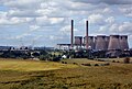
 Power Station Cooling Towers - geograph.org.uk - 2767933.jpg 3,632 × 2,689; 1.33 MB
-
 Power Station,Canal and River at Ferrybridge - geograph.org.uk - 2802939.jpg 4,104 × 2,854; 1.68 MB
-
 Railway crossing and Common Lane - geograph.org.uk - 4826657.jpg 1,024 × 768; 166 KB
-
 Sandy Gate Lane . . . - geograph.org.uk - 77549.jpg 574 × 640; 75 KB
-
 Smile! (geograph 3638651).jpg 4,608 × 3,456; 2.29 MB
-
 Snow, Sun and Steam - geograph.org.uk - 3305781.jpg 4,288 × 3,216; 2.34 MB
-
 Steam clouds - geograph.org.uk - 2790721.jpg 1,024 × 768; 540 KB
-
 Sunset in Fryston Woods - geograph.org.uk - 5652152.jpg 4,419 × 2,800; 1.22 MB
-
 Teeing off in the mist - geograph.org.uk - 5686022.jpg 3,100 × 2,097; 867 KB
-
 The A1's at Fairburn - geograph.org.uk - 5655587.jpg 2,968 × 2,012; 1.13 MB
-
 The A1M Motorway - geograph.org.uk - 3422735.jpg 4,608 × 3,456; 3.34 MB
-
 The Aire ^ Calder Navigation at Ferrybridge - geograph.org.uk - 4557699.jpg 1,024 × 768; 107 KB
-
 The Bailey, Pontefract Castle - geograph.org.uk - 429630.jpg 640 × 480; 88 KB
-
 The dark clouds gather - geograph.org.uk - 6017621.jpg 4,608 × 3,072; 1.67 MB
-

-
 The River Aire towards Ferrybridge - geograph.org.uk - 4120398.jpg 1,600 × 1,064; 551 KB
-
 The silent Giant - geograph.org.uk - 5649800.jpg 4,608 × 3,072; 2.99 MB
-
 TK Maxx warehouse next to the M62 - geograph.org.uk - 5973139.jpg 4,608 × 3,072; 3.14 MB
-
 Tree silhouette on the snowy golf course - geograph.org.uk - 5697225.jpg 4,008 × 2,772; 1.83 MB
-
 Trees surrounding Nearpark Farm - geograph.org.uk - 4303581.jpg 1,024 × 768; 108 KB
-
 View from Pontefract Castle - geograph.org.uk - 4401400.jpg 4,959 × 3,720; 4.52 MB
-

-

-
 Wheat field west of Beal Lane - geograph.org.uk - 2477921.jpg 1,024 × 768; 163 KB
-

-
 When the lights go out - geograph.org.uk - 5655606.jpg 4,608 × 3,456; 2.53 MB
-
 Willow Island on the river Aire - geograph.org.uk - 6057149.jpg 4,608 × 3,072; 4.05 MB
-
 Work In Progress - geograph.org.uk - 462489.jpg 640 × 384; 54 KB

_001.jpg)

_northbound_-_geograph.org.uk_-_4827617.jpg)
_northbound_-_geograph.org.uk_-_4827635.jpg)
_northbound_-_geograph.org.uk_-_4827648.jpg)
_northbound_-_geograph.org.uk_-_4827660.jpg)
_with_Ferrybridge_Power_Station_in_the_distance_-_geograph.org.uk_-_2040737.jpg)


_001.jpg)
_002.jpg)
_003.jpg)


_001.jpg)


.jpg)
.jpg)


.jpg)


