Category:Republic of Ireland photographs taken on 2006-05-29
Countries of Europe: Croatia · Finland · France‡ · Germany · Greece · Republic of Ireland · Italy · Latvia · Netherlands‡ · Norway · Poland · Portugal‡ · Russia‡ · Spain‡ · Sweden · Turkey‡ · Ukraine · United Kingdom
Specific status: Isle of Man
‡: partly located in Europe
Specific status: Isle of Man
‡: partly located in Europe
| ← | 29 May 2006 | → | ||
| ← | May 2006 | → | ||

Republic of Ireland photographs taken on 29 May 2006.
Image files should be categorized here automatically using {{taken on}} template. Direct categorisation is also possible, if automatic is impossible.
Subcategories
This category has only the following subcategory.
Media in category "Republic of Ireland photographs taken on 2006-05-29"
The following 28 files are in this category, out of 28 total.
-
 Ballymacavany Townland - geograph.org.uk - 449757.jpg 640 × 479; 72 KB
-
 Lough Derg stone - geograph.org.uk - 449720.jpg 479 × 640; 171 KB
-
 Pettigo Inn - geograph.org.uk - 449700.jpg 640 × 479; 56 KB
-
 Pettigoe RC Church - geograph.org.uk - 449699.jpg 640 × 479; 51 KB
-
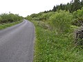
 Road at Aghafoy - geograph.org.uk - 449688.jpg 640 × 479; 80 KB
-
 Road at Ballymacavany - geograph.org.uk - 449759.jpg 640 × 479; 81 KB
-
 Road at Gortinessy - geograph.org.uk - 449717.jpg 640 × 479; 54 KB
-
 Road at Gortinessy - geograph.org.uk - 449729.jpg 640 × 479; 54 KB
-
 Road near Croagh - geograph.org.uk - 449738.jpg 640 × 479; 67 KB
-
 Saint Patrick's Purgatory, Lough Derg - geograph.org.uk - 449763.jpg 640 × 478; 58 KB
-
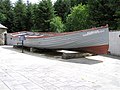 The Saint Patrick - geograph.org.uk - 449772.jpg 640 × 479; 68 KB
-
 Towlaght Townland - geograph.org.uk - 449746.jpg 640 × 479; 77 KB
-
 Towlaght, County Donegal - geograph.org.uk - 449740.jpg 640 × 479; 79 KB
-
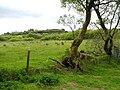
 Bog at Croagh - geograph.org.uk - 449737.jpg 640 × 479; 81 KB
-
 Drumchrin Townland - geograph.org.uk - 449714.jpg 640 × 479; 60 KB
-
 Farm at Drunchrin - geograph.org.uk - 449711.jpg 640 × 479; 89 KB
-
 Farm at Towlaght - geograph.org.uk - 449742.jpg 640 × 479; 67 KB
-
 Gortinessy - geograph.org.uk - 449736.jpg 640 × 479; 58 KB
-
 Gortinessy Townland - geograph.org.uk - 449722.jpg 640 × 479; 64 KB
-
 Gortinessy Townland - geograph.org.uk - 449727.jpg 640 × 479; 66 KB
-
 Gortinessy Townland - geograph.org.uk - 449731.jpg 640 × 479; 64 KB
-
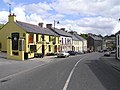
 Pettigoe - geograph.org.uk - 449708.jpg 640 × 479; 65 KB
-
 Pettigoe, County Donegal - geograph.org.uk - 449705.jpg 640 × 479; 65 KB
-
 Road at Aghafoy - geograph.org.uk - 449690.jpg 640 × 479; 73 KB
-
 Road at Mulangoad - geograph.org.uk - 449680.jpg 640 × 479; 93 KB
-
 Road at Mulnagoad - geograph.org.uk - 449695.jpg 640 × 479; 97 KB
-
 Road at Pettigoe - geograph.org.uk - 449703.jpg 640 × 479; 93 KB
-
 Waterfoot River - geograph.org.uk - 449685.jpg 640 × 479; 106 KB


