Category:Rhubarb fields in England
Media in category "Rhubarb fields in England"
The following 24 files are in this category, out of 24 total.
-
 Bridleway and Rhubarb - geograph.org.uk - 2060605.jpg 1,024 × 681; 280 KB
-
 Carlton Beck Culvert - geograph.org.uk - 1233099.jpg 480 × 640; 116 KB
-
 Carlton cricket club - geograph.org.uk - 900067.jpg 640 × 480; 89 KB
-
 Field of Rhubarb - geograph.org.uk - 2036041.jpg 1,024 × 681; 221 KB
-
 Field of Rhubarb - geograph.org.uk - 566975.jpg 640 × 480; 171 KB
-
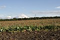 Field of Rhubarb near Thorpe Lower Lane - geograph.org.uk - 2060604.jpg 1,024 × 681; 220 KB
-
 Rhubarb - geograph.org.uk - 230633.jpg 640 × 480; 95 KB
-
 Rhubarb and Victoria No. 2 pit, Stanley - geograph.org.uk - 6423966.jpg 1,600 × 1,200; 712 KB
-
 Rhubarb Field - Carlton Lane - geograph.org.uk - 841984.jpg 640 × 419; 69 KB
-
 Rhubarb field - geograph.org.uk - 2475148.jpg 1,024 × 768; 705 KB
-
 Rhubarb Field - Priesthorpe Lane - geograph.org.uk - 480620.jpg 640 × 412; 57 KB
-
 Rhubarb Field - Roker Lane - geograph.org.uk - 420922.jpg 640 × 365; 81 KB
-
 Rhubarb Field - Wood Lane - geograph.org.uk - 1262480.jpg 640 × 480; 270 KB
-
 Rhubarb Field alongside the M62 - geograph.org.uk - 3917691.jpg 1,600 × 1,064; 487 KB
-
 Rhubarb field in Winter - geograph.org.uk - 626541.jpg 640 × 480; 76 KB
-
 Rhubarb field near Rothwell - geograph.org.uk - 3858364.jpg 1,200 × 798; 499 KB
-
 Rhubarb field near Rothwell - geograph.org.uk - 3858369.jpg 1,200 × 798; 557 KB
-

-
 Rhubarb field, Hopefield Farm - geograph.org.uk - 4298474.jpg 1,024 × 768; 137 KB
-
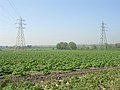
 Rhubarb field, north of Leadwell Lane (A654) - geograph.org.uk - 4298213.jpg 1,024 × 768; 153 KB
-
 Rhubarb field, north of Stanley Marsh - geograph.org.uk - 6423429.jpg 1,600 × 1,200; 781 KB
-
 Rhubarb in flower - geograph.org.uk - 2402489.jpg 1,024 × 768; 777 KB
-
 Rhubarb patch and Buxton New Road - geograph.org.uk - 1399941.jpg 640 × 480; 106 KB
-
 Rhubarb Shed.jpg 640 × 480; 106 KB


_-_geograph.org.uk_-_4298213.jpg)


