Category:Ribbleton
English: Ribbleton is a suburb and ward of the city of Preston, England. It is located to the east of the city centre, between the A59 New Hall Lane and the B6243 Longridge Road. The M6 motorway also runs through the area. The ward had a population of 7,351 recorded in the 2001 census, of which 77.2% classed themselves as Christian. At the most recent elections, the valid electorate in Ribbleton was 5,727. (→Ribbleton)
human settlement in Lancashire, UK  | |||||
| Upload media | |||||
| Instance of | |||||
|---|---|---|---|---|---|
| Location | Preston, Lancashire, North West England, England | ||||
 | |||||
Subcategories
This category has only the following subcategory.
M
Media in category "Ribbleton"
The following 36 files are in this category, out of 36 total.
-
 Booths Central Office - geograph.org.uk - 1369512.jpg 640 × 480; 115 KB
-
 Deepdale Mill Street level crossing - geograph.org.uk - 948338.jpg 640 × 480; 76 KB
-
 Eaves Brook - geograph.org.uk - 557505.jpg 640 × 480; 125 KB
-
 Entrance to empty warehouse - geograph.org.uk - 1369509.jpg 640 × 480; 65 KB
-
 Entrance to Grange Park - geograph.org.uk - 557252.jpg 640 × 480; 132 KB
-
 Footpath - geograph.org.uk - 1369506.jpg 640 × 480; 112 KB
-
 Fox and Grapes, Ribbleton Lane, Preston - geograph.org.uk - 671626.jpg 640 × 480; 249 KB
-
-
 Grange Park, Preston - geograph.org.uk - 557471.jpg 640 × 480; 113 KB
-
 Maitland Street, Preston - geograph.org.uk - 661347.jpg 640 × 480; 170 KB
-
 Moor Nook Youth Centre - geograph.org.uk - 137795.jpg 640 × 480; 75 KB
-
 New development off Blue Bell Way - geograph.org.uk - 1369508.jpg 640 × 480; 95 KB
-
 Pond near Tunbrook Wood - geograph.org.uk - 635313.jpg 640 × 480; 47 KB
-
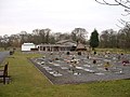 Preston Crematorium - geograph.org.uk - 136035.jpg 640 × 480; 99 KB
-
 Preston Prison - Ribbleton Street - geograph.org.uk - 529975.jpg 640 × 518; 30 KB
-
 Ribble Lodge, Ribbleton.JPG 4,608 × 3,456; 3.4 MB
-
 Ribbleton railway station 236-6.jpg 1,691 × 1,131; 527 KB
-
 Ribbleton, RSPCA refuge - geograph.org.uk - 557489.jpg 640 × 480; 88 KB
-
 River Ribble near Red Scar - geograph.org.uk - 1008195.jpg 640 × 480; 119 KB
-
 Sion Park, Ribbleton (1).JPG 4,608 × 3,456; 3.39 MB
-
 Sion Park, Ribbleton (2).JPG 4,608 × 3,456; 3.39 MB
-
 St Maria Goretti Church, Preston (1).JPG 4,608 × 3,456; 3.53 MB
-
 Sunshine Children's Centre - geograph.org.uk - 1200459.jpg 640 × 480; 52 KB
-
 The Derby Inn, Ribbleton Lane, Preston - geograph.org.uk - 671593.jpg 640 × 480; 263 KB
-
 The Gamull, Ribbleton.JPG 4,608 × 3,456; 3.55 MB
-
 The Skeffington, Ribbleton Lane, Preston - geograph.org.uk - 671629.jpg 640 × 480; 149 KB
-
 Tree crash - geograph.org.uk - 488106.jpg 640 × 426; 436 KB
-
 Weir and canister, near Red Scar - geograph.org.uk - 635306.jpg 640 × 480; 80 KB
-
 White van man's delight - geograph.org.uk - 1369514.jpg 640 × 480; 84 KB
-
 Hesketh Arms - geograph.org.uk - 152178.jpg 640 × 480; 84 KB
-
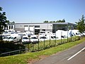
 Industrial Development - geograph.org.uk - 35051.jpg 640 × 480; 92 KB
-
 Ribbleton, Preston - geograph.org.uk - 137793.jpg 640 × 480; 101 KB
-
 River Ribble at Horseshoe Bend - geograph.org.uk - 136038.jpg 640 × 480; 115 KB
-
 Rough Hey Road Industrial Estate - geograph.org.uk - 171120.jpg 640 × 480; 229 KB
-
 Welcome to Grange Park - geograph.org.uk - 137794.jpg 640 × 480; 104 KB
-
 West View Leisure Centre - geograph.org.uk - 141134.jpg 640 × 480; 87 KB


.JPG)
.JPG)
.JPG)


