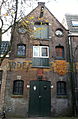
Category:Rijnstraat 64, Arnhem
| Object location | | View all coordinates using: OpenStreetMap |
|---|
 | |||||
| Upload media | |||||
| Instance of | |||||
|---|---|---|---|---|---|
| Location | Arnhem, Gelderland, Netherlands | ||||
| Street address |
| ||||
| Heritage designation |
| ||||
 | |||||
|
This is a category about rijksmonument number 8360
|
| Address |
|
Media in category "Rijnstraat 64, Arnhem"
The following 3 files are in this category, out of 3 total.
-
 Arnhem - Rijnstraat 64.jpg 1,728 × 2,592; 1.07 MB
-
 Bovendeel voorgevel - Arnhem - 20025557 - RCE.jpg 1,198 × 1,200; 315 KB
-
 De Drie Haringen, Arnhem.jpg 2,035 × 3,108; 2.31 MB

