Category:Rimswell
English: Rimswell is a village and civil parish in Holderness in the
East Riding of Yorkshire, England. The village is between the B1243 and B1362 roads, about 2 miles (3 km) northwest of Withernsea.
village in East Yorkshire, England  | |||||
| Upload media | |||||
| Instance of | |||||
|---|---|---|---|---|---|
| Location | East Riding of Yorkshire, Yorkshire and the Humber, England | ||||
 | |||||
Subcategories
This category has the following 4 subcategories, out of 4 total.
B
- Black Mill, Rimswell (5 F)
R
- Rimswell Water Tower (3 F)
S
- St Mary's Church, Rimswell (4 F)
W
- Waxholme (14 F)
Media in category "Rimswell"
The following 199 files are in this category, out of 199 total.
-
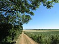
 A farm track North of Waxholme - geograph.org.uk - 2096215.jpg 800 × 600; 208 KB
-

-
 A field corner near Town's Carr Hill - geograph.org.uk - 2145875.jpg 800 × 600; 306 KB
-

-
 A footpath off Waxholme Road - geograph.org.uk - 2096187.jpg 800 × 600; 259 KB
-
 A Hill in Holderness - geograph.org.uk - 2699978.jpg 3,264 × 2,448; 2 MB
-

-
 A ploughed up footpath leading to Hollym - geograph.org.uk - 2145841.jpg 800 × 600; 278 KB
-
 A public footpath off Waxholme Road - geograph.org.uk - 2096181.jpg 800 × 600; 208 KB
-
-

-
 A weather station on Waxholme Road - geograph.org.uk - 2097628.jpg 800 × 600; 211 KB
-

-
 Arables Lane towards Chantry Lane - geograph.org.uk - 5889880.jpg 1,600 × 1,065; 637 KB
-
 B1242 towards Withernsea - geograph.org.uk - 1894021.jpg 640 × 480; 61 KB
-
 B1242 towards Withernsea - geograph.org.uk - 1894026.jpg 640 × 480; 71 KB
-
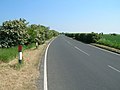
 B1362 towards Burstwick - geograph.org.uk - 1894434.jpg 640 × 480; 63 KB
-
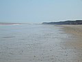 Beach near Sand le Mere - geograph.org.uk - 1894001.jpg 640 × 480; 43 KB
-

-
 By Church Road, near Rimswell - geograph.org.uk - 5821055.jpg 1,600 × 1,200; 1.29 MB
-
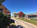
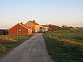
 Carr Farm, Rimswell - geograph.org.uk - 2207872.jpg 800 × 600; 140 KB
-
 Carr Lane, Rimswell - geograph.org.uk - 300406.jpg 640 × 480; 108 KB
-
 Chantry Lane - the road to Rimswell - geograph.org.uk - 876828.jpg 640 × 480; 91 KB
-
 Chantry Lane towards Winestead - geograph.org.uk - 1894466.jpg 640 × 480; 56 KB
-
 Church of St Mary, Rimswell - geograph.org.uk - 5819901.jpg 1,600 × 1,096; 1 MB
-
 Church Road towards Rimswell - geograph.org.uk - 1894447.jpg 640 × 480; 95 KB
-
 Church Road towards Rimswell - geograph.org.uk - 1894452.jpg 640 × 480; 75 KB
-
 Church Road, Rimswell - geograph.org.uk - 5821081.jpg 1,600 × 1,097; 876 KB
-
 Cliff Farm, Waxholme - geograph.org.uk - 2096206.jpg 800 × 600; 211 KB
-
 Clifftop roadway - geograph.org.uk - 5656465.jpg 1,024 × 768; 116 KB
-
 Clifftop roadway and Redhouse Farm - geograph.org.uk - 5656461.jpg 1,024 × 768; 135 KB
-
 Country Lane near Frodingham Hall - geograph.org.uk - 876818.jpg 640 × 480; 150 KB
-
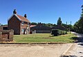
 Derelict Village Hall, Rimswell - geograph.org.uk - 4330925.jpg 1,024 × 768; 181 KB
-
 Distant farm - geograph.org.uk - 28826.jpg 640 × 480; 79 KB
-
 Dodd Hill Valley, Rimswell - geograph.org.uk - 201593.jpg 480 × 640; 153 KB
-
 Dover Lodge, Rimswell - geograph.org.uk - 300405.jpg 640 × 547; 110 KB
-
 Down the Lane - geograph.org.uk - 28831.jpg 640 × 480; 106 KB
-
 Drapes on the cliffs near Waxholme - geograph.org.uk - 4583915.jpg 640 × 427; 69 KB
-
 Enclosed track to Willow House Farm - geograph.org.uk - 4776665.jpg 4,000 × 3,000; 3.69 MB
-
 Enjoy the view - geograph.org.uk - 293369.jpg 640 × 433; 83 KB
-
 Entrance and driveway, Frodingham Hall, near Winestead - geograph.org.uk - 5821312.jpg 1,600 × 1,322; 1.37 MB
-
 Entrance to a farmhouse, Rimswell - geograph.org.uk - 4330957.jpg 1,024 × 768; 385 KB
-
 Entrance to Central Farm - geograph.org.uk - 5889889.jpg 1,600 × 1,065; 762 KB
-
 Every home should have one - geograph.org.uk - 280795.jpg 420 × 640; 131 KB
-
 Farm building, Northfield House Farm - geograph.org.uk - 1894038.jpg 640 × 429; 36 KB
-
 Farm buildings near Winestead - geograph.org.uk - 1451739.jpg 640 × 480; 87 KB
-
 Farm Buildings, Little Newsome Farm - geograph.org.uk - 1931008.jpg 640 × 480; 68 KB
-

-
 Farmers cliff top track to Waxholme - geograph.org.uk - 2406160.jpg 3,648 × 2,736; 2.41 MB
-
 Farmland looking towards Poplar Farm - geograph.org.uk - 1894478.jpg 640 × 480; 71 KB
-
 Farmland near Northfield House Farm - geograph.org.uk - 1894041.jpg 640 × 473; 51 KB
-
 Farmland near Rimswell - geograph.org.uk - 1894455.jpg 640 × 480; 62 KB
-
 Farmland near Willow House Farm - geograph.org.uk - 1931036.jpg 640 × 480; 56 KB
-
 Farmland north of the B1362 - geograph.org.uk - 1894428.jpg 640 × 480; 62 KB
-
 Farmland off the B1242 - geograph.org.uk - 1894024.jpg 640 × 480; 79 KB
-
 Farmland off Thirtle Bridge Lane - geograph.org.uk - 1894018.jpg 640 × 480; 39 KB
-
 Field margin near Hall Farm - geograph.org.uk - 1894474.jpg 640 × 480; 104 KB
-
-
 Field Track from Thirtle Bridge Lane - geograph.org.uk - 2699926.jpg 3,264 × 2,448; 2.36 MB
-
 Fields and turbines, near Rimswell - geograph.org.uk - 5822507.jpg 1,331 × 1,600; 2.01 MB
-
 Fishing boats at Sand-le-Mere - geograph.org.uk - 4583688.jpg 640 × 427; 69 KB
-
-
 Footbridge over Winestead Drain - geograph.org.uk - 5890379.jpg 1,600 × 1,065; 623 KB
-
 Footpath near Withernsea - geograph.org.uk - 1842261.jpg 426 × 640; 193 KB
-
 Footpath to Fox Covert - geograph.org.uk - 2682673.jpg 3,264 × 2,448; 1.95 MB
-

-
 Footpath to Rimswell - geograph.org.uk - 5863185.jpg 1,024 × 768; 124 KB
-
 Footpath to the beach - geograph.org.uk - 5511091.jpg 1,024 × 768; 239 KB
-
 Footpath towards Crofts Lane, Hollym - geograph.org.uk - 5889893.jpg 1,600 × 1,065; 561 KB
-
 Footpath towards Hollym - geograph.org.uk - 5821416.jpg 1,600 × 1,200; 2.45 MB
-
 Frodingham Carrs - geograph.org.uk - 51916.jpg 640 × 480; 137 KB
-
 Frodingham Cottages - geograph.org.uk - 302003.jpg 640 × 480; 80 KB
-
 Frodingham Cottages near Frodingham Hall - geograph.org.uk - 5889878.jpg 1,600 × 1,065; 710 KB
-
 Frodingham Cottages, Frodingham Lane - geograph.org.uk - 2145835.jpg 800 × 600; 247 KB
-
 Frodingham Hall - geograph.org.uk - 1931015.jpg 640 × 480; 115 KB
-
 Frodingham Hall - geograph.org.uk - 280787.jpg 640 × 477; 112 KB
-
 Frodingham Hall - geograph.org.uk - 45978.jpg 640 × 480; 156 KB
-
 Frodingham Lane - geograph.org.uk - 1931025.jpg 640 × 480; 86 KB
-
 Frodingham Lane near Willow House Farm - geograph.org.uk - 2145856.jpg 800 × 600; 229 KB
-
 Frodingham Lane, between Winestead and Hollym - geograph.org.uk - 5821333.jpg 1,600 × 1,232; 2.12 MB
-
 Frodingham Lane, near Owthorne - geograph.org.uk - 5822536.jpg 1,200 × 1,600; 2.22 MB
-

-
 From the West to the East - geograph.org.uk - 28835.jpg 640 × 480; 108 KB
-
 Frozen pond, Rimswell - geograph.org.uk - 4330964.jpg 1,024 × 768; 247 KB
-
 Grass field on Frodingham Carrs - geograph.org.uk - 5511125.jpg 1,024 × 694; 120 KB
-
 Great Newsome Farm, near Winestead - geograph.org.uk - 5821299.jpg 1,600 × 1,096; 896 KB
-
 Greenwich Meridian line near Withernsea - geograph.org.uk - 6270173.jpg 4,032 × 3,024; 1.91 MB
-
 Greenwich Meridian Sign - geograph.org.uk - 3848733.jpg 1,024 × 768; 273 KB
-
 Harrowed field and Little Newsome - geograph.org.uk - 5511177.jpg 1,024 × 768; 172 KB
-

-
 Harvesting on Dodd Hill - geograph.org.uk - 5511117.jpg 1,024 × 768; 189 KB
-
 Health and safety at play - geograph.org.uk - 2155624.jpg 800 × 600; 304 KB
-

-

-
 Houses in Rimswell - geograph.org.uk - 5821086.jpg 1,600 × 1,214; 1 MB
-
 Hull Road Cemetery, Withernsea - geograph.org.uk - 1838523.jpg 506 × 640; 217 KB
-
 Little Newsome Farm - geograph.org.uk - 302010.jpg 640 × 480; 71 KB
-
 Little Newsome Farm - geograph.org.uk - 45977.jpg 640 × 480; 134 KB
-
 Little Newsome Farm, near Frodingham, E Yorks - geograph.org.uk - 5821287.jpg 1,600 × 1,200; 851 KB
-
 Looking across to Waxholme - geograph.org.uk - 2097640.jpg 800 × 600; 235 KB
-
 Looking back at the path - geograph.org.uk - 2097682.jpg 800 × 600; 283 KB
-

-
 Looking north near Town's Carr Hill - geograph.org.uk - 2145867.jpg 800 × 600; 239 KB
-
 Looking towards Red House Farm - geograph.org.uk - 2096223.jpg 800 × 600; 241 KB
-

-
 Mona House, Rimswell - geograph.org.uk - 300407.jpg 640 × 478; 116 KB
-
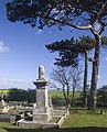
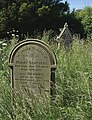 Moody Statters memorial, Rimswell - geograph.org.uk - 5819778.jpg 1,229 × 1,600; 1.32 MB
-
 Muck truck near Rimswell - geograph.org.uk - 5822505.jpg 1,600 × 1,600; 2.51 MB
-
 North Farm Stack Yard - geograph.org.uk - 2699916.jpg 3,264 × 2,448; 2 MB
-
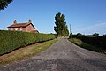
 North Farm, Rimswell - geograph.org.uk - 300399.jpg 640 × 431; 75 KB
-
 North Farm, Rimswell - geograph.org.uk - 4330962.jpg 1,024 × 768; 162 KB
-
 Northfield House Farm, Withernsea (geograph 2096172).jpg 800 × 600; 198 KB
-
 On the B1362 looking towards Withernsea - geograph.org.uk - 28836.jpg 640 × 480; 120 KB
-
 One Man and his Dog on Tunstall Beach - geograph.org.uk - 5398926.jpg 4,365 × 3,382; 3.07 MB
-
 Over Fields to Carr Farm - geograph.org.uk - 2682657.jpg 3,264 × 2,448; 2.12 MB
-
 Painted gates in Waxholme - geograph.org.uk - 5656478.jpg 1,024 × 768; 233 KB
-
 Path Kissing Gate - geograph.org.uk - 878601.jpg 480 × 640; 164 KB
-
 Pillbox on the beach at Sand-le-Mere - geograph.org.uk - 4583576.jpg 640 × 427; 47 KB
-

-
 Poplar Farm over Winter Barley - geograph.org.uk - 2682667.jpg 3,264 × 2,448; 1.74 MB
-
 Poplar Farm, Rimswell - geograph.org.uk - 300401.jpg 640 × 480; 105 KB
-

-
 Rimswell - geograph.org.uk - 300396.jpg 640 × 496; 120 KB
-
 Rimswell Carrs - geograph.org.uk - 300402.jpg 503 × 640; 67 KB
-
 Rimswell Carrs - geograph.org.uk - 300403.jpg 640 × 480; 119 KB
-
 Rimswell Hall - geograph.org.uk - 1894460.jpg 640 × 480; 119 KB
-
 Rimswell Hall - geograph.org.uk - 201608.jpg 640 × 465; 136 KB
-
 Rimswell UK parish locator map.svg 1,425 × 1,107; 1.68 MB
-
 Rimswell Valley - geograph.org.uk - 201621.jpg 640 × 491; 176 KB
-
 Rimswell Water Tower - geograph.org.uk - 1894463.jpg 640 × 491; 53 KB
-
 Rimswell Water Tower - geograph.org.uk - 3110131.jpg 800 × 800; 146 KB
-
 Rimswell, St Mary church tower - geograph.org.uk - 4495338.jpg 4,608 × 3,456; 3.96 MB
-
 Road scene - geograph.org.uk - 28824.jpg 640 × 480; 74 KB
-
 Roadside Poplars - geograph.org.uk - 876872.jpg 640 × 480; 77 KB
-
 Roadway to Carr Farm - geograph.org.uk - 4330955.jpg 1,024 × 768; 211 KB
-
 Roseberry House, Rimswell - geograph.org.uk - 300398.jpg 640 × 460; 114 KB
-
 Sand bars - geograph.org.uk - 514954.jpg 640 × 427; 116 KB
-
 Sand Hills, Rimswell - geograph.org.uk - 300397.jpg 640 × 455; 94 KB
-
 Sand le Mere - geograph.org.uk - 300409.jpg 476 × 640; 64 KB
-

-
 Semi-Submerged Pillbox - geograph.org.uk - 5398888.jpg 4,608 × 3,456; 7.6 MB
-
-
 St Marys Church Rimswell - geograph.org.uk - 2682685.jpg 3,264 × 2,448; 1.55 MB
-
 St. Mary's Rimswell - geograph.org.uk - 4330934.jpg 1,024 × 768; 173 KB
-
 Straw bales at Waxholme - geograph.org.uk - 5511111.jpg 1,024 × 768; 200 KB
-
 Stubble field and view towards Withernsea - geograph.org.uk - 5511162.jpg 1,024 × 768; 153 KB
-
 Stubble field near Rimswell - geograph.org.uk - 5511109.jpg 1,024 × 768; 227 KB
-
 Stubble field near Rimswell - geograph.org.uk - 5511172.jpg 1,024 × 768; 198 KB
-
 That's a Big Bird - geograph.org.uk - 2682696.jpg 2,448 × 3,264; 2.37 MB
-
 The beach near Tunstall - geograph.org.uk - 514960.jpg 640 × 427; 91 KB
-
 The cliff top at Waxholme - geograph.org.uk - 5656456.jpg 1,024 × 768; 175 KB
-

-
 The Rimswell to Roos road - geograph.org.uk - 28832.jpg 640 × 480; 72 KB
-
 The road to Rimswell - geograph.org.uk - 28830.jpg 640 × 480; 96 KB
-
 The Road to Withernsea (geograph 3042111).jpg 4,592 × 3,448; 4.05 MB
-
 The view towards Patrington - geograph.org.uk - 28823.jpg 640 × 480; 112 KB
-
 The Water Tower at Batty's Corner - geograph.org.uk - 2064888.jpg 800 × 600; 205 KB
-
 Thirtle Bridge and Roos Drain - geograph.org.uk - 2699935.jpg 3,264 × 2,448; 1.74 MB
-
 Thirtle Bridge Lane at North Farm - geograph.org.uk - 2699911.jpg 3,264 × 2,448; 1.81 MB
-

-
 Thirtle Bridge Lane towards Rimswell - geograph.org.uk - 1894016.jpg 640 × 480; 65 KB
-
 Thirtle Bridge Lane, near Rimswell - geograph.org.uk - 5822520.jpg 1,197 × 1,600; 2.34 MB
-
 Thirtle Bridge Lane, Rimswell - geograph.org.uk - 2064840.jpg 800 × 600; 171 KB
-
 Thirtle Bridge Lane, Rimswell - geograph.org.uk - 2207867.jpg 800 × 600; 276 KB
-
 Towards Poplar Farm, near Rimswell - geograph.org.uk - 5821446.jpg 1,200 × 1,600; 1.22 MB
-
 Tower Road towards Batty's Corner - geograph.org.uk - 2207888.jpg 800 × 600; 217 KB
-
 Tower Road, near Rimswell - geograph.org.uk - 5821098.jpg 1,600 × 1,200; 1.11 MB
-
 Track to Great Newsome Farm - geograph.org.uk - 1931013.jpg 640 × 480; 114 KB
-
 Tunstall Drain - geograph.org.uk - 2699948.jpg 3,264 × 2,448; 2.16 MB
-
-

-
 Turbines between Roos and Rimswell - geograph.org.uk - 5819928.jpg 1,600 × 1,159; 1.62 MB
-

-
 Walk on the beach at Sand-le-Mer - geograph.org.uk - 4583670.jpg 640 × 427; 55 KB
-

-

-
 Waxholme is only a small place - geograph.org.uk - 2097692.jpg 800 × 600; 173 KB
-
 Waxholme Lane - geograph.org.uk - 5656473.jpg 1,024 × 768; 168 KB
-
 Waxholme Road, near Withernsea - geograph.org.uk - 1841140.jpg 640 × 439; 191 KB
-
 Waxholme seen from the cliff top - geograph.org.uk - 2406149.jpg 3,648 × 2,736; 1.89 MB
-
 Wheatfield near Withernsea (geograph 5863196).jpg 1,024 × 768; 210 KB
-
 Where east meets west - geograph.org.uk - 1894445.jpg 640 × 522; 72 KB
-
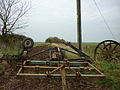
 Where tractors come to die - geograph.org.uk - 5511105.jpg 1,024 × 768; 222 KB
-
 White House Farm, Rimswell.jpg 640 × 475; 123 KB
-
 Willow House Farm - geograph.org.uk - 1931028.jpg 640 × 480; 80 KB
-
 Willow House Farm - geograph.org.uk - 5511157.jpg 1,024 × 768; 206 KB
-
 Willow House Farm on Frodingham Lane - geograph.org.uk - 5890371.jpg 1,600 × 1,065; 708 KB
-
 Willow House Farm, Rimswell - geograph.org.uk - 201571.jpg 640 × 247; 57 KB
-
 Wind turbines near Roos - geograph.org.uk - 4330968.jpg 1,024 × 768; 152 KB
-

-

-
 Winestead Drain and Hollym Carrs - geograph.org.uk - 280777.jpg 640 × 455; 110 KB
-
 Withernsea cemetery - geograph.org.uk - 1838519.jpg 518 × 640; 205 KB
-
 Withernsea cemetery - western edge - geograph.org.uk - 1838555.jpg 466 × 640; 197 KB
-
-
 Withernsea cemetery chapel - geograph.org.uk - 1838538.jpg 459 × 640; 209 KB
-
 Withernsea cemetery chapel - geograph.org.uk - 1894437.jpg 640 × 480; 114 KB
-
 Withernsea Road near Waxholme - geograph.org.uk - 5821484.jpg 1,600 × 1,220; 792 KB
-
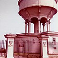
 Withernsea's Water Tower - geograph.org.uk - 28828.jpg 640 × 480; 63 KB


_near_Willow_House_Farm_-_geograph.org.uk_-_1931032.jpg)


.jpg)


.jpg)


_-_geograph.org.uk_-_4583730.jpg)


.jpg)


