Category:Ripley, North Yorkshire
village and civil parish in North Yorkshire, England, UK  | |||||
| Upload media | |||||
| Instance of | |||||
|---|---|---|---|---|---|
| Location | Harrogate, North Yorkshire, Yorkshire and the Humber, England | ||||
 | |||||
English: Ripley is a village and civil parish in North Yorkshire in England, a few miles north of Harrogate on the A61 road towards Ripon.
Subcategories
This category has the following 9 subcategories, out of 9 total.
Media in category "Ripley, North Yorkshire"
The following 200 files are in this category, out of 481 total.
(previous page) (next page)-
 'Monks Cross' - geograph.org.uk - 1554524.jpg 640 × 480; 100 KB
-
 1-10 Main Street, Ripley - geograph.org.uk - 5542619.jpg 1,280 × 853; 292 KB
-
 1-5 Main Street, Ripley.jpg 4,032 × 3,024; 6.34 MB
-
 46th RAC Rally, Forest Stage, Harrogate (260329) (9452802001).jpg 3,956 × 2,700; 3 MB
-
 A61 approaching Ripley - geograph.org.uk - 2041238.jpg 640 × 480; 57 KB
-
 A61 approaching Ripley roundabout - geograph.org.uk - 3084083.jpg 640 × 372; 95 KB
-
 A61 bridge - geograph.org.uk - 3386652.jpg 640 × 428; 101 KB
-
 A61 Bridge - geograph.org.uk - 3861659.jpg 640 × 427; 93 KB
-
 A61 by Ripley - geograph.org.uk - 3745105.jpg 800 × 600; 159 KB
-
 A61 near Nidd - geograph.org.uk - 2041255.jpg 640 × 480; 71 KB
-
 A61 near Nidd - geograph.org.uk - 2041267.jpg 640 × 480; 72 KB
-
 A61 near Ripley - geograph.org.uk - 2041244.jpg 640 × 480; 62 KB
-
 A61 near Ripley - geograph.org.uk - 4267045.jpg 640 × 515; 73 KB
-
 A61 near the junction with Nidd Lane - geograph.org.uk - 5780823.jpg 1,024 × 683; 260 KB
-
 A61 north of Ripley - geograph.org.uk - 3084101.jpg 640 × 403; 72 KB
-
 A61 Ripon Road - geograph.org.uk - 4058898.jpg 640 × 427; 106 KB
-
 A61 Ripon Road near Limekiln Wood - geograph.org.uk - 4729931.jpg 640 × 481; 39 KB
-
 A61 Ripon Road, north of Ripley - geograph.org.uk - 4730801.jpg 640 × 480; 59 KB
-
 A61 towards Ripon - geograph.org.uk - 2041250.jpg 640 × 480; 82 KB
-

-
 A61, Ripley bypass - geograph.org.uk - 4894009.jpg 640 × 372; 49 KB
-
 Access Lane to Chimney Barn - geograph.org.uk - 3026974.jpg 4,320 × 3,240; 3.21 MB
-
 Access Lane to High Kettle Spring - geograph.org.uk - 3026593.jpg 4,320 × 3,240; 5.36 MB
-
 Access road to Chimney Barn Farm - geograph.org.uk - 4975134.jpg 1,024 × 690; 382 KB
-
 Access road to High and Low Kettle Spring Farms - geograph.org.uk - 5014620.jpg 4,602 × 3,448; 6.5 MB
-
 Access road to Low Kettle Spring farm - geograph.org.uk - 4975129.jpg 1,024 × 766; 639 KB
-
 Across the Nidd - geograph.org.uk - 3386710.jpg 640 × 428; 111 KB
-
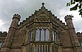
 All Saints church, Ripley - geograph.org.uk - 4663403.jpg 640 × 427; 353 KB
-

-

-

-

-
 All Saints Church, Ripley, North Yorkshire - geograph.org.uk - 6231147.jpg 2,000 × 1,333; 2.14 MB
-
 All Saints, Ripley - Chancel - geograph.org.uk - 5963067.jpg 1,000 × 738; 654 KB
-
 All Saints, Ripley - East end - geograph.org.uk - 5963062.jpg 1,000 × 749; 694 KB
-
 All Saints, Ripley - Font - geograph.org.uk - 5963061.jpg 739 × 1,000; 562 KB
-
 All Saints, Ripley - geograph.org.uk - 5963050.jpg 1,000 × 750; 632 KB
-
 All Saints, Ripley - geograph.org.uk - 5963054.jpg 1,000 × 750; 666 KB
-
 All Saints, Ripley - geograph.org.uk - 5963057.jpg 1,000 × 731; 614 KB
-
 All Saints, Ripley - Hatchment - geograph.org.uk - 5963074.jpg 1,000 × 775; 571 KB
-
 All Saints, Ripley - Monument - geograph.org.uk - 5963072.jpg 768 × 1,000; 594 KB
-
 All Saints, Ripley - North aisle - geograph.org.uk - 5963081.jpg 703 × 1,000; 680 KB
-
 All Saints, Ripley - Pulpit - geograph.org.uk - 5963069.jpg 805 × 1,000; 706 KB
-
 All Saints, Ripley - Stained glass window - geograph.org.uk - 5963077.jpg 580 × 1,000; 804 KB
-
 Along Holly Bank Lane - geograph.org.uk - 3859352.jpg 640 × 427; 155 KB
-
 Along Hollybank Lane - geograph.org.uk - 3386672.jpg 640 × 428; 150 KB
-
 Along Hollybank Lane - geograph.org.uk - 3859359.jpg 640 × 427; 126 KB
-
 Antiques and Reclamation Fair at Ripley - geograph.org.uk - 2954517.jpg 3,648 × 2,736; 4.88 MB
-
 Approaching Birthwaite Farm - geograph.org.uk - 4118725.jpg 1,920 × 2,560; 1.3 MB
-
 Awaiting traffic lights - geograph.org.uk - 3386665.jpg 640 × 428; 106 KB
-
 B6165 - geograph.org.uk - 3961442.jpg 427 × 640; 90 KB
-
 B6165 at Scarah Bridge - geograph.org.uk - 4729939.jpg 640 × 480; 48 KB
-
 B6165 at Scarah Farm in mist - geograph.org.uk - 4729937.jpg 640 × 481; 26 KB
-
 B6165 passing Scarah Farm - geograph.org.uk - 3744624.jpg 640 × 427; 51 KB
-
 B6165 towards Pateley Bridge - geograph.org.uk - 2773910.jpg 640 × 480; 75 KB
-
 B6165 towards Pateley Bridge - geograph.org.uk - 2773916.jpg 640 × 480; 63 KB
-
 Beeches along Hollybank Lane - geograph.org.uk - 2208917.jpg 2,448 × 3,264; 2.96 MB
-
 Benchmarked Stone, Hollybank Lane - geograph.org.uk - 1873712.jpg 683 × 1,024; 179 KB
-
 Bikes and hen, Ripley - geograph.org.uk - 3947785.jpg 1,920 × 1,193; 531 KB
-

-
 Birthwaite Barn - geograph.org.uk - 4118768.jpg 1,920 × 1,283; 646 KB
-
 Birthwaite Farm - geograph.org.uk - 2928229.jpg 3,072 × 2,304; 1.35 MB
-
 Birthwaite Farm - geograph.org.uk - 4118761.jpg 1,920 × 1,440; 741 KB
-
 Birthwaite House - geograph.org.uk - 3027237.jpg 4,320 × 3,240; 3.07 MB
-
 Birthwaite House - geograph.org.uk - 4118771.jpg 1,920 × 1,338; 552 KB
-
 Birthwaite Lane - geograph.org.uk - 2928223.jpg 3,072 × 2,304; 1.23 MB
-
 Birthwaite Lane - geograph.org.uk - 4118807.jpg 1,920 × 1,371; 968 KB
-
 Birthwaite Lane - geograph.org.uk - 4118830.jpg 1,920 × 2,560; 1.66 MB
-
 Birthwaite Lane toward Ripley - geograph.org.uk - 4978237.jpg 768 × 1,024; 412 KB
-
 Blossom, Birthwaite Lane - geograph.org.uk - 4118795.jpg 1,920 × 2,560; 1.33 MB
-
 Bluebells along Hollybank Lane - geograph.org.uk - 3961158.jpg 640 × 427; 179 KB
-
 Bluebells in Hollybank Wood - geograph.org.uk - 3961136.jpg 640 × 427; 182 KB
-
 Bluebells in the wood - geograph.org.uk - 3961133.jpg 427 × 640; 180 KB
-
 Bluebells in the woods - geograph.org.uk - 3961155.jpg 640 × 427; 170 KB
-
 Bluebells north of Hollybank Lane - geograph.org.uk - 3961135.jpg 640 × 427; 165 KB
-
 Bluebells off Hollybank Lane - geograph.org.uk - 3961131.jpg 427 × 640; 179 KB
-
 Bluebells, Hollybank Wood - geograph.org.uk - 1873446.jpg 683 × 1,024; 301 KB
-
 Boar fountain, Ripley (geograph 5821034).jpg 2,848 × 4,079; 1.39 MB
-
 Bolt Bench Mark, Killinghall Bridge - geograph.org.uk - 3076835.jpg 1,024 × 682; 247 KB
-
 Border country (7889300030).jpg 4,184 × 2,388; 8.04 MB
-
 Boundary Stone - geograph.org.uk - 918106.jpg 480 × 640; 112 KB
-
 Boundary Stone, Hollybank Lane - geograph.org.uk - 1873694.jpg 683 × 1,024; 257 KB
-
 Breakaway support vehicles - geograph.org.uk - 4929912.jpg 640 × 363; 118 KB
-
 Brick building near Hollybank Lodge - geograph.org.uk - 1264416.jpg 640 × 467; 91 KB
-
 Bridge across former railway, Nidd - geograph.org.uk - 2920707.jpg 640 × 480; 104 KB
-
 Bridge over Ripley Lakes - geograph.org.uk - 5280677.jpg 4,000 × 3,000; 5.01 MB
-
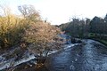
 Bridge over River Nidd - geograph.org.uk - 2888600.jpg 640 × 509; 77 KB
-
 Bridleway descending to Ripley Beck - geograph.org.uk - 3024642.jpg 4,320 × 3,240; 3.85 MB
-
 Building a fence - geograph.org.uk - 3859234.jpg 640 × 427; 97 KB
-
 Campsite in Ripley - geograph.org.uk - 4058895.jpg 640 × 427; 95 KB
-
 Cattle grid on the Nidderdale Way - geograph.org.uk - 4118685.jpg 1,920 × 1,023; 423 KB
-
 Chantry Gallery, Ripley - geograph.org.uk - 4212837.jpg 640 × 536; 77 KB
-
 Chimney Barn - geograph.org.uk - 249199.jpg 640 × 480; 77 KB
-
 Countryside by the B6165 - geograph.org.uk - 4212853.jpg 640 × 332; 32 KB
-
 Cowslips by Birthwaite Lane - geograph.org.uk - 3945435.jpg 1,920 × 1,382; 334 KB
-
 Crag Hill - geograph.org.uk - 237598.jpg 640 × 480; 73 KB
-
 Crag Wood - geograph.org.uk - 4117699.jpg 1,920 × 1,440; 1.17 MB
-
 Cross, Ripley - geograph.org.uk - 2650818.jpg 425 × 640; 67 KB
-
 Cut Bench Mark, Hollybank Lodge - geograph.org.uk - 2709999.jpg 1,024 × 681; 184 KB
-
 Cut Bench Mark, Ripley Milestone - geograph.org.uk - 2710013.jpg 1,024 × 681; 267 KB
-
 Cyclepath to Bilton - geograph.org.uk - 3386647.jpg 428 × 640; 158 KB
-
 Descending Holly Bank Lane - geograph.org.uk - 3859354.jpg 427 × 640; 165 KB
-
 Descending Hollybank Lane - geograph.org.uk - 3386726.jpg 640 × 428; 129 KB
-
 Detached house, Ripley, North Yorkshire - geograph.org.uk - 2075325.jpg 3,264 × 2,448; 3 MB
-
 Detached house, Ripley, North Yorkshire - geograph.org.uk - 2075356.jpg 3,264 × 2,448; 3.47 MB
-
 Disused George V Postbox, Ripley - geograph.org.uk - 2710026.jpg 681 × 1,024; 167 KB
-

-
 Double-spouted drinking fountain, Ripley, North Yorkshire - geograph.org.uk - 2075086.jpg 2,448 × 3,264; 3.51 MB
-

-
 Down the hill - geograph.org.uk - 3386648.jpg 428 × 640; 157 KB
-

-
 Drinking fountain, Main Street, Ripley - geograph.org.uk - 4647809.jpg 2,592 × 3,888; 2.49 MB
-
 Edge of Hollybank Wood - geograph.org.uk - 3025400.jpg 4,320 × 3,240; 4.73 MB
-
 Entrance to Ripley Land Fill site from Sadler Carr - geograph.org.uk - 1904962.jpg 2,560 × 1,920; 1.51 MB
-
 Estate Cottage, Ripley - geograph.org.uk - 4267052.jpg 640 × 430; 71 KB
-
 Fallen tree by the Nidd - geograph.org.uk - 2888608.jpg 640 × 480; 138 KB
-
 False oxlip, Hollybank Lane - geograph.org.uk - 1264392.jpg 482 × 640; 76 KB
-

-
 Farm turn, top of Scarah Bank - geograph.org.uk - 4117417.jpg 1,920 × 1,270; 642 KB
-
 Farmland by Ripon Rd - geograph.org.uk - 4894115.jpg 640 × 340; 36 KB
-
 Farmland off Ripon Road - geograph.org.uk - 2773918.jpg 640 × 480; 51 KB
-
 Farmland off the B6165 - geograph.org.uk - 2773908.jpg 640 × 480; 71 KB
-
 Farmland on Scarah Moor - geograph.org.uk - 4117422.jpg 1,920 × 1,167; 675 KB
-
 Felled tree by Sir Henry Wood - geograph.org.uk - 4118534.jpg 1,920 × 1,440; 1.01 MB
-
 Field beside the A61 - geograph.org.uk - 3024590.jpg 4,320 × 3,240; 4.24 MB
-
 Field boundary by Birthwaite Lane - geograph.org.uk - 4118821.jpg 1,920 × 1,309; 735 KB
-
 Field by Nidd Lane - geograph.org.uk - 2920729.jpg 640 × 475; 88 KB
-
 Field by Ripon Rd - geograph.org.uk - 4894035.jpg 640 × 371; 39 KB
-
 Field by Scarah Hill - geograph.org.uk - 4117431.jpg 3,994 × 2,774; 2.6 MB
-
 Field by Sir Henry Wood - geograph.org.uk - 4118489.jpg 1,920 × 1,202; 671 KB
-
 Fields by Birthwaite Lane - geograph.org.uk - 4118825.jpg 1,920 × 1,383; 737 KB
-
 Fields by Birthwaite Lane - geograph.org.uk - 4118838.jpg 1,920 × 1,233; 481 KB
-
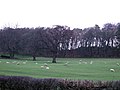
 Fields north of Ripley - geograph.org.uk - 2954524.jpg 3,648 × 2,736; 4.08 MB
-
 Footbridge and Weir, Ripley Beck - geograph.org.uk - 5280661.jpg 4,000 × 3,000; 4.81 MB
-

-
 Footpath in Bishop Thornton - geograph.org.uk - 491422.jpg 640 × 480; 143 KB
-
 Footpath to Scarah Mill west of Broxholme - geograph.org.uk - 3981713.jpg 1,600 × 1,200; 763 KB
-
 Footpath, Sadler Carr - geograph.org.uk - 1873399.jpg 1,024 × 683; 161 KB
-
 Ford on the Nidderdale Way - geograph.org.uk - 4117655.jpg 1,920 × 1,440; 1.02 MB
-
 Ford on the Nidderdale Way - geograph.org.uk - 4117683.jpg 1,920 × 2,560; 1.46 MB
-
 Forest of Knaresborough boundary stone 44 - geograph.org.uk - 5631080.jpg 3,000 × 3,998; 4.1 MB
-
 Former Leeds and Thirsk Railway - geograph.org.uk - 2920734.jpg 479 × 640; 124 KB
-
 French flag - geograph.org.uk - 4058874.jpg 640 × 427; 82 KB
-
 Front of the Peloton - geograph.org.uk - 4929915.jpg 640 × 530; 151 KB
-

-
 Gate by the B6165 - geograph.org.uk - 4212855.jpg 640 × 430; 46 KB
-
 Gate fastening, Green Lane - geograph.org.uk - 4117572.jpg 2,495 × 3,556; 2.2 MB
-
 Gateway, Kettle Spring Lane - geograph.org.uk - 4117178.jpg 1,920 × 1,440; 853 KB
-
 Gateway, Scarah Bank - geograph.org.uk - 4117317.jpg 1,920 × 1,276; 768 KB
-
 George VI Postbox, Ripley - geograph.org.uk - 2710022.jpg 681 × 1,024; 206 KB
-
 GR Postbox - geograph.org.uk - 918574.jpg 480 × 640; 113 KB
-
 Grazing land off the B6165 - geograph.org.uk - 2773914.jpg 640 × 480; 78 KB
-
 Grazing land south of Nidd Lane - geograph.org.uk - 2773922.jpg 640 × 480; 50 KB
-
 Green Lane - geograph.org.uk - 4117556.jpg 1,920 × 1,440; 990 KB
-
 He came in this - geograph.org.uk - 2650019.jpg 640 × 425; 123 KB
-
 Hedge enclosed Nidd Lane approaching Nidd - geograph.org.uk - 6015000.jpg 4,000 × 3,000; 4.07 MB
-
 Hedge-lined Birthwaite Lane at Birtwaite House and Farm - geograph.org.uk - 5523257.jpg 4,000 × 3,000; 3.37 MB
-
 Holly Bank Lodge - geograph.org.uk - 1889568.jpg 2,560 × 1,920; 1.4 MB
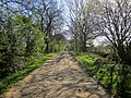
-
 Hollybank Lane - geograph.org.uk - 2709981.jpg 1,024 × 681; 299 KB
-
 Hollybank Lane - geograph.org.uk - 3386679.jpg 428 × 640; 175 KB
-
 Hollybank Lane - geograph.org.uk - 3386729.jpg 640 × 428; 156 KB
-
 Hollybank Lane - geograph.org.uk - 3859357.jpg 427 × 640; 119 KB
-
 Hollybank Lane - geograph.org.uk - 3961160.jpg 640 × 427; 170 KB
-
 Hollybank Lane - geograph.org.uk - 889930.jpg 640 × 427; 83 KB
-
 Hollybank Lane - geograph.org.uk - 890721.jpg 640 × 427; 104 KB
-
 Hollybank Lane bridleway through Hollybank Wood - geograph.org.uk - 5000817.jpg 1,024 × 757; 737 KB
-
 Hollybank Lane passing through Hollybank Wood - geograph.org.uk - 5523304.jpg 4,000 × 3,000; 2.87 MB
-
 Hollybank Lane to Hollybank Lodge - geograph.org.uk - 5000813.jpg 1,024 × 768; 756 KB
-
 Hollybank Lane, from Ripley towards Clint - geograph.org.uk - 1889551.jpg 2,560 × 1,920; 1.33 MB
-
 Hollybank Lane, Ripley - geograph.org.uk - 1154811.jpg 480 × 640; 110 KB
-
 Hollybank Lane, Ripley - geograph.org.uk - 1263681.jpg 640 × 458; 89 KB
-
 Hollybank Lane, Ripley - geograph.org.uk - 2208932.jpg 3,264 × 2,448; 2.88 MB
-
 Hollybank Lane, Ripley - geograph.org.uk - 2650757.jpg 640 × 425; 75 KB
-
 Hollybank Lane, Ripley - geograph.org.uk - 5280621.jpg 4,000 × 3,000; 4.98 MB
-
 Hollybank Lodge - geograph.org.uk - 2709995.jpg 1,024 × 681; 287 KB
-
 Hollybank Wood - geograph.org.uk - 3961140.jpg 640 × 427; 179 KB
-
 Hollybank Wood bluebells - geograph.org.uk - 3961156.jpg 427 × 640; 171 KB
-
 Hollybank Wood with a good show of Bluebells - geograph.org.uk - 5000822.jpg 1,024 × 768; 832 KB
-
 Hollybanke Lane - geograph.org.uk - 1259875.jpg 640 × 480; 278 KB
-
 Horse in heavy rain - geograph.org.uk - 4893993.jpg 640 × 426; 47 KB
-
 Horses on Hollybank Lane - geograph.org.uk - 3386677.jpg 640 × 428; 166 KB
-
 Hotel de Ville (7901682120).jpg 3,746 × 2,359; 4.91 MB
-
 Houses in Killinghall - geograph.org.uk - 3386659.jpg 640 × 428; 83 KB
-

-
 In homage to 'Le Tour' - geograph.org.uk - 4062454.jpg 4,320 × 3,240; 3.28 MB
-
 Junction of Nidd Lane with Ripon Road - geograph.org.uk - 1484461.jpg 640 × 480; 119 KB
-

-
 Kettle Spring Lane - geograph.org.uk - 4116883.jpg 1,920 × 2,291; 1.15 MB
-
 Kettle Spring Lane - geograph.org.uk - 4116940.jpg 1,920 × 1,440; 889 KB
-
 Kettle Spring Lane - geograph.org.uk - 4116984.jpg 1,920 × 1,440; 733 KB
-
 Kettle Spring Lane - geograph.org.uk - 4117073.jpg 1,920 × 1,283; 777 KB
-
 Kettle Spring Lane - geograph.org.uk - 4117163.jpg 1,920 × 2,330; 996 KB
-
 Kettle Spring Lane meets Scarah Bank - geograph.org.uk - 4117240.jpg 1,920 × 1,440; 977 KB
-
 Killinghall Bridge - geograph.org.uk - 2920052.jpg 504 × 640; 89 KB
-
 Killinghall Bridge - geograph.org.uk - 2920066.jpg 480 × 640; 87 KB
-
 Killinghall Bridge - geograph.org.uk - 3386655.jpg 640 × 428; 86 KB
-
 Killinghall Bridge - geograph.org.uk - 3497712.jpg 2,048 × 1,536; 627 KB
-
 Killinghall Bridge Weir - geograph.org.uk - 4778795.jpg 640 × 427; 107 KB
-
 Lake wall - geograph.org.uk - 4058871.jpg 640 × 427; 82 KB
-
 Lakes at Ripley Castle - geograph.org.uk - 4058904.jpg 640 × 427; 85 KB


_(9452802001).jpg)


_-_geograph.org.uk_-_4663385.jpg)

_-_geograph.org.uk_-_4663400.jpg)


.jpg)

.jpg)


.jpg)


_-_geograph.org.uk_-_2441549.jpg)


