Category:Road signs in County Cork
Subcategories
This category has only the following subcategory.
2
Media in category "Road signs in County Cork"
The following 30 files are in this category, out of 30 total.
-
 ADS Toll signage.JPG 3,000 × 4,000; 2.77 MB
-
 Another silly speed limit - geograph.org.uk - 2917788.jpg 1,024 × 768; 301 KB
-
 Ballinspittal - geograph.org.uk - 239478.jpg 640 × 480; 72 KB
-
 Belt Up^ - geograph.org.uk - 757637.jpg 640 × 480; 109 KB
-
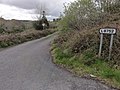
 Cahergal Junction - geograph.org.uk - 1843863.jpg 3,448 × 2,292; 1.7 MB
-
 Central Sign in Ballinspittle.jpg 1,931 × 2,682; 2.47 MB
-
 Clonakilty - geograph.org.uk - 239641.jpg 480 × 590; 71 KB
-
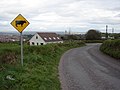 Cow Sign at the Top of Scairt Hill - geograph.org.uk - 757573.jpg 640 × 480; 67 KB
-
 End of the Road^ - geograph.org.uk - 309999.jpg 640 × 480; 76 KB
-
 Glengarriff Junction N71 and R572 2009 09 08.jpg 3,424 × 2,336; 5.28 MB
-
 Irish No Entry old style 146361.jpg 480 × 640; 67 KB
-
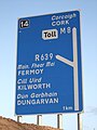
 Junction 14 cantilever Fermoy.JPG 2,146 × 1,461; 555 KB
-
 Keep Douglas Clean - geograph.org.uk - 757655.jpg 640 × 480; 74 KB
-
 Kildorrery3.JPG 3,888 × 2,592; 1.67 MB
-
 L7263 - geograph.org.uk - 2116982.jpg 640 × 480; 124 KB
-
 Lots just up the road - geograph.org.uk - 2117210.jpg 640 × 480; 177 KB
-
 N22 rcs IE.png 943 × 768; 219 KB
-
 N28 rcs IE.png 1,024 × 458; 37 KB
-
 N71 road, In, er, County Cork - geograph.org.uk - 265670.jpg 640 × 480; 97 KB
-
 N72 rcs IE.png 878 × 768; 63 KB
-
 Pill box bunker on the old Cork to Bandon Road (geograph 4855003).jpg 1,600 × 1,200; 670 KB
-
 R515junctionwithR578.JPG 3,176 × 2,365; 4.78 MB
-
 R581NorthCork.JPG 3,888 × 2,592; 6.67 MB
-
 R583roadMillstreet.JPG 3,740 × 2,135; 5.42 MB
-
 R618 Road Junction Ahead - geograph.org.uk - 994268.jpg 640 × 480; 91 KB
-
 R619road.JPG 3,391 × 2,536; 5.39 MB
-
 R626 signage.JPG 3,338 × 3,000; 2.08 MB
-
 The R666 signage Ireland.JPG 4,000 × 3,000; 2.58 MB
-
 The Winnowing Place Castlefreke - geograph.org.uk - 498583.jpg 480 × 640; 199 KB
-
 XroadsCork.JPG 2,565 × 1,732; 4 MB


.jpg)


