Category:Road signs in Jefferson County, Alabama
Counties of Alabama: Baldwin · Barbour · Bibb · Blount · Bullock · Butler · Calhoun · Cherokee · Chilton · Choctaw · Clarke · Cleburne · Coffee · Conecuh · Covington · Crenshaw · Cullman · Dale · Dallas · DeKalb · Escambia · Etowah · Fayette · Franklin · Geneva · Greene · Hale · Henry · Houston · Jackson · Jefferson · Lamar · Lauderdale · Lawrence · Lee · Limestone · Lowndes · Macon · Madison · Marengo · Marion · Marshall · Mobile · Monroe · Montgomery · Morgan · Perry · Pickens · Pike · Randolph · Russell · Shelby · St. Clair · Sumter · Talladega · Tuscaloosa · Walker · Washington · Wilcox · Winston
Media in category "Road signs in Jefferson County, Alabama"
The following 84 files are in this category, out of 84 total.
-
 AL150eRoad-ToInt459-LargeAL150sign (39657149131).jpg 2,400 × 1,600; 2.71 MB
-
 AL150eRoadSign-Bessemer (33042453870).jpg 2,400 × 1,600; 2.07 MB
-
 AL150wRoadSign-NearUS31 (24359352497).jpg 2,400 × 1,600; 1.96 MB
-
 AL151sRoadSign (38701253354).jpg 2,400 × 1,600; 2.01 MB
-
 AL69sRoad-ToUS78ewAL5nsSigns (39265772224).jpg 2,400 × 1,600; 1.57 MB
-
 AL79nRoad-CR131-AL79-AL151nToAL75 (38701252054).jpg 2,400 × 1,600; 2.41 MB
-
 AL79nRoadSign-TarrantAL (38701250394).jpg 2,400 × 1,600; 1.74 MB
-
 BHM-14thSt-4thAveS-TruckUS78eUS11nUS31nWideSigns (39626234382).jpg 2,400 × 1,600; 2.06 MB
-
 BHM-14thSt-5thAveS-TruckUS78eUS11nUS31nWideSigns (38759971275).jpg 2,400 × 1,600; 1.94 MB
-
 Birmingham Truck Routes US11 US31ns US280 Left Orange Signs (40996565905).jpg 1,600 × 2,400; 2.66 MB
-
 Birmingham Truck Routes US11s US31n US78w Blue Signs (41178324074).jpg 1,600 × 2,400; 1.34 MB
-
 Birmingham Truck Routes US11s US31n US78w Signs (40996564455).jpg 1,600 × 2,400; 1.96 MB
-
 Birmingham Truck Routes US78ew US31ns US11 US280 Left Orange Signs (41178324274).jpg 1,600 × 2,400; 1.54 MB
-
 Black "US 78 Truck" Shield in Birmingham (12940495594).jpg 533 × 800; 422 KB
-
 Blue Truck Shields in Birmingham (12940192213).jpg 533 × 800; 366 KB
-
 Hwy31150IMG 0449.JPG 1,600 × 1,200; 556 KB
-
 I-20 59 East North Exit 124AB I-65 North South (33425460225).jpg 2,400 × 1,600; 1.8 MB
-
 I-20 East I-59 North - Exit124BC - I-65 North South Overheads - Apr2018 (26953471737).jpg 2,400 × 1,600; 1.71 MB
-
 I-20 West I-59 South - Exit 123 - US78 West - April 2018 (41178324624).jpg 2,400 × 1,600; 1.66 MB
-
 I-459 End Sign (35191234435).jpg 2,400 × 1,600; 1.42 MB
-
 I-459 South - Exit 32 - US11 (34804697150).jpg 2,400 × 1,600; 2.01 MB
-
 I-65 South - MM259 - Button Copy Shield (39142593852).jpg 2,400 × 1,600; 1.01 MB
-
 I20I59Birmingham.JPG 3,264 × 2,448; 592 KB
-
 Int20e59nRoad-Exit125B-22streetSignBC (33384965496).jpg 2,400 × 1,600; 1.66 MB
-
 Int20eInt59nRoad-Exit120-AL269 (33425459425).jpg 2,400 × 1,600; 1.7 MB
-
 Int20eInt59nRoad-Exit125A-17thStBHM-Closed (39409501041).jpg 2,400 × 1,600; 1.91 MB
-
 Int20eInt59nRoad-Exit125B-22ndStBHM-BC (39409502001).jpg 2,400 × 1,600; 1.66 MB
-
 Int20eInt59nRoad-RampFromInt65n-BCsigns (38759968245).jpg 2,400 × 1,600; 1.67 MB
-
 Int20ewInt59US11AL5nsSignsBessemer (33384969196).jpg 2,400 × 1,600; 1.65 MB
-
 Int20wInt59s-Exit125-BHM-Exits124AB-Int65ns (28565562226).jpg 1,200 × 800; 489 KB
-
 Int20wInt59sRoad-BessemerButtonCopySign (33425458635).jpg 2,400 × 1,600; 1.7 MB
-
 Int20wInt59sRoad-Exit119B-AvenueI (33425457085).jpg 2,400 × 1,600; 1.99 MB
-
 Int20wInt59sRoad-Exit120-AL269 (33297058801).jpg 2,400 × 1,600; 2.12 MB
-
 Int20wInt59sRoad-Exit121-BushBlvdEnsley (33269755732).jpg 2,400 × 1,600; 1.88 MB
-
 Int20wInt59sRoad-Exit121-Exit120-AL269 (33297055931).jpg 2,400 × 1,600; 1.76 MB
-
 Int20wInt59sRoad-Exit123-US78Jasper (33269754322).jpg 2,400 × 1,600; 2.09 MB
-
 Int22eRoad-Exit85-US78-BHMsigns (39626222472).jpg 2,400 × 1,600; 1.54 MB
-
 Int22eRoad-Exit91-JeffersonCR105 (39657143071).jpg 2,400 × 1,600; 1.8 MB
-
 Int22eRoad-Exit93-JeffersonCR77hm-MustExit (39657077131).jpg 2,400 × 1,600; 1.96 MB
-
 Int22eRoad-MM90 (39657140851).jpg 2,400 × 1,600; 1.75 MB
-
 Int22eRoad-MM95-Int65nsOverhead (33042429620).jpg 2,400 × 1,600; 1.78 MB
-
 Int22wUS78wRoadSigns-MM94 (33425443105).jpg 2,400 × 1,600; 1.91 MB
-
 Int459nRoad-Exit10-AL150-VeryCloudy (38345829655).jpg 2,400 × 1,600; 1.57 MB
-
 Int459nRoad-Exit13-US31-Cloudy (38345830065).jpg 2,400 × 1,600; 1.73 MB
-
 Int459nRoad-MM6-Cloudy-ToIn65signs (24359358307).jpg 2,400 × 1,600; 1.98 MB
-
 Int459sRoad-Exit13A-US31-Al150signs (25355278928).jpg 2,400 × 1,600; 1.58 MB
-
 Int459sRoad-ToInt20Int59signs (34346676584).jpg 2,400 × 1,600; 1.46 MB
-
 Int459sRoadSign-MM14 (27445435069).jpg 2,400 × 1,600; 1.46 MB
-
 Int459sRoadSign-MM28-ToInt20sign (34804697960).jpg 2,400 × 1,600; 1.92 MB
-
 Int59nGadsden-Int459-ATL-MGMsignsBC (34381656953).jpg 2,400 × 1,600; 1.9 MB
-
 Int59nRoad-Exit130-Int20e (34381656103).jpg 2,400 × 1,600; 1.71 MB
-
 Int59nRoad-Exit137-Int459sBC-OneMile (34381656513).jpg 2,400 × 1,600; 2.04 MB
-
 Int59nRoad-MM131-OportoMadridBlvd (34381656313).jpg 2,400 × 1,600; 1.96 MB
-
 Int59nRoad-MM136-ToInt20eInt65sTrussvilleBC (35191230035).jpg 2,400 × 1,600; 2.66 MB
-
 Int59nRoadSign-MM140 (35191230185).jpg 2,400 × 1,600; 2.05 MB
-
 Int59sInt20wUS11sAL5sSignsRoadside (35191234535).jpg 2,400 × 1,600; 1.51 MB
-
 Int59sRoad-Exit137-Int459sBCsigns (34804696630).jpg 2,400 × 1,600; 1.85 MB
-
 Int65nRoad-Exit252-US31-MGMhwy (39657151471).jpg 2,400 × 1,600; 1.47 MB
-
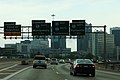
 Int65nRoad-Exit261AB-Int20ewInt59ns-Dec2017 (39409499921).jpg 2,400 × 1,600; 1.58 MB
-
 Int65nRoad-Exit261AB-Int59nsInt20ew-Feb2014 (27878401829).jpg 2,400 × 1,600; 1.67 MB
-
 Int65nRoad-Exit261AB-Int59nsInt20ewDiagramSign (27878399409).jpg 2,400 × 1,600; 1.44 MB
-
 Int65nRoad-Exit282-WarriorRobins (27878410419).jpg 2,400 × 1,600; 1.36 MB
-
 Int65nRoad-MM264-Int22-230millionTaxesSign-Feb2014 (27878403459).jpg 2,400 × 1,600; 1.39 MB
-
 Int65sRoad-Exit250-Int459-HM (39626237372).jpg 2,400 × 1,600; 1.57 MB
-
 Int65sRoad-Exit250-Int459ns (32784274591).jpg 2,400 × 1,600; 1.35 MB
-
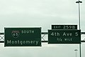
 Int65sRoad-Exit259AB-4th6thAveBHM-ButtonCopy (32065439944).jpg 2,400 × 1,600; 1.42 MB
-
 Int65sRoad-Exit259B-6thAveBCsigns-Feb2014 (39626225982).jpg 2,400 × 1,600; 1.73 MB
-
 Int65sRoad-Exit260-6thAveBHM-ButtonCopy (32784269811).jpg 2,400 × 1,600; 1.35 MB
-
 Int65sRoad-Exit261AB-Int20ewInt59ns-TwoMiles (33269753202).jpg 2,400 × 1,600; 1.74 MB
-
 Int65sRoad-Exit265-Int22-US31 (33297035201).jpg 2,400 × 1,600; 1.62 MB
-
 Int65sRoad-MM259-BHM-LowClouds (39142594502).jpg 2,400 × 1,600; 1.22 MB
-
 Int65sRoadCDLanes-Exit265A-Int22w (33297039211).jpg 2,400 × 1,600; 1.66 MB
-
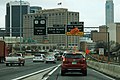
 Interstate 65, Birmingham, Alabama (27978671445).jpg 5,478 × 3,722; 19.29 MB
-
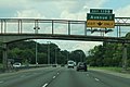
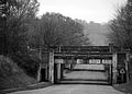 Irondale (Alabama) bridge.jpg 3,615 × 2,592; 4.26 MB
-
 Nearing the end...? (15543822950).jpg 800 × 533; 226 KB
-
 Orange Truck Shields in Birmingham, Part 1 (12940081685).jpg 533 × 800; 351 KB
-
 Orange Truck Shields in Birmingham, Part 2 (12940190803).jpg 533 × 800; 332 KB
-
 Repurposed Arrows - US78 East US31 US280 (41820914131).jpg 2,400 × 1,600; 1.08 MB
-
 Rev Abraham Woods Blvd - Southern Railway Bridge - Birmingham (27027097487).jpg 2,400 × 1,600; 2.16 MB
-
 US11nAL5nRoadSigns-AL150eSign (33042449650).jpg 2,400 × 1,600; 2.2 MB
-
 US11nAL5nRoadSigns-Birmingham (33042451650).jpg 2,400 × 1,600; 2.31 MB
-
 US78US11US31TruckHandPaintedSignsBHM (33425467785).jpg 1,600 × 2,400; 2.08 MB
-
 Wide Shields in Birmingham, Part 1 (12940079345).jpg 533 × 800; 386 KB
-
 Wide Shields in Birmingham, Part 2 (12940190073).jpg 533 × 800; 316 KB
.jpg)
.jpg)
.jpg)
.jpg)
.jpg)
.jpg)
.jpg)
.jpg)
.jpg)
.jpg)
.jpg)
.jpg)
.jpg)
.jpg)
.jpg)

.jpg)
.jpg)
.jpg)
.jpg)
.jpg)
.jpg)

.jpg)
.jpg)
.jpg)
.jpg)
.jpg)
.jpg)
.jpg)
.jpg)
.jpg)
.jpg)
.jpg)
.jpg)
.jpg)
.jpg)
.jpg)
.jpg)
.jpg)
.jpg)
.jpg)
.jpg)
.jpg)
.jpg)
.jpg)
.jpg)
.jpg)
.jpg)
.jpg)
.jpg)
.jpg)
.jpg)
.jpg)
.jpg)
.jpg)
.jpg)
.jpg)
.jpg)
.jpg)
.jpg)
.jpg)
.jpg)
.jpg)
.jpg)
.jpg)
.jpg)
.jpg)
.jpg)
.jpg)
.jpg)
.jpg)
.jpg)
_bridge.jpg)
.jpg)
.jpg)
.jpg)
.jpg)
.jpg)
.jpg)
.jpg)
.jpg)
.jpg)
.jpg)