Category:Road signs in Minnesota
States of the United States: Alabama · Alaska · Arizona · Arkansas · California · Colorado · Connecticut · Delaware · Florida · Georgia · Hawaii · Idaho · Illinois · Indiana · Iowa · Kansas · Kentucky · Louisiana · Maine · Maryland · Massachusetts · Michigan · Minnesota · Mississippi · Missouri · Montana · Nebraska · Nevada · New Hampshire · New Jersey · New Mexico · New York · North Carolina · North Dakota · Ohio · Oklahoma · Oregon · Pennsylvania · Rhode Island · South Carolina · South Dakota · Tennessee · Texas · Utah · Vermont · Virginia · Washington · West Virginia · Wisconsin · Wyoming – District of Columbia: Washington, D.C.
Guam · Puerto Rico
Guam · Puerto Rico
Subcategories
This category has the following 17 subcategories, out of 17 total.
Media in category "Road signs in Minnesota"
The following 104 files are in this category, out of 104 total.
-
 1412LeechLakeRoute.jpg 2,515 × 3,270; 3.8 MB
-
 Road markers on the reservation - NARA - 285715.jpg 1,779 × 3,000; 1.03 MB
-
 Road markers on the reservation - NARA - 285716.jpg 3,000 × 1,724; 975 KB
-
 2012-0814-WinstedCH-new.jpg 4,185 × 2,790; 967 KB
-
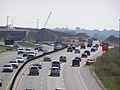
 35W - Minneapolis, MN - panoramio (3).jpg 3,264 × 2,340; 2.24 MB
-
 35W - Minneapolis, MN - panoramio (4).jpg 3,104 × 2,219; 2.37 MB
-
 35W - Minneapolis, MN - panoramio (5).jpg 3,016 × 2,154; 1.96 MB
-
 35W - Minneapolis, MN - panoramio (6).jpg 2,371 × 1,696; 1.19 MB
-
 Air Quality Alert Sign (27613142285).jpg 3,590 × 2,185; 4.36 MB
-
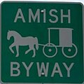 Amish Buggy Byway (Minnesota).jpg 287 × 287; 9 KB
-
 Big Stone County, Minnesota Sign (34686360614).jpg 5,201 × 3,658; 8.96 MB
-
 Bottineau Blvd 85th Ave N.jpg 628 × 720; 109 KB
-
 Dead End sign and snow in Aitkin County, Minnesota.jpg 8,303 × 5,535; 24.45 MB
-
 Des Moines Township, MN, USA - panoramio.jpg 3,536 × 2,572; 1.47 MB
-
 Drug Free Zone - We Care Stevens Square Sign - Minneapolis (49216126601).jpg 10,129 × 6,835; 49.13 MB
-
-
 EndInt494-BeginInt694signRoad (29218445773).jpg 2,400 × 1,600; 1.92 MB
-
 FEMA - 45459 - Road closed due to flooding in Minnesota.jpg 3,000 × 1,993; 4.53 MB
-
 Fort Snelling - panoramio (1).jpg 4,000 × 3,000; 4.36 MB
-
 Freewayentrancesign-minnesota.jpg 200 × 231; 67 KB
-
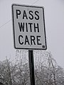 Freezing Rain, Pass With Care - panoramio.jpg 1,944 × 2,592; 1.94 MB
-
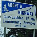 GLCSsign.jpg 640 × 640; 147 KB
-
 Goodview Tower - panoramio.jpg 3,072 × 2,304; 1.32 MB
-
 Grasshopper Corner, Minnesota.jpg 800 × 600; 63 KB
-
 Grayling Cemetery sign in Aitkin County, Minnesota.jpg 5,616 × 3,744; 11.82 MB
-
 Great River Road sign in Palisade, Minnesota.jpg 6,000 × 4,000; 13.74 MB
-
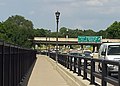
 Highway 14 Elk River Bridge.jpg 2,816 × 1,584; 2.08 MB
-
 Hwy 36 - Maplewood, MN - panoramio.jpg 2,794 × 1,997; 1.27 MB
-
 Hwy 36 and Interstate 35E - Little Canada, MN - panoramio.jpg 2,569 × 1,836; 1.28 MB
-
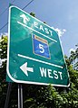 Hwy 5 - St Paul, MN - panoramio (4).jpg 2,219 × 3,106; 2.74 MB
-
 Hwy 5 - St Paul, MN - panoramio (5).jpg 1,579 × 1,129; 900 KB
-
 Hwy 5 - St Paul, MN - panoramio.jpg 2,448 × 1,746; 881 KB
-
 Hwy 5 and Hwy 55 - Minneapolis, MN - panoramio.jpg 2,967 × 2,120; 3.18 MB
-
 Hwy 55 - panoramio.jpg 3,120 × 1,755; 1.87 MB
-
 I 94 - Minneapolis, MN - panoramio (15).jpg 3,073 × 2,196; 2.2 MB
-
 I 94 - Minneapolis, MN - panoramio (20).jpg 2,852 × 2,039; 2 MB
-
 I 94 - Minneapolis, MN - panoramio (21).jpg 2,705 × 1,931; 1.74 MB
-
 I 94 - Minneapolis, MN - panoramio.jpg 3,155 × 2,255; 2.14 MB
-
 I-35 and MN 23.jpg 4,608 × 3,456; 2.59 MB
-
 I35W Bridge Collapse Detour.jpg 600 × 400; 92 KB
-
 I90AustinMN2006-05-20.JPG 2,560 × 1,920; 1.14 MB
-
 Int35En-Exit242B-MultipleBGSigns (29731515422).jpg 2,400 × 1,600; 1.55 MB
-
 Int35EnRoad-StPaulSkyline (29761881391).jpg 2,400 × 1,600; 1.64 MB
-
 Int35EnSignRoad1 (29844570205).jpg 2,400 × 1,600; 2.01 MB
-
 Interstate 35 Duluth Minnesota Night (31823390782).jpg 4,462 × 3,086; 13.67 MB
-
 Interstate 35E - panoramio (12).jpg 2,772 × 1,982; 3.1 MB
-
 Interstate 35E - panoramio (15).jpg 3,264 × 2,448; 3.7 MB
-
 Interstate 35E - St Paul, MN - panoramio (15).jpg 2,777 × 1,981; 1.58 MB
-
 Interstate 35E - St Paul, MN - panoramio (17).jpg 3,062 × 2,191; 2.09 MB
-
 Interstate 35E - St Paul, MN - panoramio (2).jpg 2,754 × 1,971; 1.18 MB
-
 Interstate 35E - St Paul, MN - panoramio (4).jpg 3,264 × 2,448; 1.78 MB
-
 Interstate 35E - St Paul, MN - panoramio (5).jpg 3,247 × 2,325; 1.55 MB
-
 Interstate 35E - St Paul, MN - panoramio (6).jpg 3,263 × 2,332; 1.73 MB
-
 Interstate 35E - St Paul, MN - panoramio (7).jpg 2,993 × 2,139; 1.38 MB
-
 Interstate 35E Bridge - panoramio (7).jpg 4,128 × 2,322; 3.55 MB
-
 Interstate 35W - Minneapolis, MN - panoramio (15).jpg 3,012 × 2,150; 2.13 MB
-
 Interstate 35W - Minneapolis, MN - panoramio (17).jpg 2,735 × 1,956; 1.69 MB
-
 Interstate 35W - Minneapolis, MN - panoramio (2).jpg 3,264 × 2,333; 2.01 MB
-
 Interstate 35W - Minneapolis, MN - panoramio (22).jpg 2,753 × 1,966; 1.58 MB
-
 Interstate 35W and 46th Street sign in Minneapolis.jpg 4,032 × 3,024; 3.62 MB
-
 Interstate 494 - Maple Grove, MN - panoramio (10).jpg 2,878 × 2,055; 3.67 MB
-
 Interstate 94 - Minneapolis, MN - panoramio (1).jpg 2,943 × 2,100; 2.48 MB
-
 Interstate 94 - Minneapolis, MN - panoramio (10).jpg 3,264 × 2,333; 2.2 MB
-
 Interstate 94 - St Paul, MN - panoramio (12).jpg 2,253 × 1,657; 1.58 MB
-
 Interstate 94 - St Paul, MN - panoramio (2).jpg 2,971 × 2,129; 1.41 MB
-
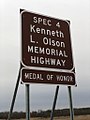 Kenneth L. Olson Memorial Highway.jpg 768 × 1,024; 125 KB
-
 Marshall-ave-mt-exempt.jpg 684 × 912; 290 KB
-
 Minneapolis free wireless hotspot.jpg 4,000 × 3,000; 2.8 MB
-
 Minneapolis neighborhood Bryn Mawr (52080286275).jpg 6,099 × 4,068; 15.3 MB
-
 Minneapolis neighborhood Central (52091056488).jpg 5,993 × 4,000; 17.17 MB
-
 Minneapolis, MN - panoramio (78).jpg 2,885 × 2,060; 1.73 MB
-
 Minnesota 55 - panoramio.jpg 4,000 × 3,000; 4.24 MB
-
 Minnesota Interstate 35E Sign (15189940886).jpg 1,200 × 800; 431 KB
-
 Minnesota Interstate 94 Sign (15026397957).jpg 1,200 × 800; 1.02 MB
-

-
 Minnesota share the road sign.jpg 3,456 × 2,304; 2.98 MB
-
 Minnesota State Highway 280 - St Paul, MN - panoramio (1).jpg 3,264 × 2,330; 2.21 MB
-
 Minnesota State Highway 5 - St Paul, MN - panoramio (2).jpg 4,128 × 2,322; 2.87 MB
-
 MN-62 and CR 62.JPG 960 × 720; 250 KB
-
 MNStateHwy299sign.JPG 766 × 933; 773 KB
-
 MNstatehwy57mile10.JPG 1,480 × 757; 1.02 MB
-

-
 Nature Road Bridge.jpg 1,024 × 577; 275 KB
-
 Nicollet County Line, Minnesota (28286904941).jpg 4,460 × 2,928; 9.63 MB
-
 Nicollet Island Inn MN.jpg 2,355 × 2,208; 758 KB
-
 North Shore - Exit Only Highway Sign, Duluth, Minnesota (43012743030).jpg 6,175 × 4,025; 13.45 MB
-
 North West Angle border 1.JPG 1,600 × 1,200; 882 KB
-
 North West Angle border 2.JPG 1,600 × 1,200; 911 KB
-
 Olney Township, MN, USA - panoramio.jpg 3,968 × 2,780; 1.57 MB
-
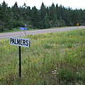 PalmersMNsign.jpg 2,063 × 2,063; 2.42 MB
-
 Paul Bunyan Scenic Byway - Paul Bunyan Highway Sign - NARA - 7720978.jpg 2,048 × 2,016; 2.08 MB
-
 Pb express.svg 159 × 133; 4 KB
-
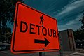 Pedestrian Detour Sign, Minneapolis (41329883000).jpg 6,016 × 4,016; 12.92 MB
-
 Photograph of Birch Lake Plantation - NARA - 2128745.jpg 1,283 × 822; 787 KB
-
 Protest and riot aftermath on East Lake Street (49946524893).jpg 6,000 × 4,000; 10.46 MB
-
 Rally calling for raising the Minneapolis minimum wage to $15 hour (29638815755).jpg 7,360 × 4,912; 15 MB
-
 St Paul, MN - panoramio (13).jpg 2,967 × 2,123; 2.57 MB
-
 St Paul, MN - panoramio (63).jpg 4,128 × 2,322; 2.05 MB
-
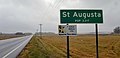 St. Augusta, Minnesota road sign.jpg 4,032 × 1,960; 757 KB
-
 Tea Party Rally in Minneapolis? (4392303419).jpg 1,200 × 900; 790 KB
-
 Unweave040307.jpg 1,152 × 864; 416 KB
-
 Unweave073007.jpg 2,048 × 1,536; 562 KB
-
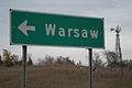 Warsaw rice mn sign.JPG 3,072 × 2,048; 1.99 MB
-
 Wide 94 + Narrow 169 (15026398887).jpg 1,200 × 800; 571 KB


.jpg)
.jpg)
.jpg)
.jpg)
.jpg)
.jpg)
.jpg)


.jpg)

.jpg)

.jpg)


.jpg)
.jpg)


.jpg)
.jpg)
.jpg)


.jpg)
.jpg)
.jpg)
.jpg)
.jpg)
.jpg)
.jpg)
.jpg)
.jpg)
.jpg)
.jpg)
.jpg)
.jpg)
.jpg)
.jpg)
.jpg)
.jpg)
.jpg)

.jpg)
.jpg)
.jpg)
.jpg)
.jpg)


.jpg)
.jpg)
.jpg)

.jpg)
.jpg)


.jpg)
.jpg)


.jpg)

.jpg)

.jpg)


.jpg)

.jpg)
.jpg)
.jpg)
.jpg)

.jpg)


.jpg)