Category:Road signs in Onondaga County, New York
Counties of New York (state): Albany · Allegany · Broome · Cattaraugus · Cayuga · Chautauqua · Chemung · Chenango · Clinton · Columbia · Cortland · Delaware · Dutchess · Erie · Essex · Franklin · Fulton · Genesee · Greene · Hamilton · Herkimer · Jefferson · Lewis · Livingston · Madison · Monroe · Montgomery · Nassau · Niagara · Oneida · Onondaga · Ontario · Orange · Orleans · Oswego · Otsego · Putnam · Rensselaer · Rockland · Saratoga · Schenectady · Schoharie · Schuyler · Seneca · St. Lawrence · Steuben · Suffolk · Sullivan · Tioga · Tompkins · Ulster · Warren · Washington · Wayne · Westchester · Wyoming · Yates

Media in category "Road signs in Onondaga County, New York"
The following 41 files are in this category, out of 41 total.
-
 20180527 - 54 - Van Buren, NY.jpg 2,040 × 1,530; 164 KB
-
 END! NY 41.jpg 1,600 × 1,200; 487 KB
-
 First marker on NY 11A north.jpg 640 × 480; 53 KB
-
 First NY 317 shield northbound.jpg 640 × 480; 73 KB
-
 I-481 at Exit 9N.jpg 640 × 480; 34 KB
-
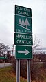 Manlius-Center-NY-Erie-Canal.jpg 2,988 × 5,312; 4.04 MB
-
 New York Route 92 at Route 257 in Manlius.jpg 1,600 × 1,200; 524 KB
-
 New York State Route 11A - 4308166533.jpg 1,024 × 768; 186 KB
-
 New York State Route 11A - 4308166811.jpg 1,024 × 768; 170 KB
-
 New York State Route 11A - 4308904704.jpg 1,024 × 768; 153 KB
-
 New York State Route 11A - 4308904770.jpg 1,024 × 768; 188 KB
-
 New York State Route 11A - 4308904812.jpg 1,024 × 768; 191 KB
-
 New York State Route 11A.jpg 640 × 480; 58 KB
-
 New York State Route 370 Onondaga Lake.jpg 2,048 × 1,536; 719 KB
-
 New York State Route 690 - 4330463220.jpg 740 × 504; 36 KB
-
 New York State Route 80 at Route 173 with old signage.jpg 1,024 × 768; 315 KB
-
 NY 173 - NY 92 in Manlius.jpg 640 × 480; 67 KB
-
 NY 174 at old NY 5 in Camillus.jpg 1,024 × 768; 305 KB
-
 NY 257 through Manlius.jpg 1,024 × 768; 304 KB
-
 NY 281N terminus.jpg 1,024 × 768; 305 KB
-
 NY 297 at the interchange with the state fairgrounds.jpg 1,600 × 1,200; 321 KB
-
 NY 359.jpg 3,264 × 2,448; 1.43 MB
-
 NY 370 west at I-81 in Syracuse.jpg 2,048 × 1,536; 716 KB
-
 NY 370 west at NY 631.jpg 1,600 × 1,200; 475 KB
-
 NY 48 south in Baldwinsville.jpg 1,600 × 1,200; 421 KB
-
 NY 481 at exit 12.jpg 2,048 × 1,536; 553 KB
-
 NY 598 south.jpg 1,600 × 1,200; 676 KB
-
 NY 635 at NY 298.jpg 4,608 × 3,456; 7.33 MB
-
 NY 80 West NY 91 South.jpg 640 × 480; 63 KB
-
 NY 91S at US 20.jpg 1,024 × 768; 313 KB
-
 NY Route 317 in Jordan.jpg 640 × 480; 76 KB
-
 NY-31.svg 600 × 600; 5 KB
-
 NY-370.svg 750 × 600; 7 KB
-
 Onondaga County, New York.jpg 1,600 × 1,200; 499 KB
-
 Onondaga Nation sign I-81 2.jpg 6,000 × 4,000; 11.33 MB
-
 Onondaga Nation sign I-81 3.jpg 6,000 × 4,000; 10.37 MB
-
 Onondaga Nation sign I-81.jpg 6,000 × 4,000; 11.46 MB
-
 Route 11A north at NY 80 east.jpg 640 × 480; 51 KB
-
 Sign for the Carpenter's Brook Fish Hatchery.JPG 1,600 × 1,200; 210 KB
-
 U.S. Route 20 in LaFayette, New York - 20200903.jpg 1,618 × 1,213; 865 KB
-
 Village of Skaneatles sign on NY 41N.jpg 1,600 × 1,200; 475 KB


