Category:Road signs in Telfair County, Georgia
Counties of Georgia: Appling · Atkinson · Bacon · Baker · Banks · Barrow · Bartow · Ben Hill · Berrien · Brantley · Brooks · Bryan · Butts · Calhoun · Camden · Carroll · Charlton · Chatham · Chattooga · Cherokee · Clay · Clayton · Clinch · Cobb · Coffee · Colquitt · Columbia · Cook · Coweta · Crawford · Crisp · Dade · Dawson · Decatur · DeKalb · Dodge · Dooly · Dougherty · Douglas · Early · Effingham · Evans · Floyd · Forsyth · Franklin · Fulton · Gilmer · Glynn · Gordon · Grady · Greene · Gwinnett · Habersham · Hall · Haralson · Harris · Hart · Henry · Houston · Irwin · Jasper · Jeff Davis · Jefferson · Lamar · Lanier · Laurens · Lee · Liberty · Long · Lowndes · Lumpkin · Macon · Madison · Marion · McIntosh · Miller · Mitchell · Monroe · Montgomery · Murray · Peach · Pierce · Pike · Polk · Pulaski · Putnam · Randolph · Rockdale · Schley · Seminole · Spalding · Stephens · Stewart · Sumter · Talbot · Tattnall · Taylor · Telfair · Terrell · Thomas · Tift · Toombs · Towns · Troup · Turner · Upson · Walker · Ware · Wayne · Wheeler · White · Whitfield · Wilcox · Worth
City-counties: Athens–Clarke · Augusta–Richmond · Columbus–Muscogee · Georgetown–Quitman · Macon–Bibb · Preston–Webster · Statenville–Echols
City-counties: Athens–Clarke · Augusta–Richmond · Columbus–Muscogee · Georgetown–Quitman · Macon–Bibb · Preston–Webster · Statenville–Echols
Media in category "Road signs in Telfair County, Georgia"
The following 31 files are in this category, out of 31 total.
-
 Coffee County border, Ocmulgee River bridge, US319SB.JPG 4,608 × 3,456; 4.74 MB
-
 Dodge County, US341WB.JPG 4,608 × 3,456; 5.71 MB
-
 Georgia State Route 149 Connector, NW terminus.JPG 4,608 × 3,456; 5.67 MB
-
 Helena Welcome sign.JPG 4,608 × 3,456; 4.46 MB
-
 Jacksonville city limit, US441SB.JPG 4,608 × 3,456; 5.19 MB
-
 Jeff Davis County limit US341SB.jpg 5,184 × 3,456; 6.01 MB
-
 Looking NB at US 319 RR crossing, McRae.jpg 4,608 × 3,456; 3.82 MB
-
 Lumber City city limit US19SB.jpg 5,184 × 3,456; 10.7 MB
-
 Lumber City city limit US341NB.jpg 5,184 × 3,456; 7.88 MB
-
 McRae-Helena limit US319NB.jpg 5,184 × 3,456; 7.88 MB
-
 NB Telfair County, Ocmulgee River.jpg 5,184 × 3,456; 5.46 MB
-
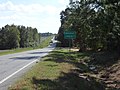
 Scotland City limit, GA149NB.JPG 4,608 × 3,456; 4.98 MB
-
 Scotland City limit, Telfair County border, GA149SB.JPG 4,608 × 3,456; 4.73 MB
-
 Telfair County limit US341NB.jpg 5,184 × 3,456; 7.78 MB
-
 Telfair County US319NB.jpg 5,184 × 3,456; 6.98 MB
-
 Telfair County, US341EB.JPG 4,608 × 3,456; 5.53 MB
-
 U.S. Route 319 roadside park, Telfair County 5.jpg 5,184 × 3,456; 9.37 MB
-
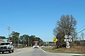
 US280 WB McRae-Helena city limit.jpg 5,184 × 3,456; 5.55 MB
-
 US280 WB Telfair County.jpg 5,184 × 3,456; 4.87 MB
-
 US319 SB Alligator Creek.jpg 5,184 × 3,456; 4.89 MB
-
 US319 SB Big Horse Creek.jpg 5,184 × 3,456; 4.98 MB
-
 US319 SB Turnpike Creek.jpg 5,184 × 3,456; 5.03 MB
-
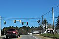
 US319 US441 GA31 SB.jpg 5,184 × 3,456; 5.03 MB
-
 US319 US441 NB GA 117 Intersection.jpg 5,184 × 3,456; 5.61 MB
-
 US319 US441 NB GA132 turn left.jpg 5,184 × 3,456; 5.74 MB
-
 US319 US441 NB McRae-Helena City limit.jpg 5,184 × 3,456; 5.9 MB
-
 US319 US441, GA149 Connector turn left.jpg 5,184 × 3,456; 5.89 MB
-
 US441 NB Jacksonville City limit.jpg 5,184 × 3,456; 5.25 MB
-
 Wheeler County, GA149NB.JPG 4,608 × 3,456; 4.98 MB
-
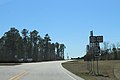
 Wheeler County, US280NB.jpg 5,184 × 3,456; 5.75 MB
-
 Workmore Community, US319SB.JPG 4,608 × 3,456; 5.34 MB


