Category:Road signs in White Pine County, Nevada
Media in category "Road signs in White Pine County, Nevada"
The following 198 files are in this category, out of 198 total.
-

-

-

-

-
 2012.10.03.155620 Aultman Street x 6th Street Ely Nevada.jpg 1,920 × 1,280; 808 KB
-
 2012.10.03.160212 Aultman Street Ely Nevada.jpg 1,920 × 1,280; 1.07 MB
-
-

-

-

-

-

-
 2014-05-21 10 30 20 View west along Nevada State Route 490 entering Hercules Gap.JPG 3,264 × 2,448; 2.78 MB
-
 2014-05-21 10 34 14 Sign at the west end of Nevada State Route 490.JPG 3,264 × 2,448; 2.14 MB
-
 2014-05-21 10 34 23 West end of Nevada Route 490.JPG 3,264 × 2,448; 2.42 MB
-
 2014-05-21 10 34 53 First reassurance sign along eastbound Nevada State Route 490.JPG 3,264 × 2,448; 2.4 MB
-
 2014-05-21 10 39 08 View east along Nevada State Route 490 approaching Hercules Gap.JPG 3,264 × 2,448; 2.64 MB
-

-

-

-

-

-

-

-
 2014-05-21 12 23 06 View west along U.S. Route 50 just west of downtown Ely, Nevada.JPG 3,264 × 2,448; 2.44 MB
-
-

-

-
 2014-05-21 12 33 14 The junction of U.S. Route 50 and U.S. Route 93 in Ely, Nevada.JPG 3,264 × 2,448; 2.31 MB
-
 2014-05-21 13 17 50 Pony Express sign along U.S. Route 93 in Schellbourne, Nevada.JPG 3,264 × 2,448; 3.18 MB
-
 2014-05-21 13 18 53 Lincoln Highway marker along U.S. Route 93 in Schellbourne, Nevada.JPG 2,448 × 3,264; 4.66 MB
-

-

-
-

-

-

-
-

-

-

-

-

-

-

-
-

-

-

-
-

-

-
-
-

-

-

-

-

-

-

-

-

-

-

-
-

-

-

-

-

-

-

-

-

-

-

-

-

-

-

-

-

-

-

-

-

-

-

-

-

-

-

-

-

-

-

-

-
-

-

-
-

-

-

-

-

-

-

-

-

-

-

-

-

-

-

-

-

-

-

-

-

-

-

-

-

-

-

-

-

-

-

-

-

-

-

-

-

-

-

-

-

-

-

-

-

-

-
-

-

-

-

-

-
-

-

-

-

-

-

-

-

-

-

-

-

-

-

-

-

-

-
-

-

-

-

-
 2014-08-11 16 00 08 Sign at the entrance to Ward Charcoal Ovens State Historic Park.JPG 3,264 × 2,448; 3.46 MB
-

-

-

-

-

-

-

-

-

-

-

-

-

-

-
-
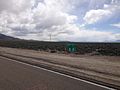
 Intersection of Nevada Routes 487 & 488 in Baker, Nevada.jpg 4,320 × 3,240; 4.3 MB
-
 NV487NVUTBorder1.jpg 640 × 427; 55 KB
-
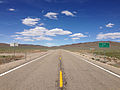
 Start of Nevada Route 893.jpg 4,320 × 3,240; 5.41 MB
-
 U.S. Route 50 - Welcome to Nevada (37732981515).jpg 4,549 × 3,639; 17.72 MB
-
 US50Utahstate line.jpg 4,672 × 3,104; 10.01 MB


_near_U.S._Route_93_in_White_Pine_County,_Nevada.JPG)
_near_U.S._Route_93_in_White_Pine_County,_Nevada.JPG)
.JPG)
.JPG)
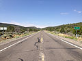
_near_the_west_end_of_former_Nevada_State_Route_489_in_Cherry_Creek,_Nevada.JPG)
_near_the_west_end_of_former_Nevada_State_Route_489_in_Cherry_Creek,_Nevada.JPG)


_in_White_Pine_County,_Nevada.JPG)
_in_White_Pine_County,_Nevada.JPG)


_in_White_Pine_County,_Nevada.JPG)
_about_0.2_miles_north_of_the_end_of_pavement_in_Shoshone,_Nevada.JPG)
_about_1.1_miles_north_of_the_end_of_pavement_in_Shoshone,_Nevada.JPG)
_near_the_north_end_at_U.S._Route_93_in_White_Pine_County,_Nevada.JPG)


_in_White_Pine_County,_Nevada.JPG)


_in_White_Pine_County,_Nevada.JPG)
_about_6.2_miles_north_of_the_Utah_state_line_at_the_junction_with_Nevada_State_Route_488_(Lehman_Caves_Road)_in_Baker,_Nevada.JPG)
_at_the_junction_with_Nevada_State_Route_487_(Baker_Road)_in_Baker,_Nevada.JPG)
_in_Baker,_Nevada.JPG)
_about_4.5_miles_east_of_Great_Basin_National_Park_in_Baker,_Nevada.JPG)
_at_Great_Basin_National_Park,_Nevada.JPG)
_at_Great_Basin_National_Park,_Nevada.JPG)
_just_east_of_Great_Basin_National_Park,_Nevada.JPG)
_near_the_junction_with_Nevada_State_Route_487_(Baker_Road)_in_Baker,_Nevada.JPG)
_at_the_junction_with_Nevada_State_Route_487_(Baker_Road)_in_Baker,_Nevada.JPG)
_at_the_Utah_state_line_and_junction_with_Utah_State_Route_21_in_White_Pine_County,_Nevada.JPG)
_at_the_Utah_state_line_and_junction_with_Utah_State_Route_21_in_White_Pine_County,_Nevada.JPG)
_in_Millard_County,_Utah.JPG)
_in_Millard_County,_Utah.JPG)
_in_White_Pine_County,_Nevada.JPG)
_about_1.1_miles_north_of_the_Utah_state_line_in_White_Pine_County,_Nevada.JPG)
_about_4.5_miles_north_of_the_Utah_state_line_near_Baker,_Nevada.JPG)
_about_6.1_miles_north_of_the_Utah_state_line_at_the_junction_with_Nevada_State_Route_488_(Lehman_Caves_Road)_in_Baker,_Nevada.JPG)
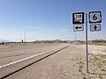
_at_U.S._Routes_6_and_50_in_White_Pine_County,_Nevada.JPG)
_at_U.S._Routes_6_and_50_in_White_Pine_County,_Nevada.JPG)


_in_White_Pine_County,_Nevada.JPG)

_in_White_Pine_County,_Nevada.JPG)
_in_White_Pine_County,_Nevada.JPG)
_about_8.6_miles_north_of_U.S._Routes_6_and_50_in_White_Pine_County,_Nevada.JPG)
_in_White_Pine_County,_Nevada.JPG)
_near_the_south_end_at_U.S._Routes_6_and_50_in_White_Pine_County,_Nevada.JPG)


_in_White_Pine_County,_Nevada.JPG)
_in_White_Pine_County,_Nevada.JPG)
_in_White_Pine_County,_Nevada.JPG)
_in_White_Pine_County,_Nevada.JPG)
_in_White_Pine_County,_Nevada.JPG)
_about_27.7_miles_north_of_U.S._Route_50_in_White_Pine_County,_Nevada.JPG)
_about_23.3_miles_north_of_U.S._Route_50_in_Strawberry,_Nevada.JPG)
_about_23.3_miles_north_of_U.S._Route_50_in_Strawberry,_Nevada.JPG)
_about_22.6_miles_north_of_U.S._Route_50_in_White_Pine_County,_Nevada.JPG)
_at_U.S._Route_50_in_White_Pine_County,_Nevada.JPG)


_in_White_Pine_County,_Nevada.JPG)


_in_White_Pine_County,_Nevada.jpg)
.jpg)
_and_the_south_end_of_Success_Summit_Road_in_Cave_Lake_State_Park,_Nevada.jpg)
_in_White_Pine_County,_Nevada.JPG)
_in_White_Pine_County,_Nevada.JPG)
_and_the_south_end_of_Success_Summit_Road_in_Cave_Lake_State_Park,_Nevada.jpg)
_about_6.4_miles_north_of_U.S._Routes_6,_50_and_93_in_Cave_Lake_State_Park,_Nevada.jpg)
_about_10.4_miles_north_of_the_end_of_pavement_in_White_Pine_County,_Nevada.JPG)


.jpg)

-cropped.jpg)
.JPG)