Category:Road signs in the London Borough of Lewisham

Media in category "Road signs in the London Borough of Lewisham"
The following 13 files are in this category, out of 13 total.
-
 Canonbie Road - Steep Hill 18^ - geograph.org.uk - 1435555.jpg 640 × 400; 69 KB
-
 Canonbie Road - Steep Hill 18^ - geograph.org.uk - 1435559.jpg 640 × 400; 88 KB
-
 En route (8341816982).jpg 3,552 × 2,368; 3.35 MB
-
 Granville Park - Steep Hill 15^ - geograph.org.uk - 1435524.jpg 640 × 400; 100 KB
-
 Montem Road - geograph.org.uk - 3170644.jpg 640 × 480; 135 KB
-
 Now can you see it^ - geograph.org.uk - 1633828.jpg 640 × 480; 57 KB
-
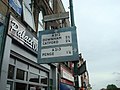 Old road signs, Sydenham - geograph.org.uk - 1886693.jpg 2,048 × 1,536; 955 KB
-
 Old street name sign, Whitburn Road - geograph.org.uk - 3869481.jpg 640 × 480; 113 KB
-
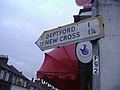 Pre-Worboys direction arrow, Malpas Road - geograph.org.uk - 2274562.jpg 1,600 × 1,200; 565 KB
-
 Pre-Worboys direction sign, Kirkdale - geograph.org.uk - 2274517.jpg 1,600 × 1,200; 617 KB
-
 Pre-Worboys sign Lee Road, Blackheath - geograph.org.uk - 2274583.jpg 1,600 × 1,200; 548 KB
-
 Sydenham Hill - Steep Hill 12^ - geograph.org.uk - 1435570.jpg 640 × 400; 81 KB
-
 Sydenham Hill - Steep Hill 12^ - geograph.org.uk - 1435577.jpg 640 × 400; 60 KB


.jpg)


