Category:Roads in County Cavan
Wikimedia category | |||||
| Upload media | |||||
| Instance of | |||||
|---|---|---|---|---|---|
| Category combines topics | |||||
| County Cavan | |||||
county in Ireland .jpg)    | |||||
| Instance of | |||||
| Location |
| ||||
| Capital | |||||
| Legislative body |
| ||||
| Executive body |
| ||||
| Population |
| ||||
| Area |
| ||||
| official website | |||||
 | |||||
Subcategories
This category has the following 11 subcategories, out of 11 total.
D
- Dirt roads in County Cavan (8 F)
M
N
- N3 (Ireland) (15 F)
- N87 road (Ireland) (8 F)
R
- R154 road (Ireland) (5 F)
- R178 road (Ireland) (2 F)
- R190 road (Ireland) (12 F)
- R191 road (Ireland) (22 F)
- R212 road (Ireland) (11 F)
S
- Road signs in County Cavan (11 F)
Media in category "Roads in County Cavan"
The following 200 files are in this category, out of 753 total.
(previous page) (next page)-
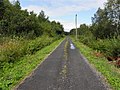
 A bend on the N54 in the village of Cloverhill - geograph.org.uk - 3179846.jpg 1,024 × 767; 109 KB
-
 A road with a view - geograph.org.uk - 2676666.jpg 1,024 × 692; 86 KB
-
 Access road to quarry at Drumlumman - geograph.org.uk - 2756061.jpg 1,024 × 768; 205 KB
-
 All Saints, Market Street, Cootehill - geograph.org.uk - 2487359.jpg 1,024 × 766; 155 KB
-
 Annafarney Bridge over the Annalee River - geograph.org.uk - 3174393.jpg 1,024 × 626; 148 KB
-
 Anne Street, Ballyjamesduff - geograph.org.uk - 1752700.jpg 3,968 × 2,976; 4.82 MB
-

-

-

-

-

-
 Approaching Gannon's Cross on the N54 - geograph.org.uk - 3179881.jpg 1,024 × 759; 156 KB
-

-

-

-
 Approaching Roosky Cross Roads on the L3505 - geograph.org.uk - 3828351.jpg 1,024 × 767; 232 KB
-
 Approaching the cross roads near the Pound Lough - geograph.org.uk - 3829603.jpg 1,024 × 768; 265 KB
-

-

-

-
 Approaching the Knocknaveagh Cross Roads - geograph.org.uk - 2663062.jpg 1,024 × 768; 149 KB
-
 Ballinamore Road - geograph.org.uk - 4014137.jpg 640 × 480; 159 KB
-
 Ballinamore Road - geograph.org.uk - 4014178.jpg 640 × 480; 156 KB
-
 Ballinamore Road - geograph.org.uk - 4014183.jpg 640 × 480; 160 KB
-
 Ballinamore Road, Cordressogagh - geograph.org.uk - 4014136.jpg 640 × 480; 160 KB
-
 Ballyconnell bridge.jpg 2,053 × 2,731; 2.06 MB
-
 Ballyconnell main street.JPG 3,140 × 2,355; 2.31 MB
-
 Ballyconnell Road at Gortawee - geograph.org.uk - 1853766.jpg 640 × 480; 50 KB
-
 Bawnboy.jpg 640 × 480; 46 KB
-
 Bellavally Gap - geograph.org.uk - 3597134.jpg 640 × 480; 72 KB
-
 Belturbet - Creeny Bridge - 20180928115338.jpg 4,128 × 3,096; 7.72 MB
-
 Bend in the L3042 east of Woods Cross Roads - geograph.org.uk - 2663020.jpg 1,024 × 768; 179 KB
-

-
 Bend in the N54 at Coolnalitteragh - geograph.org.uk - 3179870.jpg 1,024 × 719; 109 KB
-
 Bend in the R181 at Carrickcreeny - geograph.org.uk - 2661329.jpg 1,024 × 750; 120 KB
-

-
 Bend on R192 between Cootehill and Shercock - geograph.org.uk - 3174564.jpg 1,024 × 768; 135 KB
-
 Berrymount.jpg 640 × 480; 52 KB
-

-
 Bridge over the Annalee River at Crilea - geograph.org.uk - 2648427.jpg 1,024 × 699; 149 KB
-
 Bridge over the Blackwater River - geograph.org.uk - 2663005.jpg 1,024 × 755; 110 KB
-
 Bridge over the Maudabawn River - geograph.org.uk - 3830454.jpg 1,024 × 768; 285 KB
-
 Bridge over the upper Maudabawn River - geograph.org.uk - 3784211.jpg 1,024 × 768; 263 KB
-
 Bridge over the upper Maudabawn River - geograph.org.uk - 3830461.jpg 1,024 × 768; 223 KB
-
 Bridge Street, Cootehill - geograph.org.uk - 2639478.jpg 1,024 × 632; 90 KB
-
 Brockly Crossroads, Co Cavan - geograph.org.uk - 2492237.jpg 1,024 × 623; 85 KB
-
 Bunnoe Bridge on the Cootehill Road - geograph.org.uk - 2643098.jpg 1,024 × 767; 207 KB
-
 Buttercups along the roadside - geograph.org.uk - 4014203.jpg 640 × 480; 187 KB
-
 Camagh.jpg 640 × 480; 71 KB
-
 Carrickmacross Road, Kingscourt - geograph.org.uk - 3250818.jpg 640 × 480; 280 KB
-
 Carrigasimon - geograph.org.uk - 3074608.jpg 640 × 480; 262 KB
-
 Carrowmore, Ballyconnell.jpg 640 × 480; 47 KB
-
 Cavan Road, Cootehill - geograph.org.uk - 3053236.jpg 640 × 480; 44 KB
-
 Cavan Road, Cootehill - geograph.org.uk - 3054029.jpg 640 × 480; 47 KB
-
 Cavan Street, Cootehill - geograph.org.uk - 3056027.jpg 640 × 480; 47 KB
-
 Cavan Street, Cootehill - geograph.org.uk - 3056036.jpg 640 × 480; 44 KB
-

-
 Church Street, Cootehill - geograph.org.uk - 3094234.jpg 1,024 × 602; 101 KB
-
 Cloneary.jpg 640 × 480; 44 KB
-
 Clontycarnaghan.jpg 640 × 480; 60 KB
-
 Cornagunleog.jpg 640 × 480; 78 KB
-
 Cornalara Cross Roads on the R162 - geograph.org.uk - 2660187.jpg 1,024 × 733; 120 KB
-
 Corragh Glebe - geograph.org.uk - 1301075.jpg 640 × 480; 90 KB
-
 Corran.jpg 640 × 480; 71 KB
-
 Corranierna.jpg 640 × 480; 51 KB
-

-
 Country lane at Polladooey - geograph.org.uk - 1302679.jpg 640 × 480; 125 KB
-
 Country road at Gartbrattan - geograph.org.uk - 1304044.jpg 640 × 480; 113 KB
-
 Country road in the Townland of Muff - geograph.org.uk - 3070485.jpg 1,024 × 767; 140 KB
-
 Country road, Drumad, Co. Cavan - geograph.org.uk - 863667.jpg 640 × 480; 96 KB
-
 Country Roads, Corraquigley - geograph.org.uk - 3586904.jpg 640 × 480; 74 KB
-
 Cow, Cabragh - geograph.org.uk - 3141487.jpg 640 × 480; 52 KB
-
 Cross roads on the Maudabawn Road - geograph.org.uk - 3083305.jpg 1,024 × 768; 233 KB
-
 Cross roads on the R162 at Taghart North - geograph.org.uk - 2660128.jpg 1,024 × 765; 114 KB
-
 Crossing the Cavan-Monaghan Boundary on the R162 - geograph.org.uk - 3178691.jpg 1,024 × 644; 118 KB
-
 Crossroads, Ardlougher, Co. Cavan - geograph.org.uk - 1389386.jpg 640 × 454; 78 KB
-
-
 Cullies Cross Roads - geograph.org.uk - 2648790.jpg 1,024 × 720; 267 KB
-
 Derelict houses at Doocarrick Cross Roads - geograph.org.uk - 2643304.jpg 1,024 × 768; 160 KB
-
 Derryginny.jpg 640 × 480; 58 KB
-
 Derryhum Cross Roads, Co. Cavan - geograph.org.uk - 1884596.jpg 1,600 × 1,200; 1,017 KB
-
 Derrylahan Townland - geograph.org.uk - 1089633.jpg 640 × 479; 63 KB
-
 Derrymony.jpg 640 × 480; 108 KB
-
 Descending road in Glasleck Lower - geograph.org.uk - 2676637.jpg 1,024 × 752; 80 KB
-
 Deteriorating surface of the Clonraw Road - geograph.org.uk - 2647460.jpg 1,024 × 768; 212 KB
-

-
 Dowra - east.jpg 592 × 400; 30 KB
-
 Dowra - Main Street.jpg 592 × 400; 38 KB
-
 Drumlougher.jpg 640 × 480; 95 KB
-
 Dunbeggan crossroads - geograph.org.uk - 1302706.jpg 640 × 480; 94 KB
-
 Entering Drung from the east on the R188 - geograph.org.uk - 2665836.jpg 1,024 × 768; 112 KB
-
 Entrance, The Burren - geograph.org.uk - 1089554.jpg 640 × 479; 63 KB
-
 Erraran.jpg 640 × 480; 76 KB
-
-

-
 Farranydaly, Co. Cavan - geograph.org.uk - 1202898.jpg 640 × 480; 67 KB
-
 Gortaclogher.jpg 640 × 480; 84 KB
-
 Gorteen.jpg 640 × 480; 60 KB
-
 Gortmore.jpg 640 × 480; 88 KB
-
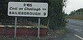 IMG R165road2045.jpg 3,475 × 1,715; 1.32 MB
-
 IMG R201road2841c.jpg 2,711 × 1,581; 1.4 MB
-
 IMG R394road530.JPG 3,888 × 2,592; 5.93 MB
-
 Joining the N87 road from the R202 (geograph 2698924).jpg 1,024 × 533; 82 KB
-

-
 Kildoagh.jpg 640 × 480; 48 KB
-
 Killycrin.jpg 640 × 480; 82 KB
-
 Killymoriarty.jpg 640 × 480; 96 KB
-
 Killyneary.jpg 730 × 1,024; 143 KB
-
 Killywaum.jpg 640 × 480; 72 KB
-
 Kilsob.jpg 640 × 480; 62 KB
-
 Kingfisher Trail and the N3 - geograph.org.uk - 1304253.jpg 640 × 480; 93 KB
-
 L1008, Tullynafraeve - geograph.org.uk - 3586771.jpg 640 × 480; 75 KB
-
 L1013, Gowlan - geograph.org.uk - 3585923.jpg 640 × 480; 65 KB
-
 L1016, Carrick West (geograph 3586010).jpg 640 × 480; 62 KB
-
 L1024, Drumcask (geograph 3597204).jpg 640 × 480; 60 KB
-
 L1024, Gubrawully - geograph.org.uk - 3597185.jpg 640 × 480; 69 KB
-
 L1024, Pedar A' Vohers Heading SSW from the R200.jpg 640 × 480; 63 KB
-
 L1028 at Cartronnagilta (geograph 3610979).jpg 640 × 480; 67 KB
-
 L5006 Road, Corlea - geograph.org.uk - 3585725.jpg 2,560 × 1,920; 2.15 MB
-
 L5006 Road, Corlea - geograph.org.uk - 3585732.jpg 640 × 480; 69 KB
-
 L5006 Road, Corrahoash - geograph.org.uk - 3584995.jpg 640 × 480; 76 KB
-
 L5008, Moneen - geograph.org.uk - 3586860.jpg 640 × 480; 84 KB
-
 L50101, Garvesk - geograph.org.uk - 3586804.jpg 640 × 480; 68 KB
-
 L5015 Road, Curraghvah - geograph.org.uk - 3585916.jpg 640 × 480; 83 KB
-
 L5026 near Borim - geograph.org.uk - 3597239.jpg 640 × 480; 74 KB
-
 L5026, Dunglave - geograph.org.uk - 3597255.jpg 640 × 480; 81 KB
-
 L55491, Cloverhill - geograph.org.uk - 2937029.jpg 640 × 480; 76 KB
-
 L6023, Lisagoan - geograph.org.uk - 2937123.jpg 640 × 480; 59 KB
-
 L6093 at Lisnaclea - geograph.org.uk - 3150920.jpg 640 × 480; 77 KB
-
 Lane at Corduff - geograph.org.uk - 1303515.jpg 640 × 480; 92 KB
-
 Lane at Creea - geograph.org.uk - 1089651.jpg 640 × 479; 58 KB
-
 Lane leading to a farm off the Clonraw Road - geograph.org.uk - 3824993.jpg 1,024 × 768; 242 KB
-
 Lane near Garty Lough - geograph.org.uk - 1301314.jpg 640 × 480; 117 KB
-
 Lane Pottlereagh - geograph.org.uk - 3141495.jpg 640 × 480; 65 KB
-
 Lane to Drumcondra - geograph.org.uk - 2484477.jpg 1,024 × 768; 193 KB
-
 Lane, Aghadreena - geograph.org.uk - 2937066.jpg 640 × 480; 78 KB
-
 Lane, Aghaweenagh (geograph 2914377).jpg 640 × 480; 92 KB
-
 Lane, Ballymagirril (geograph 3610782).jpg 640 × 480; 102 KB
-
 Lane, Bilberry - geograph.org.uk - 2914373.jpg 640 × 480; 60 KB
-
 Lane, Carrick West - geograph.org.uk - 3586611.jpg 640 × 480; 78 KB
-
 Lane, Corgarve - geograph.org.uk - 2936897.jpg 640 × 480; 72 KB
-
 Lane, Corlea - geograph.org.uk - 3585735.jpg 640 × 480; 67 KB
-
 Lane, Cortober - geograph.org.uk - 3055075.jpg 640 × 480; 88 KB
-
 Lane, Curraghanoe - geograph.org.uk - 2937005.jpg 640 × 480; 92 KB
-
 Lane, Drumachon - geograph.org.uk - 3042281.jpg 640 × 480; 74 KB
-
 Lane, Drumboory (geograph 3597230).jpg 640 × 480; 84 KB
-
 Lane, Drumliff - geograph.org.uk - 2937143.jpg 640 × 480; 85 KB
-
 Lane, Eshveagh (geograph 3585964).jpg 640 × 480; 71 KB
-
 Lane, Evlagh Beg (geograph 2870377).jpg 640 × 480; 80 KB
-
 Lane, Greathill - geograph.org.uk - 1865144.jpg 640 × 480; 53 KB
-
 Lane, Moneen - geograph.org.uk - 4014171.jpg 640 × 480; 168 KB
-
 Lane, Moneenaghbrone - geograph.org.uk - 3586636.jpg 640 × 480; 55 KB
-
 Lane, Mullaghboy - geograph.org.uk - 3042335.jpg 640 × 480; 49 KB
-
 Lane, Sruhagh - geograph.org.uk - 2869010.jpg 640 × 480; 76 KB
-
 Lane, Straloaghan - geograph.org.uk - 3610926.jpg 640 × 480; 103 KB
-
 Lissanover.jpg 640 × 480; 48 KB
-
-
 Local road in Knockalosset TD - geograph.org.uk - 3836740.jpg 1,024 × 768; 267 KB
-
 Local road, Ryefield - geograph.org.uk - 3074567.jpg 640 × 480; 254 KB
-
 Main Street, Bailieborough, Co. Cavan - geograph.org.uk - 623995.jpg 640 × 480; 73 KB
-
 Market Street, Cootehill - geograph.org.uk - 3055991.jpg 640 × 480; 47 KB
-
 Market Street, Cootehill - geograph.org.uk - 3142293.jpg 1,024 × 641; 123 KB
-
 Market Street,Ballyjamesduff - geograph.org.uk - 1752710.jpg 3,968 × 2,976; 5.16 MB
-
 Mill Road - geograph.org.uk - 1054750.jpg 640 × 479; 61 KB
-
 Mill Road - geograph.org.uk - 1061075.jpg 640 × 479; 74 KB
-
 Mill Road, Swanlinbar - geograph.org.uk - 1054714.jpg 640 × 479; 52 KB
-
 Minor junction on the Mountain Lodge road - geograph.org.uk - 3072167.jpg 1,024 × 620; 107 KB
-
 Minor road alongside the Dromore River - geograph.org.uk - 2641412.jpg 1,024 × 768; 163 KB
-
-
 Minor road at Ronard - geograph.org.uk - 3042394.jpg 640 × 480; 45 KB
-
 Minor road between Knocknaveagh and Knockaraheen - geograph.org.uk - 2663081.jpg 1,024 × 766; 189 KB
-
-
 Minor road east of Gannons Cross - geograph.org.uk - 2642950.jpg 1,024 × 679; 205 KB
-
 Minor road east of Ralaghan Cross Roads - geograph.org.uk - 3832477.jpg 1,024 × 768; 252 KB
-
 Minor road in the Townland of Drumgill - geograph.org.uk - 3056866.jpg 1,024 × 768; 282 KB
-
 Minor road junction at Knockbride - geograph.org.uk - 2647535.jpg 1,024 × 631; 140 KB
-
 Minor road junction at Lisnagoon - geograph.org.uk - 3745775.jpg 1,024 × 768; 221 KB
-
 Minor road junction in Drumaveil South - geograph.org.uk - 3177739.jpg 1,024 × 768; 92 KB
-
 Minor road junction in the Townland of Clonraw - geograph.org.uk - 3784202.jpg 1,024 × 768; 247 KB
-
 Minor road junction on the Drumgill Road - geograph.org.uk - 3156596.jpg 1,024 × 768; 184 KB
-

-

-
 Minor road junction on the R200 at Tullynacross (geograph 2703964).jpg 1,024 × 767; 123 KB
-
 Minor road leading to Corraneary - geograph.org.uk - 3784205.jpg 991 × 1,024; 230 KB
-
 Minor road linking Corraneary with the L3505 - geograph.org.uk - 3831356.jpg 1,024 × 768; 245 KB
-

-
 Minor road linking the R165 and R162 roads - geograph.org.uk - 3822546.jpg 1,024 × 989; 226 KB
-

-
-

-

-
 Minor Road to Cormeen Glebe - geograph.org.uk - 3083559.jpg 1,024 × 804; 257 KB
-
 Moher, Ballyconnell.jpg 640 × 480; 71 KB
-
 Monaghan Road, Cootehill, Co. Cavan - geograph.org.uk - 623975.jpg 640 × 480; 57 KB
-
 Muinaghan.jpg 640 × 480; 54 KB
-
 Mullaghmore.jpg 640 × 480; 61 KB
-
 N3 approaching Maghera - geograph.org.uk - 5634085.jpg 640 × 427; 441 KB
-
 N3 at Feedarragh - geograph.org.uk - 1855146.jpg 640 × 480; 56 KB
-
 N3 at Whitegate Cross - geograph.org.uk - 5634079.jpg 640 × 427; 412 KB
-
 N3 between Whitegate Cross and Lisduff - geograph.org.uk - 5634083.jpg 640 × 427; 459 KB


.jpg)


.jpg)


.jpg)
.jpg)


.jpg)


.jpg)
.jpg)


.jpg)

.jpg)
.jpg)


.jpg)


