Category:Roads in Senegal

Countries of Africa: Algeria · Angola · Benin · Botswana · Burkina Faso · Burundi · Cameroon · Cape Verde · Central African Republic · Chad · Democratic Republic of the Congo · Republic of the Congo · Djibouti · Egypt‡ · Equatorial Guinea · Eritrea · Eswatini · Ethiopia · Gabon · The Gambia · Ghana · Guinea · Guinea-Bissau · Ivory Coast · Kenya · Lesotho · Liberia · Libya · Madagascar · Malawi · Mali · Mauritania · Mauritius · Morocco · Mozambique · Namibia · Niger · Nigeria · Rwanda · São Tomé and Príncipe · Senegal · Seychelles · Sierra Leone · Somalia · South Africa · South Sudan · Sudan · Tanzania · Togo · Tunisia · Uganda · Zambia · Zimbabwe
Other areas: Canary Islands · Madeira · Mayotte · Réunion · Western Sahara
‡: partly located in Africa
Other areas: Canary Islands · Madeira · Mayotte · Réunion · Western Sahara
‡: partly located in Africa
Wikimedia category | |||||
| Upload media | |||||
| Instance of | |||||
|---|---|---|---|---|---|
| Category combines topics | |||||
| Category contains | |||||
 | |||||
Subcategories
This category has the following 7 subcategories, out of 7 total.
D
- Dirt roads in Senegal (13 F)
H
L
N
R
- Roadworks in Senegal (4 F)
S
V
- Voie de dégagement Nord (2 F)
Media in category "Roads in Senegal"
The following 34 files are in this category, out of 34 total.
-
 20130609-DSC 8907 (9087382188).jpg 4,928 × 3,264; 1.88 MB
-
 20130609-IMG 2441 (9085303383).jpg 3,264 × 2,448; 1.65 MB
-
 20130609-IMG 2442 (9085358465).jpg 3,264 × 2,448; 1.65 MB
-
 26 tire truck n Senegal.jpg 4,160 × 3,120; 3.12 MB
-
 A bus travelling to Northern Senegal from Dakar.jpg 3,120 × 4,160; 3.21 MB
-
 Baobab trees.jpg 928 × 614; 119 KB
-
 Carte de Grand Yoff.jpg 3,507 × 2,480; 1.99 MB
-
 Dakar-Bamako ferroviaire.jpg 2,398 × 1,350; 706 KB
-
 Dakar-Virage-Mamelles.jpg 3,648 × 2,736; 4.12 MB
-
 Forêt classée de Samba Dia au Sénégal 01.jpg 720 × 830; 74 KB
-
 Forêt classée de Samba Dia au Sénégal 02.jpg 720 × 1,600; 270 KB
-
 Joal Sénégal 01.jpg 960 × 1,280; 191 KB
-
 Joal Sénégal 02.jpg 960 × 1,280; 247 KB
-
 Karang 2692.jpg 5,184 × 3,456; 7.87 MB
-
 Landmine warning sign near Ziguinchor, Senegal.jpg 4,326 × 2,865; 1.93 MB
-
 Photos-0045.jpg 1,024 × 768; 151 KB
-
 Road construction on Kedougou - Salimata road.jpg 4,608 × 3,456; 2.71 MB
-
 Road in Gambia 0004.jpg 3,072 × 2,304; 4.01 MB
-
 Road off road (5482125154).jpg 3,264 × 2,448; 1.37 MB
-
 Route dans l'aéroport Blaise de Dakar.jpg 4,128 × 3,096; 941 KB
-
 Route de Mboro.jpg 4,000 × 3,000; 2.41 MB
-
 Route Lac rose.jpg 4,320 × 3,240; 2.2 MB
-
 Route principale de Bagaya.jpg 2,592 × 1,952; 1.54 MB
-
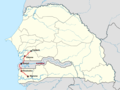
 Senegal N1 road.png 1,194 × 900; 260 KB
-
 Senegal N2 road.png 1,194 × 900; 254 KB
-
 Senegal N3 road.png 1,194 × 900; 258 KB
-
 Senegal N4 Trans-Gambia Highway.png 1,194 × 900; 251 KB
-
 Senegal N5 road.png 1,194 × 900; 252 KB
-
 Senegal N6 road.png 1,194 × 900; 253 KB
-
 Senegal N7 road.png 1,194 × 900; 259 KB
-
 Senegal roadside produce.jpg 1,988 × 1,483; 739 KB
-
 TRANSPORT SENEGAL CHEMIN DE FER 01.jpg 1,440 × 2,560; 5.43 MB
-
 Travel in Senegal.jpg 1,076 × 1,048; 564 KB
-
 Témoin du passé et du présent.jpg 2,592 × 1,728; 1.22 MB
.jpg)
.jpg)
.jpg)


.jpg)


