Category:Roads in South Ayrshire
Council areas (municipalities) of Scotland: Aberdeen · Aberdeenshire · Angus · Argyll and Bute · Clackmannanshire · Dumfries and Galloway · Dundee · East Ayrshire · East Dunbartonshire · East Lothian · East Renfrewshire · Edinburgh · Falkirk · Fife · Glasgow · Highland · Inverclyde · Midlothian · Moray · North Ayrshire · North Lanarkshire · Outer Hebrides · Orkney Islands · Perth and Kinross · Renfrewshire · Scottish Borders · Shetland Islands · South Ayrshire · South Lanarkshire · Stirling · West Dunbartonshire · West Lothian
Subcategories
This category has the following 7 subcategories, out of 7 total.
A
D
- Dalmaca Farm old road (4 F)
- Deil's Elbow, South Ayrshire (4 F)
- Dirt roads in South Ayrshire (52 F)
O
- Old Rome bridge (3 F)
R
S
Media in category "Roads in South Ayrshire"
The following 200 files are in this category, out of 216 total.
(previous page) (next page)-
 A70 at Carbieston Byres - geograph.org.uk - 178462.jpg 640 × 480; 65 KB
-
 A70 at Coylton - geograph.org.uk - 178465.jpg 640 × 480; 66 KB
-
 A77 South (Holmston Roundabout, Ayr) - geograph.org.uk - 344551.jpg 640 × 481; 135 KB
-
 A77 with average speed cameras - geograph.org.uk - 85539.jpg 640 × 480; 61 KB
-
 Approaching Kilkerran Level Crossing - geograph.org.uk - 4087822.jpg 1,920 × 1,280; 2.1 MB
-
 Ayr Hospital entrance - geograph.org.uk - 63609.jpg 640 × 424; 87 KB
-
 Ayrshire Road - geograph.org.uk - 380391.jpg 640 × 480; 55 KB
-
 B743 and Easter Smithstone Farm - geograph.org.uk - 421207.jpg 640 × 480; 93 KB
-
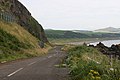 Bennane Head - geograph.org.uk - 4444512.jpg 3,504 × 2,336; 3.94 MB
-
 Burnfoot Bridge - geograph.org.uk - 421222.jpg 640 × 480; 123 KB
-
 Cattle market entrance - geograph.org.uk - 178752.jpg 640 × 480; 54 KB
-
 Climbing The Hill Road - geograph.org.uk - 1190522.jpg 391 × 600; 85 KB
-
 Cloverhill - geograph.org.uk - 588230.jpg 640 × 470; 116 KB
-
 Country Road - geograph.org.uk - 476138.jpg 640 × 480; 108 KB
-
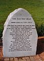 Electric Brae Cairn2.jpg 941 × 1,303; 219 KB
-
 Farm Road to High Woodston - geograph.org.uk - 382029.jpg 640 × 480; 67 KB
-
 Forest Track - geograph.org.uk - 707782.jpg 640 × 479; 119 KB
-
 Gowancroft - geograph.org.uk - 464217.jpg 640 × 480; 79 KB
-
 Grazing Cattle - geograph.org.uk - 258347.jpg 640 × 480; 110 KB
-
 Hilltop Trees Near Symington - geograph.org.uk - 324438.jpg 640 × 478; 173 KB
-
 Hogg's Corner, Minishant - geograph.org.uk - 249780.jpg 640 × 459; 106 KB
-
 Jelliston - geograph.org.uk - 184993.jpg 640 × 480; 54 KB
-
 Junction at Bogend - geograph.org.uk - 325054.jpg 640 × 478; 204 KB
-

-
 Kirkmichael - geograph.org.uk - 993941.jpg 400 × 600; 136 KB
-
 Knockgardner - geograph.org.uk - 264586.jpg 640 × 480; 60 KB
-
 Local Boundary - geograph.org.uk - 375368.jpg 640 × 471; 146 KB
-
 Minor Road Near Crooks - geograph.org.uk - 324972.jpg 640 × 478; 209 KB
-
 Minor Road Near Rowanhill - geograph.org.uk - 325051.jpg 640 × 478; 168 KB
-
 Minor Road Near Symington - geograph.org.uk - 325022.jpg 640 × 478; 210 KB
-
 Monk's Road, Fail.JPG 2,288 × 1,712; 1.27 MB
-
 Nick of the Balloch (north side) - geograph.org.uk - 263383.jpg 640 × 480; 74 KB
-

-
 Prestwick Road, Ayr - geograph.org.uk - 250022.jpg 640 × 480; 121 KB
-
 Roadside Flowers - geograph.org.uk - 400357.jpg 640 × 473; 161 KB
-
 School Crossing - geograph.org.uk - 683554.jpg 640 × 468; 69 KB
-

-
 South Craig Farm - geograph.org.uk - 382407.jpg 640 × 480; 80 KB
-
 St Quivox Road, taken from the A77 end - geograph.org.uk - 349542.jpg 480 × 640; 108 KB
-
 Straiton Road near Tairlaw - geograph.org.uk - 748238.jpg 640 × 480; 59 KB
-
 The junction at Aitkenhead - geograph.org.uk - 775028.jpg 640 × 480; 84 KB
-

-
 The Old Road - geograph.org.uk - 226560.jpg 640 × 480; 135 KB
-
 The road past Bennan farm junction - geograph.org.uk - 501920.jpg 640 × 480; 101 KB
-
 The road to Braden Dam - geograph.org.uk - 745628.jpg 640 × 480; 56 KB
-
 Walker - geograph.org.uk - 382010.jpg 640 × 480; 82 KB
-
 Welcome to Ayr - geograph.org.uk - 249785.jpg 640 × 480; 112 KB
-
 A Busy Part Of The River Ayr Way - geograph.org.uk - 579071.jpg 640 × 480; 104 KB
-
 A neatly-kept verge at Garphar - geograph.org.uk - 331959.jpg 640 × 480; 103 KB
-
 A Slippery Road - geograph.org.uk - 1190564.jpg 640 × 480; 86 KB
-

-
 A719 at Glenlea - geograph.org.uk - 1101674.jpg 640 × 428; 97 KB
-
 A77 North (from Holmston Roundabout) - geograph.org.uk - 344550.jpg 640 × 481; 132 KB
-
 A77 Trunk Road to the south of Ayr - geograph.org.uk - 257885.jpg 640 × 480; 151 KB
-
 Along The Track - geograph.org.uk - 1101095.jpg 640 × 402; 110 KB
-
 Annbank - geograph.org.uk - 182062.jpg 640 × 480; 79 KB
-
 Auchairne Junction - geograph.org.uk - 707745.jpg 640 × 479; 85 KB
-
 Ayr to Galston Road - geograph.org.uk - 340007.jpg 640 × 480; 59 KB
-
 Back lane to Penkill in the Girvan valley - geograph.org.uk - 262946.jpg 640 × 480; 121 KB
-
 Baing Farm Road - geograph.org.uk - 261866.jpg 640 × 480; 117 KB
-
 Barrhill farm entrance - geograph.org.uk - 350667.jpg 640 × 480; 108 KB
-
 Bend In The Track - geograph.org.uk - 817294.jpg 640 × 480; 86 KB
-
 Beneraird Path - geograph.org.uk - 695266.jpg 640 × 479; 105 KB
-
 Brig o' Doon House Hotel - geograph.org.uk - 425238.jpg 640 × 427; 97 KB
-
 Brown Carrick Hill Road - geograph.org.uk - 372647.jpg 640 × 480; 127 KB
-
 Burn Farm - geograph.org.uk - 351274.jpg 640 × 480; 126 KB
-
 By The A77 - geograph.org.uk - 648975.jpg 640 × 480; 92 KB
-
 Carngillan, Ayrshire - geograph.org.uk - 61596.jpg 640 × 424; 62 KB
-
 Clanmore Forest track - geograph.org.uk - 464090.jpg 640 × 480; 105 KB
-
 Clearing up the carnage - geograph.org.uk - 354329.jpg 640 × 424; 45 KB
-
 Coast Road - geograph.org.uk - 616074.jpg 640 × 480; 68 KB
-
 Coldcethll - geograph.org.uk - 340002.jpg 640 × 480; 68 KB
-
 Coming Down From The Dam - geograph.org.uk - 416728.jpg 640 × 480; 133 KB
-
 Coming Round Delamford Hill - geograph.org.uk - 416877.jpg 640 × 487; 128 KB
-
 Coming Up The Hill - geograph.org.uk - 375335.jpg 640 × 480; 94 KB
-
 Country Road - geograph.org.uk - 328614.jpg 640 × 480; 106 KB
-
 Country road near Longhouse - geograph.org.uk - 308463.jpg 480 × 640; 64 KB
-
 Craigdow Forest - geograph.org.uk - 461708.jpg 640 × 480; 116 KB
-
 Crossing The Burn - geograph.org.uk - 775847.jpg 450 × 600; 94 KB
-

-
 Dowhill - geograph.org.uk - 250499.jpg 640 × 479; 58 KB
-
 East Aquaduct Road - geograph.org.uk - 263522.jpg 640 × 480; 97 KB
-
 Farm Road - geograph.org.uk - 521314.jpg 446 × 600; 58 KB
-
 Floral entrance - geograph.org.uk - 461678.jpg 640 × 480; 114 KB
-
 Footpath next to the River Ayr - geograph.org.uk - 764206.jpg 640 × 480; 149 KB
-
 Forest road above Pinvalley - geograph.org.uk - 263377.jpg 640 × 480; 71 KB
-
 Forest Road at Airyewn - geograph.org.uk - 561336.jpg 640 × 480; 145 KB
-
 Forest road in Changue Forest - geograph.org.uk - 263360.jpg 640 × 480; 79 KB
-
 Forest road in Changue Forest - geograph.org.uk - 333926.jpg 480 × 640; 85 KB
-

-
 Forest Track - geograph.org.uk - 261853.jpg 640 × 480; 200 KB
-
 Forest track in Lambdoughty Forest - geograph.org.uk - 440567.jpg 640 × 480; 169 KB
-
 Forest Track, Linfern Road - geograph.org.uk - 260656.jpg 640 × 465; 156 KB
-
 Forest Walk - geograph.org.uk - 261834.jpg 640 × 480; 215 KB
-
 From The Sclenteuch Moor Path - geograph.org.uk - 618858.jpg 450 × 600; 71 KB
-
 Frosty Track - geograph.org.uk - 618892.jpg 450 × 600; 72 KB
-
 Gates and Gorse - geograph.org.uk - 405847.jpg 640 × 480; 129 KB
-
 Glen App - geograph.org.uk - 696688.jpg 640 × 479; 130 KB
-
 Going To Ayr - geograph.org.uk - 609992.jpg 640 × 418; 56 KB
-
 Going Up The Hill - geograph.org.uk - 354787.jpg 480 × 640; 177 KB
-
 Going Up The Hill - geograph.org.uk - 415762.jpg 640 × 480; 188 KB
-
 Gowlands terrace. - geograph.org.uk - 554246.jpg 640 × 480; 150 KB
-
 Grass Track - geograph.org.uk - 405844.jpg 640 × 480; 190 KB
-
 Grassy Corner - geograph.org.uk - 618904.jpg 450 × 600; 83 KB
-
 Heading Towards the Stinchar Valley - geograph.org.uk - 260682.jpg 640 × 480; 115 KB
-
 Hedge Lined Minor Road Near Plewlands - geograph.org.uk - 291191.jpg 640 × 480; 158 KB
-
 Heronsford Trail - geograph.org.uk - 692704.jpg 640 × 479; 102 KB
-
 Heronsford Trail - geograph.org.uk - 695282.jpg 640 × 479; 106 KB
-
 Heronsford Trail - geograph.org.uk - 706169.jpg 640 × 479; 155 KB
-
 High Ballochdowan Road - geograph.org.uk - 707335.jpg 640 × 479; 99 KB
-
 High Mark - geograph.org.uk - 696897.jpg 640 × 479; 84 KB
-
 High Troweir Farm - geograph.org.uk - 618509.jpg 640 × 480; 80 KB
-
 Hill road - geograph.org.uk - 232583.jpg 640 × 427; 109 KB
-
 Ice Patterns - geograph.org.uk - 618939.jpg 450 × 600; 82 KB
-
 Into The Forest - geograph.org.uk - 618870.jpg 450 × 600; 75 KB
-
 Into the Stinchar Valley - geograph.org.uk - 260689.jpg 640 × 480; 163 KB
-
 Junction - geograph.org.uk - 380348.jpg 640 × 480; 140 KB
-
 Junction - geograph.org.uk - 380398.jpg 640 × 480; 80 KB
-
 Kilantringan Road - geograph.org.uk - 709970.jpg 640 × 479; 65 KB
-
 Knockycoid Cottage - geograph.org.uk - 476144.jpg 640 × 480; 86 KB
-
 Knowe Road. - geograph.org.uk - 554238.jpg 640 × 480; 152 KB
-
 Landing Lights - geograph.org.uk - 355531.jpg 640 × 490; 128 KB
-
 Linfern Road - geograph.org.uk - 260647.jpg 640 × 480; 134 KB
-
 Linfern Road - geograph.org.uk - 260672.jpg 640 × 480; 120 KB
-
 Littlehill farm roadend - geograph.org.uk - 308443.jpg 640 × 480; 60 KB
-
 Loads Of Logs - geograph.org.uk - 476142.jpg 640 × 464; 101 KB
-
 Logs By The Track - geograph.org.uk - 594281.jpg 640 × 475; 130 KB
-
 Lots Of Mud Here - geograph.org.uk - 619006.jpg 452 × 600; 72 KB
-
 Macnairston - geograph.org.uk - 178754.jpg 640 × 480; 76 KB
-
 Minor Road at Low Wardneuk - geograph.org.uk - 297970.jpg 640 × 478; 192 KB
-
 Minor Road Leading to Little Foulton - geograph.org.uk - 297962.jpg 478 × 640; 161 KB
-
 Minor Road Near Gatehead - geograph.org.uk - 325074.jpg 640 × 478; 212 KB
-
 Minor Road Near High Wardneuk - geograph.org.uk - 295394.jpg 640 × 478; 174 KB
-
 Minor Road Near High Wardneuk - geograph.org.uk - 297973.jpg 478 × 640; 209 KB
-
 Minor Road Near High Wardneuk - geograph.org.uk - 297975.jpg 640 × 478; 179 KB
-
 Minor Road Near Laigh Langside - geograph.org.uk - 291092.jpg 640 × 480; 165 KB
-
 Moorland Gate - geograph.org.uk - 405872.jpg 640 × 480; 151 KB
-
 Moorland road - geograph.org.uk - 598081.jpg 640 × 477; 63 KB
-
 Moorland Track - geograph.org.uk - 405870.jpg 640 × 480; 163 KB
-
 Moorland Track - geograph.org.uk - 695237.jpg 640 × 479; 82 KB
-
 Mossblown, Ayrshire - geograph.org.uk - 61580.jpg 640 × 424; 74 KB
-
 Near Knockcroon - geograph.org.uk - 464346.jpg 640 × 480; 120 KB
-
 Nether Culzean Farm Entrance - geograph.org.uk - 261924.jpg 640 × 480; 126 KB
-
 New Forest Road - geograph.org.uk - 260705.jpg 640 × 480; 171 KB
-
 New Forest Road - geograph.org.uk - 261836.jpg 640 × 480; 148 KB
-
 New Luce Trail - geograph.org.uk - 695225.jpg 640 × 479; 88 KB
-
 New Luce Trail - geograph.org.uk - 695303.jpg 640 × 479; 122 KB
-
 Northern side of Coylton - geograph.org.uk - 686308.jpg 640 × 480; 47 KB
-
 On The Boardwalk - geograph.org.uk - 578970.jpg 450 × 600; 109 KB
-
 On The Dunure Hill Path - geograph.org.uk - 619029.jpg 640 × 480; 74 KB
-
 On The Lindsayston Walk - geograph.org.uk - 594616.jpg 640 × 480; 136 KB
-
 On The Straiton-Patna Hill Path - geograph.org.uk - 618874.jpg 640 × 480; 100 KB
-
 On The Way In - geograph.org.uk - 476170.jpg 640 × 480; 102 KB
-
 Over The March Burn - geograph.org.uk - 618883.jpg 640 × 421; 71 KB
-
 Pile of roadstone - geograph.org.uk - 263510.jpg 640 × 480; 83 KB
-
 Pocknave farm roadend - geograph.org.uk - 308362.jpg 640 × 447; 43 KB
-
 Poundland Wood - geograph.org.uk - 57222.jpg 640 × 480; 167 KB
-
 Ramageton farm roadend - geograph.org.uk - 308446.jpg 640 × 480; 65 KB
-

-
 River Ayr Way - geograph.org.uk - 347320.jpg 640 × 480; 156 KB
-
 River Ayr Way at Ayr - geograph.org.uk - 347304.jpg 640 × 480; 104 KB
-
 River Ayr Way at Mainholm - geograph.org.uk - 347330.jpg 640 × 480; 142 KB
-

-
 Road Junction at Stinchar Bridge - geograph.org.uk - 528348.jpg 640 × 480; 88 KB
-
 Road junction with waste wood pile - geograph.org.uk - 308395.jpg 640 × 480; 64 KB
-
 Road to Adamton Mains - geograph.org.uk - 295390.jpg 640 × 478; 161 KB
-
 Road to High Ballochdowan Farm - geograph.org.uk - 707326.jpg 640 × 479; 102 KB
-
 Road to Tarbolton - geograph.org.uk - 295382.jpg 640 × 478; 195 KB
-
 Road to Yonderton Farm - geograph.org.uk - 382042.jpg 640 × 480; 87 KB
-
 Roadside Verge - geograph.org.uk - 625691.jpg 640 × 480; 75 KB
-

-
 Rowantree Toll - geograph.org.uk - 197886.jpg 640 × 480; 51 KB
-
 Sandyford Roundabout - geograph.org.uk - 345855.jpg 640 × 173; 31 KB
-
 Sharp Bend - geograph.org.uk - 464222.jpg 640 × 480; 114 KB
-
 Springs - geograph.org.uk - 178478.jpg 640 × 480; 76 KB
-
 Steep Hill Down to Underhills - geograph.org.uk - 295401.jpg 478 × 640; 219 KB
-
 Steep Hill Near Underhills - geograph.org.uk - 297982.jpg 640 × 478; 202 KB
-
 Still a forest - geograph.org.uk - 464321.jpg 640 × 480; 77 KB
-
 Straight Minor Road - geograph.org.uk - 340035.jpg 480 × 640; 72 KB
-

-
 Tairlaw Toll - geograph.org.uk - 137128.jpg 640 × 480; 100 KB
-
 Tallaminnoch - geograph.org.uk - 137131.jpg 640 × 480; 135 KB
-
 The A719 At Pennyglen - geograph.org.uk - 616043.jpg 450 × 600; 51 KB
-
 The Barony Hill Walk - geograph.org.uk - 594793.jpg 484 × 600; 71 KB
-
 The Coast Road from Drumshang - geograph.org.uk - 313694.jpg 640 × 480; 84 KB
-
 The Electric Brae Experience - geograph.org.uk - 313687.jpg 640 × 468; 95 KB
-
 The Hill Road - geograph.org.uk - 261858.jpg 640 × 480; 195 KB
-
 The lane to Downam, near Ballantrae - geograph.org.uk - 262994.jpg 640 × 480; 84 KB
-
 The Lang Scots Mile - geograph.org.uk - 178196.jpg 640 × 480; 49 KB
-
 The road to South Auchinweet - geograph.org.uk - 350670.jpg 640 × 482; 56 KB
-
 The road to Spittalhill - geograph.org.uk - 350682.jpg 640 × 480; 99 KB
-
 The Straiton Walk to Patna - geograph.org.uk - 375324.jpg 640 × 457; 159 KB
-
 The Straiton-Patna Path - geograph.org.uk - 618863.jpg 640 × 480; 83 KB
-
 Through Glengee Wood - geograph.org.uk - 594657.jpg 640 × 455; 143 KB
-
 To The Turbines - geograph.org.uk - 577530.jpg 450 × 600; 54 KB
-
 Towards Auchencrosh - geograph.org.uk - 415764.jpg 640 × 480; 122 KB
-
 Towards Glenshalloch Wood - geograph.org.uk - 631606.jpg 450 × 600; 60 KB
-
 Towards Howmoor - geograph.org.uk - 372625.jpg 640 × 438; 122 KB
-
 Towards Newbarns Wood - geograph.org.uk - 579056.jpg 640 × 473; 96 KB
-
 Towards The Heads Of Ayr - geograph.org.uk - 610028.jpg 469 × 600; 59 KB


_-_geograph.org.uk_-_344551.jpg)


_-_geograph.org.uk_-_263383.jpg)


_-_geograph.org.uk_-_344550.jpg)


_showing_present_use_as_winter_cattle_feed_station_-_geograph.org.uk_-_347434.jpg)


