Category:Roadsides
Wikimedia disambiguation page | |||||
| Instance of | |||||
|---|---|---|---|---|---|
| Said to be the same as | Gabia | ||||
| |||||
Subcategories
This category has the following 19 subcategories, out of 19 total.
Media in category "Roadsides"
The following 135 files are in this category, out of 135 total.
-
 'Berfrestone' (DB) St Nicholas Church from road northeast Barfrestone Kent England.jpg 5,472 × 3,648; 15.17 MB
-
 -2018-12-09 Finger sign post, Mundesley road, Trunch.JPG 5,152 × 3,864; 6.09 MB
-
 -2020-09-16 Sign post on Mill common road, Witton Bridge.JPG 3,864 × 5,152; 4.57 MB
-
 -2021-06-30 Directional road sign, The Street, Knapton.jpg 1,024 × 768; 372 KB
-
 -2022-04-02 Sign post, Church Road, West Beckham, Norfolk.JPG 3,864 × 5,152; 7.39 MB
-
 2015 - panoramio (33).jpg 1,280 × 833; 913 KB
-
 A laneside at the north of Nuthurst, West Sussex, England ~ posts and wire.JPG 3,648 × 5,472; 11.42 MB
-
 Faggoters Lane High Laver and Matching Essex England.jpg 3,878 × 3,102; 16.91 MB
-
 Fingerpost at High Laver and Matching Essex England.jpg 3,340 × 5,009; 20.57 MB
-
 Hedge at Stapleford Tawney, Essex, England.jpg 5,472 × 3,648; 12.56 MB
-
 Oak at Stapleford Tawney, Essex, England 1.jpg 2,000 × 3,000; 6.36 MB
-
 Fence and road verge at Hatfield Broad Oak Essex England.jpg 2,250 × 3,000; 5.9 MB
-
 Bus stop at night in Nuthurst, West Sussex, England.jpg 3,000 × 2,000; 4.99 MB
-
 Roadside puddle on Sedgwick Lane, Nuthurst, West Sussex 01.jpg 3,000 × 2,000; 7.13 MB
-
 Roadside puddle on Sedgwick Lane, Nuthurst, West Sussex 02.jpg 3,000 × 2,000; 7.05 MB
-
 Roadside traffic mirror in Nuthurst, West Sussex, England.jpg 2,000 × 3,000; 5.75 MB
-
 Bridge over Pincey Brook on Chelmsford Road, Hatfield Heath, Essex, England.jpg 5,472 × 3,648; 33.25 MB
-
 Bridge over Pincey Brook on Matching Road, Hatfield Heath, Essex, England 02.jpg 3,500 × 2,333; 8.55 MB
-
 Bridge over Pincey Brook on Matching Road, Hatfield Heath, Essex, England 03.jpg 3,500 × 2,333; 6.99 MB
-
 Churchgate Street, Harlow, Essex, England.jpg 3,500 × 2,333; 6.68 MB
-
 Pincey Brook bridge on Church Lane, Sheering, Essex, England 01.jpg 3,500 × 2,333; 10.75 MB
-
 Access road to Hatfield Park Essex England 5.jpg 3,000 × 2,250; 7.86 MB
-
 Log-pile wood-stack at Hatfield Broad Oak, Essex England 1.jpg 3,500 × 2,625; 5.76 MB
-
 Barn at Greenhill, Hatfield Broad Oak, Essex England 1.jpg 3,500 × 2,625; 6.16 MB
-
 Barn at Greenhill, Hatfield Broad Oak, Essex England 3.jpg 2,625 × 3,500; 6.12 MB
-
 Barn at Greenhill, Hatfield Broad Oak, Essex England 2.jpg 3,500 × 2,625; 6.76 MB
-
 Bacon End footpath bridge, Great Canfield, Essex, England 01.jpg 4,154 × 6,231; 23.54 MB
-
 Bacon End footpath bridge, Great Canfield, Essex, England 02.jpg 4,160 × 6,240; 23.81 MB
-
 Bacon End road junction fingerpost, Great Canfield, Essex, England.jpg 4,160 × 6,240; 23.68 MB
-
 Bacon End hegerow wood stack at Great Canfield, Essex, England.jpg 6,240 × 4,160; 25.22 MB
-
 Paddock gate on Fountain Road, Good Easter, Essex.jpg 6,242 × 4,164; 29.11 MB
-
 Bridge parapet on Fountain Road, Good Easter, Essex 01.jpg 5,434 × 3,623; 14.56 MB
-
 Bridge parapet on Fountain Road, Good Easter, Essex 02.jpg 6,240 × 4,160; 29.23 MB
-
 2018-05-12 Signpost in Trimingham, Norfolk.JPG 3,864 × 5,152; 6.78 MB
-
 Stonards Hill at Coopersale Street hamlet, Essex, England.jpg 6,087 × 4,058; 17.98 MB
-
 Houblons Hill from Coopersale Street hamlet, Essex, England.jpg 5,998 × 3,998; 22.5 MB
-
 Grade II listed barn at Coopersale Street hamlet, Essex, England.jpg 6,068 × 3,413; 18.71 MB
-
 City of London Cemetery and Crematorium - roadside street lamp 1.jpg 3,075 × 6,151; 25.65 MB
-
 Prunus tree blossom in Haringey, London 1.jpg 3,370 × 4,494; 15.48 MB
-
 Prunus tree blossom in Haringey, London 2.jpg 3,361 × 4,481; 15.67 MB
-
 30 mph limit on the B1051 road approach into Elsenham Essex England.jpg 5,472 × 3,648; 11.98 MB
-
 A K6 telephone box and utility poles Little Laver Road Essex England.jpg 2,000 × 3,000; 7.3 MB
-
 A lane at the north of Nuthurst, West Sussex, England ~ roadside trees.JPG 5,472 × 3,648; 16.19 MB
-
 A lane at the north of Nuthurst, West Sussex, England ~ roadside verge vegetation.JPG 5,472 × 3,648; 15.05 MB
-

-
 A red brick and tiled house at Theydon Mount Essex England.JPG 5,472 × 3,648; 11.55 MB
-
 A road view southwest towards the City of London from Theydon Mount Essex England 01.JPG 3,648 × 5,472; 12.36 MB
-
 A road with gate, hedge and trees at Nuthurst, West Sussex, England.JPG 5,472 × 3,648; 16.77 MB
-
 Abbess Beauchamp and Berners Roding, Essex England - cottages.JPG 4,761 × 2,863; 9.85 MB
-
 Abbess Roding - roadside public bench - Essex England.jpg 4,000 × 3,000; 13.27 MB
-
 Abbess Roding - roadside white gate - Essex England.jpg 4,000 × 3,000; 8.86 MB
-
 Abbess Roding - utility pole - Essex England.jpg 2,667 × 4,000; 10.69 MB
-
 Abbess Roding bridge over roadside stream for public footpath from north - Essex England.jpg 4,000 × 2,667; 9.22 MB
-
 Abbess Roding bridge over roadside stream for public footpath from south - Essex England.jpg 4,000 × 2,667; 9.31 MB
-
 Abbess Roding domestic Emden geese - Essex England 01.jpg 4,000 × 2,666; 8.47 MB
-
 Abbess Roding domestic Emden geese - Essex England 02.jpg 4,000 × 2,666; 8.75 MB
-
 Abbess Roding domestic Emden geese - Essex England 03.jpg 4,000 × 2,667; 7.16 MB
-
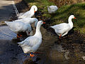 Abbess Roding domestic Emden geese - Essex England 04.jpg 4,382 × 3,286; 8.37 MB
-
 Abbess Roding domestic Emden geese - Essex England 05.jpg 2,500 × 2,500; 4.15 MB
-
 Abbess Roding domestic Emden geese - Essex England 06.jpg 2,500 × 2,500; 3.23 MB
-
 Abbess Roding domestic Emden geese - Essex England 07.jpg 2,500 × 2,500; 3.38 MB
-
 Abbess Roding domestic Emden geese - Essex England 08.jpg 3,664 × 2,748; 4.81 MB
-
 Abbess Roding farm gates, listed barn and hall - Essex England.jpg 4,000 × 2,667; 9.66 MB
-
 Abbess Roding roadside house and St Edmund's Church entrance - Essex England.jpg 4,000 × 2,667; 8.73 MB
-
 Access road to Hatfield Park Essex England 1.jpg 3,000 × 2,250; 6.9 MB
-
 Access road to Hatfield Park Essex England 2.jpg 3,000 × 2,250; 5.72 MB
-
 Access road to Hatfield Park Essex England 3.jpg 3,000 × 2,250; 5.58 MB
-
 Access road to Hatfield Park Essex England 4.jpg 3,000 × 2,250; 4.93 MB
-
 Along Mashbury Hall Lane from the north, Mashbury, Essex, England.JPG 5,472 × 3,648; 10.43 MB
-

-
 Apple blossom time in Bemmel.jpg 4,896 × 3,264; 9.18 MB
-
 Aspen and Spruce (396ce8b2-1dd8-b71c-0730-318ca9ed5261).jpg 800 × 1,200; 1.08 MB
-
 Avenue of trees Magdalen Laver Essex England.jpg 3,000 × 2,000; 8.12 MB
-
 Back lane at north of Barfrestone church Kent England.jpg 5,472 × 3,648; 23.41 MB
-
 Back lane north of Barfrestone church Kent England.jpg 5,472 × 3,648; 17.39 MB
-
 Bali, sociología 1998 05.jpg 1,042 × 697; 1.04 MB
-
 Balsam Poplar (3965b243-1dd8-b71c-0786-3c766e79cb05).jpg 800 × 1,200; 788 KB
-

-
 Below Hotel Rock (3967a0b9-1dd8-b71c-0732-aa943db5002a).jpg 800 × 1,200; 877 KB
-
 Betts Lane telephone and phone box at Nazeing, Essex, England.JPG 3,648 × 5,105; 15.9 MB
-
 Bluebells and Butterfly (396f4e58-1dd8-b71c-0738-c7fb7f2aa1e5).jpg 800 × 571; 306 KB
-
 Box and pole and church Little Easton Essex England.jpg 3,658 × 4,877; 21.9 MB
-
 Branston Moor - geograph.org.uk - 380495.jpg 640 × 427; 65 KB
-
 Brent Pelham B1038 road and Church Cottage Hertfordshire England 1.jpg 3,648 × 5,472; 22.34 MB
-
 Brent Pelham B1038 road and Church Cottage Hertfordshire England 2.jpg 5,268 × 3,512; 16.65 MB
-
 Brent Pelham B1038 road and Church Cottage Hertfordshire England 3.jpg 5,240 × 3,492; 22.75 MB
-
 Brent Pelham phone and post box Hertfordshire England.jpg 3,648 × 5,472; 22.8 MB
-
 Brent Pelham war memorial Hertfordshire England.jpg 3,565 × 5,348; 25.2 MB
-
 Cangas del Narcea 1991 05.jpg 987 × 668; 913 KB
-
 Canopied Ricking Road Wicken Bonhunt Essex England.jpg 3,420 × 5,328; 24.81 MB
-
 Church End at Panfield Essex England 1.jpg 3,000 × 2,000; 6.58 MB
-
 Church End at Panfield Essex England 2.jpg 3,000 × 2,000; 6.02 MB
-
 Church St and Cock Inn through trees at Henham Essex England.jpg 5,472 × 3,648; 17.25 MB
-
 Concrete post fence and house, High Street Henham Essex England.jpg 5,387 × 3,532; 18.69 MB
-
 Cottage at Wicken Bonhunt Essex England.jpg 5,472 × 3,648; 22.37 MB
-
 Country lane north Nuthurst, West Sussex, England.jpg 3,648 × 5,472; 23.56 MB
-
 Crow St phone and post box with telephone pole Henham Essex England.jpg 3,305 × 5,361; 10.56 MB
-
 Crow St phone box and telephone pole Henham Essex England.jpg 3,648 × 5,472; 11.47 MB
-
 Curved road entrance to church Magdalen Laver Essex England.jpg 3,000 × 2,000; 7.09 MB
-
 Curved road west from church Magdalen Laver Essex England.jpg 3,000 × 2,000; 7.47 MB
-
 Direction fingerpost at Staplefield, West Sussex, England.jpg 2,000 × 3,000; 5.87 MB
-
 Elizabeth II post box K6 telephone box and utility poles Little Laver Road Essex England.jpg 3,000 × 2,000; 6.79 MB
-
 Elsenham Broxsted fingerpost and path Henham Essex England.jpg 3,525 × 4,920; 13.74 MB
-
 Elsenham Debden fingerpost and house Henham Essex England.jpg 5,420 × 3,572; 16.6 MB
-
 English flag and war memorial Henham Essex England.jpg 3,578 × 4,801; 15.77 MB
-
 EnRoute Akhalzikhe-Akhalkalaki2012-03.jpg 1,935 × 1,445; 2.35 MB
-
 Epping Forest High Beach Waltham Abbey Essex England - Mott Street 01.jpg 2,000 × 3,000; 7.63 MB
-
 Epping Forest High Beach Waltham Abbey Essex England - Mott Street 03.jpg 2,500 × 2,500; 7.98 MB
-
 Fence and tree lined lawn Little Laver Road, Essex England.jpg 3,000 × 2,000; 6.64 MB
-
 Field and road at Theydon Mount Essex England.JPG 4,924 × 3,648; 11.17 MB
-
 Fingerpost at Rickling Green Essex England.jpg 5,472 × 3,648; 19.37 MB
-
 Fuerteventura, carreteras 1993.jpg 1,068 × 706; 680 KB
-
 Hellman's Cross, Great Canfield, Essex, England - entry from NW.JPG 5,472 × 3,648; 17.26 MB
-
 Hellmans Cross, Great Canfield, Essex, England - exit from SE.JPG 5,472 × 3,648; 9.84 MB
-
 Hellmans Cross, Great Canfield, Essex, England - roadside trees at SW.JPG 5,472 × 3,648; 14.94 MB
-

-
 KEEP AMERICA BEAUTIFUL DAY. BOY SCOUTS REMOVING LITTER FROM SALINAS - NARA - 543176.jpg 2,033 × 3,000; 1.45 MB
-
-

-
 Le Tilleul (France), road between trees and wall.JPG 4,288 × 2,848; 6.67 MB
-
 Magallanes, ruta 9, 3.jpg 4,288 × 2,624; 7.93 MB
-
 Massachusetts-devils strip.JPG 2,112 × 2,816; 3.12 MB
-
 Paper Birch (3970c711-1dd8-b71c-0769-f4d3d01cc22f).jpg 800 × 1,200; 654 KB
-
 Portioning out the bread at a road-side dump (4688608974).jpg 1,000 × 779; 93 KB
-
 Psilocarphus elatior, meadow woollyheads.jpg 4,048 × 3,036; 2.8 MB
-
 Roadside Trail (3963ed27-1dd8-b71c-0761-809030effab5).jpg 1,200 × 800; 1,006 KB
-
 Roadside Trail (396a8432-1dd8-b71c-0793-7c6c0cd78d42).jpg 1,200 × 800; 507 KB
-
 Roadside-Stream ForestWander.JPG 960 × 1,280; 1.66 MB
-
 Roadside-waterfall - West Virginia - ForestWander.jpg 1,209 × 806; 569 KB
-
 Spruce Cones (397316e0-1dd8-b71c-07dc-6d67a08a2b92).jpg 800 × 1,200; 1.01 MB
-

-
 Tschiertschen. Weg tussen Tschiertschen en Molinis 008.jpg 5,184 × 3,456; 18.22 MB
-
 Tschiertschen. Weg tussen Tschiertschen en Molinis 014.jpg 5,183 × 3,027; 18.29 MB
-
 Upside-down sign at Imber Range - geograph.org.uk - 537230.jpg 640 × 480; 75 KB
-
 Yosemite N.P., carteles 1989 03.jpg 578 × 884; 663 KB
_St_Nicholas_Church_from_road_northeast_Barfrestone_Kent_England.jpg)


.jpg)


.jpg)


.jpg)

.jpg)

.jpg)


,_road_between_trees_and_wall.JPG)


.jpg)
.jpg)

.jpg)
.jpg)


.jpg)


