Category:Rochers Gréau
| Object location | | View all coordinates using: OpenStreetMap |
|---|
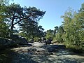
forest in the south of Île-de-France ,_rochers_Gr%C3%A9au_8.JPG) | |||||
| Upload media | |||||
| Instance of | |||||
|---|---|---|---|---|---|
| Location | Saint-Pierre-lès-Nemours, Seine-et-Marne, Île-de-France, Metropolitan France, France | ||||
 | |||||
Media in category "Rochers Gréau"
The following 15 files are in this category, out of 15 total.
-
 Rochers Gréau 01.jpg 4,608 × 3,456; 7.2 MB
-
 Rochers Gréau 02.jpg 4,608 × 3,456; 7.78 MB
-
 Rochers Gréau 03.jpg 4,608 × 3,456; 6.71 MB
-
 Rochers Gréau 04.jpg 4,608 × 3,456; 8.12 MB
-
 Rochers Gréau 05.jpg 4,608 × 3,456; 7.74 MB
-
 Rochers Gréau 06.jpg 3,456 × 4,608; 8.37 MB
-
 Rochers Gréau 07.jpg 4,608 × 3,456; 9.86 MB
-
 Saint-Pierre-lès-Nemours (77), rochers Gréau 1.JPG 3,648 × 2,736; 4.33 MB
-
 Saint-Pierre-lès-Nemours (77), rochers Gréau 2.JPG 3,648 × 2,736; 4.2 MB
-
 Saint-Pierre-lès-Nemours (77), rochers Gréau 3.JPG 2,736 × 3,648; 4.25 MB
-
 Saint-Pierre-lès-Nemours (77), rochers Gréau 4.JPG 2,736 × 3,648; 4.3 MB
-
 Saint-Pierre-lès-Nemours (77), rochers Gréau 5.JPG 3,648 × 2,736; 4.2 MB
-
 Saint-Pierre-lès-Nemours (77), rochers Gréau 6.JPG 3,648 × 2,736; 4.23 MB
-
 Saint-Pierre-lès-Nemours (77), rochers Gréau 7.JPG 2,736 × 3,648; 4.27 MB
-
 Saint-Pierre-lès-Nemours (77), rochers Gréau 8.JPG 3,648 × 2,736; 4.23 MB


,_rochers_Gr%C3%A9au_1.JPG)
,_rochers_Gr%C3%A9au_2.JPG)
,_rochers_Gr%C3%A9au_3.JPG)
,_rochers_Gr%C3%A9au_4.JPG)
,_rochers_Gr%C3%A9au_5.JPG)
,_rochers_Gr%C3%A9au_6.JPG)
,_rochers_Gr%C3%A9au_7.JPG)