Category:Rock formations in the United States
Countries of the Americas: Argentina · The Bahamas · Barbados · Belize · Bolivia · Brazil · Canada · Chile · Colombia · Costa Rica · Cuba · Dominican Republic · Ecuador · El Salvador · Guatemala · Guyana · Haiti · Honduras · Mexico · Nicaragua · Panama · Paraguay · Peru · Saint Vincent and the Grenadines · Suriname · United States of America · Uruguay · Venezuela
Other areas: Aruba · Bermuda · Cayman Islands · Greenland · Guadeloupe · Martinique · Montserrat · Saint-Martin · Saint Pierre and Miquelon
Other areas: Aruba · Bermuda · Cayman Islands · Greenland · Guadeloupe · Martinique · Montserrat · Saint-Martin · Saint Pierre and Miquelon
States of the United States: Alabama · Alaska · Arizona · Arkansas · California · Colorado · Connecticut · Delaware · Florida · Georgia · Hawaii · Idaho · Illinois · Indiana · Iowa · Kansas · Kentucky · Louisiana · Maine · Maryland · Massachusetts · Michigan · Minnesota · Mississippi · Missouri · Montana · Nebraska · Nevada · New Hampshire · New Jersey · New Mexico · New York · North Carolina · North Dakota · Ohio · Oklahoma · Oregon · Pennsylvania · Rhode Island · South Carolina · South Dakota · Tennessee · Texas · Utah · Vermont · Virginia · Washington · West Virginia · Wisconsin · Wyoming – Washington, D.C.
American Samoa · Northern Mariana Islands
American Samoa · Northern Mariana Islands
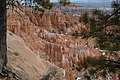
- English: Rock formations in the United States.
| Upload media | |||||
| Instance of | |||||
|---|---|---|---|---|---|
| |||||
Subcategories
This category has the following 26 subcategories, out of 26 total.
+
-
.
A
- Arch Creek (15 F)
B
E
- Enchanted Rock (39 F)
H
K
- Kolana Rock (14 F)
N
- Natural bridge (North Adams) (7 F)
P
R
S
Media in category "Rock formations in the United States"
The following 91 files are in this category, out of 91 total.
-
 Argus - A.Y.P. ed. - Page 12.jpg 4,711 × 6,854; 7.87 MB
-
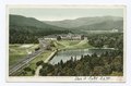
 Midway Point on 17 Mile Drive, Montrey, Calif (NYPL b12647398-62154).tiff 2,460 × 1,644; 11.58 MB
-
 Castle Rock, Columbia River, Ore (NYPL b12647398-62204).tiff 2,441 × 1,579; 11.03 MB
-
 Natural Bridge, Orr's Island, Near, Portland, Me (NYPL b12647398-63106).tiff 2,432 × 1,468; 10.22 MB
-
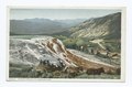 Jupiter Terrace, Mammoth Spring, Yellowstone Ntl. Park, Wyo (NYPL b12647398-68019).tiff 2,456 × 1,616; 11.36 MB
-
 Roaring Rock, York Beach, Me (NYPL b12647398-68854).tiff 2,400 × 1,559; 10.71 MB
-
-
 Surf at Thunder Hole, Bar Harbor, Me (NYPL b12647398-69429).tiff 2,400 × 1,599; 10.99 MB
-
 Natural Bridge, Lookout Mountain, Tenn (NYPL b12647398-69498).tiff 2,368 × 1,569; 10.64 MB
-
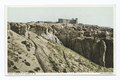
 Summit, Rubidoux Mountain, Riverside Calif (NYPL b12647398-75616).tiff 2,360 × 1,581; 10.68 MB
-
 Rock Formation, Crystal Park Gateway, Colorado Springs, Colo (NYPL b12647398-75784).tiff 2,376 × 1,599; 10.88 MB
-
 Lower Falls, Ammonoosuc River, White Mtns., N. H (NYPL b12647398-75794).tiff 1,554 × 2,376; 10.57 MB
-
 Church at Acoma, New Mexico (NYPL b12647398-75831).tiff 2,376 × 1,590; 10.82 MB
-
 Badlands in South Dacota.JPG 3,264 × 2,448; 1.51 MB
-
 Balancedrock-ky-12-13-08.jpg 1,200 × 1,600; 1.1 MB
-
 Bandon Oregon Coastal rocks 01.jpg 3,525 × 2,345; 2.25 MB
-
 Basalt cliffs blocking view of Ki-a-Kuts Falls.JPG 3,872 × 2,592; 4.02 MB
-
 Basalt rocks near Ki-a-Kuts Falls.JPG 3,872 × 2,592; 4.04 MB
-
 Big South Fork National River and Recreation Area BISO7039.jpg 3,072 × 2,048; 3.92 MB
-
 Canyonlands from Ancestral Puebloan Granary at the Top of Aztec Butte.jpg 2,816 × 1,880; 1.97 MB
-
 Castlerocktown.jpeg 480 × 359; 35 KB
-
 Catawba, VA, USA - panoramio - Idawriter.jpg 2,448 × 3,264; 2.41 MB
-
 Conkles Hollow.jpg 852 × 1,136; 902 KB
-
 Deltaic 8601.jpg 2,000 × 1,333; 1.03 MB
-
 Desert Lake (11714651826).jpg 4,228 × 2,188; 3.06 MB
-
 Devils slide montana.JPG 640 × 480; 80 KB
-
 Doane Rock.jpeg 400 × 442; 20 KB
-
 Flowers (7726192450).jpg 2,376 × 1,584; 2.26 MB
-
 Gallery, 'Point Lookout.' Lookout Mountain, Tenn. (16628120853).jpg 639 × 1,000; 482 KB
-
 Geology (1907) (14776109242).jpg 2,034 × 2,266; 602 KB
-
 Giant's Club, near Green River Station. Sweetwater County, Wyoming. - NARA - 516619.jpg 3,000 × 2,345; 1.28 MB
-
 GreatChannels Virginia DarktoLightView.jpg 2,448 × 3,264; 781 KB
-
 GreatChannels Virginia VerticalPanorama WithPerson.jpg 1,536 × 3,410; 1.52 MB
-
 Harbor Tidal Pool (Matinicus Island, ME).jpg 1,200 × 1,600; 710 KB
-
 Harpers Ferry National Historical Park HAFE0023.jpg 2,048 × 1,536; 614 KB
-
 Hattie harry.jpg 432 × 323; 158 KB
-
 Hoodoos at Sunset Point in Bryce Canyon.jpg 3,008 × 2,000; 2.91 MB
-
 Hoodoos in Devils Garden.jpg 3,008 × 2,000; 3.03 MB
-
 Huntley Mountain Fm 1.jpg 1,024 × 768; 330 KB
-
 Little City of Rocks Idaho.JPG 3,648 × 2,736; 6.04 MB
-
 Middle Dev strat Marcellus.png 1,542 × 862; 265 KB
-
 Montreal River Gorge - panoramio.jpg 1,360 × 2,048; 2.08 MB
-
 Mother-ann.JPG 500 × 504; 35 KB
-
 N58102886 30611581 9191.jpeg 604 × 453; 72 KB
-
 Natural Bridges State Park.jpg 5,777 × 2,450; 11.65 MB
-
 New England; a human interest geographical reader (1917) (14580843369).jpg 1,844 × 1,280; 326 KB
-
 Phallic Rock.jpg 2,567 × 2,012; 2.23 MB
-
 Point Lobos 20 at 04-07-2010.jpg 4,777 × 4,125; 18 MB
-
 Point Lobos 9 at 04-07-2010.jpg 7,000 × 2,379; 13.53 MB
-
 Point Lobos 91 at 04-07-2010.jpg 5,229 × 1,777; 8.86 MB
-
 PSM V81 D234 Toyalane near luni pueblo new mexico.png 2,915 × 1,652; 1.32 MB
-
 PSM V81 D236 Enchanted mesa in western new mexico.png 1,634 × 1,646; 714 KB
-
 PSM V81 D238 Outliers of the great acoma mesa.png 1,591 × 1,221; 989 KB
-
 PSM V81 D239 An isolated mesa near acoma pueblo.png 1,619 × 1,252; 393 KB
-
 PSM V81 D240 Cretacic sandstone and breccia near los cerrillos new mexico.png 1,625 × 1,257; 516 KB
-
 PSM V81 D241 Face of the high acoma mesa.png 1,622 × 1,265; 471 KB
-
 PSM V81 D242 Forest of denuded volcanic rocks san mateo new mexico.png 2,922 × 1,507; 1.14 MB
-
 Rainbow Basin.JPG 2,592 × 1,944; 1.42 MB
-
 Reeds Rock, near Sherman. Laramie range. Albany County, Wyoming. - NARA - 516611.jpg 3,000 × 2,337; 1.01 MB
-
 Reeds Rock, near Sherman. Laramie range. Albany County, Wyoming. - NARA - 516611.tif 3,000 × 2,337; 6.69 MB
-
 Rock formation - NARA - 516959.jpg 3,000 × 1,859; 1.53 MB
-
 Rock formation - NARA - 516959.tif 3,000 × 1,859; 5.32 MB
-
 Rock formation - NARA - 516961.jpg 3,000 × 1,850; 1.38 MB
-
 Rock formation - NARA - 516961.tif 3,000 × 1,850; 5.29 MB
-
 Rock forms, near Green River Station. Sweetwater County, Wyoming. - NARA - 516621.jpg 3,000 × 2,282; 1.27 MB
-
 Rock forms, near Green River Station. Sweetwater County, Wyoming. - NARA - 516621.tif 3,000 × 2,282; 6.53 MB
-
 Big Round Top.jpg 632 × 599; 77 KB
-
 Schoonmaker-Reef detail Jul.jpg 500 × 337; 38 KB
-
 Schoonmaker-Reef Jul09.jpg 619 × 800; 161 KB
-
 Sewanee natural bridge.jpg 1,232 × 922; 372 KB
-
 Skier above Tokaloo Rock, Mount Rainier (509709081).jpg 765 × 597; 159 KB
-
 SleepingGiantLoRes.jpg 240 × 318; 54 KB
-
 Sphinx Head Descrip.JPG 2,592 × 1,944; 1.17 MB
-
 Spruce Knob - boulders 1.jpg 3,872 × 2,592; 3.8 MB
-
 Superstition Mountain - Petroglyph Trail.jpg 5,181 × 1,416; 4.87 MB
-

-
 Threegossips.JPG 3,264 × 2,448; 1.62 MB
-
 Tillamook State Forest Banner.JPG 3,872 × 553; 815 KB
-
 Time-Honored Rockfall.jpg 2,048 × 1,360; 2.93 MB
-
 Toyota Tacoma & Fleetwood Bounder Motorhome in the Desert Southwest - panoramio (1804).jpg 3,648 × 2,736; 2.37 MB
-
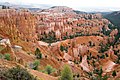 USA 10610 Bryce Canyon Luca Galuzzi 2007.jpg 2,000 × 1,333; 3.11 MB
-
 USA 10620 Bryce Canyon Luca Galuzzi 2007.jpg 2,000 × 1,333; 2.64 MB
-
 USGS 2006 1237 Fig7b.png 1,713 × 709; 138 KB
-
 View of Liberty Bell Arch (41c871ce-a6f6-4013-9deb-5574715afe41).jpg 4,075 × 5,000; 2.73 MB
-
 View of unknown origin or location - NARA - 516958.jpg 3,000 × 1,758; 1.52 MB
-
 View of unknown origin or location - NARA - 516958.tif 3,000 × 1,758; 5.03 MB
-
 View to Copalis Rock from Roosevelt Beach, WA 14.jpg 4,288 × 2,848; 4.26 MB
-

-
 Weepah Spring Wilderness.jpg 800 × 537; 156 KB
-

-
 Wills Creek Fm fold.jpg 464 × 586; 214 KB


.jpg)


.jpg)
.jpg)
_(14776109242).jpg)


.jpg)


_(14580843369).jpg)


.jpg)


.jpg)


.jpg)


,_Goosenecks_Point_along_Sulphur_Creek,_Capitol_Reef_National_Park,_southern_Utah_1_(8433710477).jpg)

_(harDA0131a).jpg)
