Category:Rogers Dam (Michigan)
| Object location | | View all coordinates using: OpenStreetMap |
|---|
dam in Michigan  | |||||
| Upload media | |||||
| Instance of | |||||
|---|---|---|---|---|---|
| Location | Mecosta County, Michigan | ||||
 | |||||
|
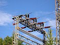
Images of, or related to, the Rogers Dam, a dam and powerplant complex on the Muskegon River in Mecosta Township, Mecosta County, Michigan, operated by Consumers Energy |
 |
Media in category "Rogers Dam (Michigan)"
The following 11 files are in this category, out of 11 total.
-
 Rogers Dam Muskegon River DSCN1178.JPG 1,600 × 1,200; 417 KB
-
 Rogers Dam Muskegon River DSCN1183.JPG 1,600 × 1,200; 439 KB
-
 Rogers Dam Muskegon River DSCN1188.JPG 1,600 × 1,200; 363 KB
-
 Rogers Dam Muskegon River DSCN1191.JPG 1,600 × 1,200; 389 KB
-
 Rogers Dam Muskegon River DSCN1195.JPG 1,600 × 1,200; 369 KB
-
 Rogers Dam Muskegon River DSCN1196.JPG 1,600 × 1,200; 392 KB
-
 Rogers Dam Muskegon River DSCN1203.JPG 1,600 × 1,200; 435 KB
-
 Rogers Dam Muskegon River DSCN1207.JPG 1,600 × 1,200; 345 KB
-
 Rogers Dam Muskegon River DSCN1208.JPG 1,600 × 1,200; 350 KB
-
 Rogers Dam Muskegon River DSCN1214.JPG 1,600 × 1,200; 381 KB
-
 Rogers Dam photo locator map.SVG 1,000 × 1,000; 50 KB


