Category:Rosedale, Victoria
town in Victoria, Australia   | |||||
| Upload media | |||||
| Instance of | |||||
|---|---|---|---|---|---|
| Location |
| ||||
| Population |
| ||||
 | |||||
English: Rosedale is a pastoral and agricultural town 184 kilometres east of Melbourne via the Princes Highway. Once a staging post on the Port Albert to Sale coach run, it was once the administrative centre of the Shire of Rosedale which extended to the east and included Ninety Mile Beach. It is now part of the Wellington Shire centred in Sale. At the 2006 census, Rosedale had a population of 1,077. (→Rosedale, Victoria)
Subcategories
This category has the following 2 subcategories, out of 2 total.
R
- Rosedale railway station (4 F)
S
Media in category "Rosedale, Victoria"
The following 22 files are in this category, out of 22 total.
-
 First day envelope.jpg 4,076 × 1,978; 2.26 MB
-
 Former Rosedale Shire meeting room - July 2021.jpg 4,032 × 3,024; 1.26 MB
-
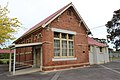
 Mechanics Institute Rosedale.jpg 5,184 × 3,456; 7.28 MB
-
 Original Rosedale Primary School.jpg 5,184 × 3,456; 6.69 MB
-
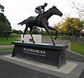 Patrobas (AUS).jpg 2,048 × 1,892; 2.41 MB
-
 Rosedale Bakery Statue-1 (8544680488).jpg 1,291 × 1,920; 431 KB
-
 Rosedale building for weddings-1 (8536269540).jpg 1,920 × 1,385; 425 KB
-
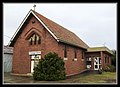
 Rosedale Community Centre - July 2021.jpg 4,032 × 3,024; 2.25 MB
-
 Rosedale Eagle-1 (8549346605).jpg 1,920 × 1,320; 437 KB
-
 Rosedale home-1 (8549350013).jpg 1,920 × 1,323; 351 KB
-
 Rosedale Hotel Aussie Pub-1 (8536273120).jpg 1,920 × 1,320; 407 KB
-
 ROSEDALE Railway Station, Victoria.jpg 2,592 × 1,944; 528 KB
-
 Rosedale railway station.jpg 2,560 × 1,440; 1.08 MB
-
 Rosedale Railway Station.jpg 4,171 × 2,057; 2.11 MB
-
 Rosedale RSL building - July 2021.jpg 3,024 × 4,032; 2.19 MB
-
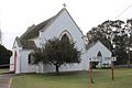
 Rosedale St Georges Church-1 (8549353841).jpg 1,920 × 1,392; 370 KB
-
 Rosedale Taven-1 (8536276496).jpg 1,920 × 1,300; 307 KB
-
 Shire Offices Rosedale.jpg 5,184 × 3,456; 7.66 MB
-
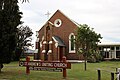 St Andrew's Church Rosedale.jpg 5,184 × 3,456; 7.02 MB
-
 St Rose of Lima Catholic Church Rosedale.jpg 5,184 × 3,456; 6.33 MB
-
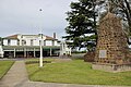 War Memorial and Angus McMillan Memorial.jpg 5,184 × 3,456; 7.15 MB
-
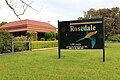 Welcome to Rosedale.jpg 5,184 × 3,456; 7 MB


.jpg)
.jpg)
.jpg)

.jpg)
.jpg)
.jpg)


.jpg)
.jpg)


