Category:Rudston
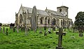
English: Rudston is a small village and civil parish in the East Riding of Yorkshire, England. It is situated approximately 6 miles (9.7 km) to the west of Bridlington and lies on the B1253 road.
village and civil parish in East Riding of Yorkshire, United Kingdom  | |||||
| Upload media | |||||
| Instance of | |||||
|---|---|---|---|---|---|
| Location | East Riding of Yorkshire, Yorkshire and the Humber, England | ||||
 | |||||
Subcategories
This category has the following 3 subcategories, out of 3 total.
R
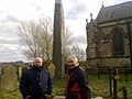
- Rudston Monolith (23 F)
- Rudston War Memorial (2 F)
Media in category "Rudston"
The following 200 files are in this category, out of 605 total.
(previous page) (next page)-
 12th C west tower, All Saints Church, Rudston - geograph.org.uk - 2862337.jpg 1,024 × 752; 345 KB
-

-
 A footpath heading to Rudston - geograph.org.uk - 2197011.jpg 800 × 600; 273 KB
-
 A minor towards Rudston - geograph.org.uk - 2196946.jpg 800 × 600; 189 KB
-
 A public right of way - geograph.org.uk - 2164785.jpg 800 × 600; 200 KB
-
 Across The Bridleway To North Wood - geograph.org.uk - 373254.jpg 640 × 480; 96 KB
-
 All Saints Church, Rudston - geograph.org.uk - 2862357.jpg 1,024 × 768; 220 KB
-
 All Saints Church, Rudston - geograph.org.uk - 3732591.jpg 640 × 480; 68 KB
-
 All Saints Church, Rudston - geograph.org.uk - 3732594.jpg 640 × 480; 67 KB
-
 All Saints Church, Rudston - geograph.org.uk - 5544796.jpg 640 × 379; 65 KB
-
 All Saints' church, Rudston - geograph.org.uk - 5639404.jpg 1,024 × 768; 159 KB
-
 Alongside the Gypsey Race - geograph.org.uk - 5765574.jpg 1,024 × 768; 221 KB
-

-
-
 Approaching Rudston - geograph.org.uk - 4875488.jpg 640 × 480; 67 KB
-
 Approaching The Belt - geograph.org.uk - 1408948.jpg 640 × 480; 77 KB
-
 Approaching Zigzag Plantation - geograph.org.uk - 1408962.jpg 640 × 480; 87 KB
-
 Argam Lane - geograph.org.uk - 4459391.jpg 640 × 428; 88 KB
-
 Autumn sown crop by the B1253 - geograph.org.uk - 5946045.jpg 1,024 × 768; 262 KB
-
 B1253 approaching crossroads - geograph.org.uk - 5171529.jpg 640 × 480; 83 KB
-
 B1253 East of Rudston - geograph.org.uk - 1233367.jpg 640 × 480; 65 KB
-
 B1253 heading west - geograph.org.uk - 4875485.jpg 640 × 480; 81 KB
-
 B1253 towards Octon - geograph.org.uk - 5171515.jpg 640 × 480; 50 KB
-
 B1253 towards Octon - geograph.org.uk - 5171524.jpg 640 × 480; 50 KB
-
 B1253 towards Rudston - geograph.org.uk - 4095011.jpg 640 × 480; 97 KB
-
 B1253 towards Rudston - geograph.org.uk - 4095031.jpg 640 × 480; 79 KB
-
 B1253 towards Rudston - geograph.org.uk - 4095038.jpg 640 × 480; 108 KB
-
 B1253 towards Rudston - geograph.org.uk - 4095044.jpg 640 × 480; 104 KB
-
 B1253 towards Rudston - geograph.org.uk - 4095098.jpg 640 × 480; 87 KB
-
 B1253 towards Rudston - geograph.org.uk - 4095149.jpg 640 × 480; 91 KB
-
 B1253 towards Rudston - geograph.org.uk - 4856825.jpg 640 × 480; 63 KB
-
 B1253 towards Rudston - geograph.org.uk - 4856835.jpg 640 × 480; 81 KB
-
 B1253 towards Rudston - geograph.org.uk - 4856849.jpg 640 × 429; 113 KB
-
 B1253 towards Rudston - geograph.org.uk - 4875481.jpg 640 × 480; 61 KB
-
 B1253 towards Sledmere - geograph.org.uk - 4850683.jpg 640 × 480; 63 KB
-
 B1253 towards Sledmere - geograph.org.uk - 4850689.jpg 640 × 480; 57 KB
-
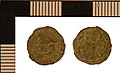
 Barbarous radiate from Rudston (FindID 482295).jpg 3,543 × 2,074; 684 KB
-
 Barbarous Radiate from Rudston (FindID 482618).jpg 2,835 × 1,636; 609 KB
-
 Barbarous radiate from Rudston (FindID 482658).jpg 3,543 × 1,524; 632 KB
-
 Bench mark, church tower, Rudston - geograph.org.uk - 2862313.jpg 1,024 × 758; 437 KB
-
 Big sky country - geograph.org.uk - 2406017.jpg 3,981 × 2,000; 1.29 MB
-
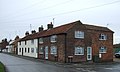
 Bosville Arms Rudston.jpg 640 × 480; 77 KB
-
 Bracelet fragment from Rudston (FindID 436850).jpg 1,772 × 1,634; 719 KB
-
 Breeze Farm, Rudston - geograph.org.uk - 3732561.jpg 1,001 × 541; 164 KB
-
 Brick Bridge over the Gypsy Race - geograph.org.uk - 4146397.jpg 3,920 × 2,204; 2.78 MB
-
 Bridleway - geograph.org.uk - 373231.jpg 640 × 480; 127 KB
-
 Bridleway Beside North Wood - geograph.org.uk - 1233275.jpg 640 × 480; 71 KB
-
 Bridleway East of Rudston - geograph.org.uk - 1233374.jpg 640 × 480; 77 KB
-
 Bridleway from High Caythorpe to Low Caythorpe - geograph.org.uk - 5765586.jpg 1,024 × 768; 233 KB
-
 Bridleway From The B1253 - geograph.org.uk - 373243.jpg 640 × 480; 87 KB
-
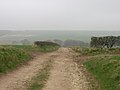
 Bridleway from the Roman Road - geograph.org.uk - 1408927.jpg 640 × 480; 110 KB
-
 Bridleway heading south - geograph.org.uk - 4095139.jpg 640 × 480; 85 KB
-
 Bridleway junction at Rudston - geograph.org.uk - 1408770.jpg 480 × 640; 122 KB
-
 Bridleway NE of Rudston - geograph.org.uk - 154878.jpg 640 × 480; 114 KB
-
 Bridleway Near Littlethorpe - geograph.org.uk - 1233302.jpg 640 × 480; 52 KB
-
 Bridleway North East of Rudston - geograph.org.uk - 1233456.jpg 640 × 480; 105 KB
-
 Bridleway to Rudston - geograph.org.uk - 143340.jpg 640 × 480; 71 KB
-
 Bridleway to Rudston - geograph.org.uk - 4456486.jpg 640 × 428; 83 KB
-
 Bridleway to Rudston - geograph.org.uk - 5765582.jpg 1,024 × 768; 162 KB
-
 Bridleway towards High Caythorpe - geograph.org.uk - 4095022.jpg 640 × 480; 67 KB
-
 Bridleway towards Kilham Lane - geograph.org.uk - 4361228.jpg 640 × 480; 92 KB
-
 Bridleway towards Littlethorpe - geograph.org.uk - 4095118.jpg 640 × 480; 61 KB
-
 Bridleway towards Littlethorpe - geograph.org.uk - 4095132.jpg 480 × 640; 117 KB
-
 Bridleway Towards North Wood - geograph.org.uk - 373247.jpg 640 × 480; 93 KB
-

-

-

-
 Burton Agnes Balk - geograph.org.uk - 1233501.jpg 640 × 480; 82 KB
-
 Burton Agnes Balk - geograph.org.uk - 5136446.jpg 640 × 480; 73 KB
-
 Burton Agnes Balk heading north - geograph.org.uk - 3732259.jpg 640 × 480; 47 KB
-
 Burton Agnes Balk heading north - geograph.org.uk - 3732262.jpg 640 × 447; 48 KB
-
 Burton Agnes Balk heading north - geograph.org.uk - 3732266.jpg 640 × 480; 45 KB
-
 Burton Agnes Balk heading north - geograph.org.uk - 3732291.jpg 640 × 480; 47 KB
-
 Burton Agnes Balk heading north - geograph.org.uk - 3732297.jpg 640 × 480; 49 KB
-
 Burton Agnes Balk heading north - geograph.org.uk - 3732324.jpg 640 × 480; 58 KB
-
 Burton Agnes Balk heading north - geograph.org.uk - 3732517.jpg 640 × 480; 50 KB
-
 Burton Agnes Balk heading north - geograph.org.uk - 3732533.jpg 640 × 480; 78 KB
-
 Burton Agnes Balk heading north - geograph.org.uk - 3732544.jpg 640 × 480; 70 KB
-

-
 Burton Agnes Balk meets Woldgate - geograph.org.uk - 2197031.jpg 800 × 600; 181 KB
-
 Burton Agnes Balk, Rudston - geograph.org.uk - 3732557.jpg 640 × 480; 54 KB
-
 Burton Fleming Road - geograph.org.uk - 4103265.jpg 640 × 480; 104 KB
-
 Burton Fleming Road - geograph.org.uk - 4103268.jpg 640 × 480; 70 KB
-
 Burton Fleming Road - geograph.org.uk - 4103290.jpg 640 × 480; 75 KB
-
 Burton Fleming Road - geograph.org.uk - 4103766.jpg 640 × 480; 61 KB
-
 Burton Fleming Road - geograph.org.uk - 4103788.jpg 640 × 480; 51 KB
-
 Burton Fleming Road - geograph.org.uk - 4103795.jpg 640 × 480; 72 KB
-
 Cattle grazing near Manor House Farm, Rudston - geograph.org.uk - 5765542.jpg 1,024 × 768; 161 KB
-
 Chalky farmland - geograph.org.uk - 4456488.jpg 640 × 428; 81 KB
-
 Chalky farmland south of Woldgate - geograph.org.uk - 3732040.jpg 640 × 480; 72 KB
-
 Chalky farmland south of Woldgate - geograph.org.uk - 3732093.jpg 640 × 480; 64 KB
-
 Chalky farmland south of Woldgate - geograph.org.uk - 3732104.jpg 640 × 480; 91 KB
-
 Chalky Field - geograph.org.uk - 1233461.jpg 640 × 480; 106 KB
-
 Chalky field off the B1253 - geograph.org.uk - 5171521.jpg 640 × 480; 81 KB
-
 Chalky ridges - geograph.org.uk - 4459401.jpg 640 × 428; 143 KB
-
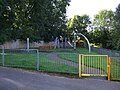 Children's playground, Rudston - geograph.org.uk - 5136443.jpg 640 × 480; 103 KB
-

-
 Church of All Saints, Rudston - geograph.org.uk - 5529631.jpg 640 × 480; 79 KB
-
 Church, Rudston - geograph.org.uk - 3745604.jpg 1,024 × 768; 199 KB
-
 Churchyard Wall, Rudston - geograph.org.uk - 506535.jpg 640 × 480; 101 KB
-
 Clearing the Gypsey Race, Rudston - geograph.org.uk - 5639409.jpg 1,024 × 768; 236 KB
-

-
 Commemorative Nummus Copy of Claudius II from Rudston (FindID 436814).jpg 2,362 × 1,444; 784 KB
-
 Communications Mast - geograph.org.uk - 143337.jpg 640 × 480; 74 KB
-
 Communications mast off Woldgate - geograph.org.uk - 3732092.jpg 480 × 640; 56 KB
-
 Communications mast off Woldgate - geograph.org.uk - 3732099.jpg 480 × 640; 51 KB
-
 Communications mast off Woldgate - geograph.org.uk - 3732201.jpg 480 × 640; 50 KB
-
 Copy Nummus of House of Constantine from Rudston (FindID 436833).jpg 2,362 × 1,313; 772 KB
-
 Copy Nummus of House of Constantine from Rudston (FindID 482629).jpg 2,835 × 1,725; 627 KB
-
 Copy Nummus of House of Constantine from Rudston (FindID 482642).jpg 2,835 × 1,336; 843 KB
-
 Copy Radiate of Victorinus from Rudston (FindID 436908).jpg 2,362 × 1,370; 638 KB
-
 Corner of North Wood - geograph.org.uk - 5212799.jpg 2,300 × 1,724; 2.17 MB
-
 Cottage Farm on Burton Road - geograph.org.uk - 2164834.jpg 800 × 600; 297 KB
-
 Cottages on Long Street, Rudston - geograph.org.uk - 3732573.jpg 640 × 384; 53 KB
-
 Country Road - geograph.org.uk - 143341.jpg 640 × 480; 73 KB
-
 Countryside around Rudston - geograph.org.uk - 1408763.jpg 480 × 640; 132 KB
-
 Countryside around Rudston village - geograph.org.uk - 1408819.jpg 640 × 480; 85 KB
-
 Cresting the Hill - geograph.org.uk - 1233268.jpg 640 × 480; 57 KB
-
 Crop field and hedgerow - geograph.org.uk - 3732086.jpg 640 × 480; 69 KB
-
 Crop field and hedgerow - geograph.org.uk - 4095178.jpg 640 × 480; 102 KB
-
 Crop field and hedgerow - geograph.org.uk - 4103291.jpg 640 × 480; 85 KB
-
 Crop field and woodland - geograph.org.uk - 4095141.jpg 640 × 480; 101 KB
-

-
 Crop field north of the B1253 - geograph.org.uk - 4850695.jpg 640 × 480; 96 KB
-
 Crop field north of Woldgate - geograph.org.uk - 3732197.jpg 640 × 480; 84 KB
-

-

-
 Crop field off the B1253 - geograph.org.uk - 4095113.jpg 640 × 480; 51 KB
-
 Crop field off the B1253 - geograph.org.uk - 4095181.jpg 640 × 480; 101 KB
-
 Crop field off the B1253 - geograph.org.uk - 4095185.jpg 640 × 480; 105 KB
-
 Crop field off Woldgate - geograph.org.uk - 3732063.jpg 640 × 480; 68 KB
-
 Crop field off Woldgate Roman Road - geograph.org.uk - 4371892.jpg 640 × 480; 118 KB
-
 Crop field south of Woldgate - geograph.org.uk - 3732065.jpg 640 × 480; 90 KB
-
 Crop field south of Woldgate - geograph.org.uk - 3732071.jpg 640 × 480; 97 KB
-
 Crop field south of Woldgate - geograph.org.uk - 3732074.jpg 640 × 480; 75 KB
-
 Crop field south of Woldgate - geograph.org.uk - 3732088.jpg 640 × 480; 61 KB
-
 Crop field south of Woldgate - geograph.org.uk - 3732186.jpg 640 × 480; 81 KB
-
 Crop field south of Woldgate - geograph.org.uk - 3732211.jpg 640 × 480; 41 KB
-
 Crop field towards The Sheepwalk - geograph.org.uk - 3732280.jpg 640 × 480; 65 KB
-
 Crop field west of Burton Agnes Balk - geograph.org.uk - 3732310.jpg 640 × 480; 74 KB
-
 Crop field west of Burton Agnes Balk - geograph.org.uk - 3732323.jpg 640 × 480; 76 KB
-
 Crop field west of Burton Agnes Balk - geograph.org.uk - 3732326.jpg 640 × 480; 56 KB
-
-

-

-
 Crop field, Breeze Farm - geograph.org.uk - 3732559.jpg 640 × 480; 93 KB
-
 Crop field, Burton Agnes Field - geograph.org.uk - 4361233.jpg 640 × 480; 101 KB
-
 Crop field, Glebe Farm - geograph.org.uk - 4103264.jpg 640 × 480; 83 KB
-
 Crop field, Low Caythorpe - geograph.org.uk - 4095018.jpg 640 × 480; 101 KB
-
 Crop field, Rudston - geograph.org.uk - 4875489.jpg 640 × 421; 67 KB
-
 Crossroads on the B1253 - geograph.org.uk - 4875496.jpg 640 × 480; 61 KB
-
 Cyclists heading for Bridlington - geograph.org.uk - 4456477.jpg 640 × 428; 101 KB
-
 Cyclists on Burton Fleming Road - geograph.org.uk - 4103784.jpg 640 × 480; 59 KB
-
 Cyclists on National cycle route 1 - geograph.org.uk - 4371886.jpg 640 × 412; 59 KB
-
 Denarius of Domitian from Rudston (FindID 482264).jpg 3,419 × 1,736; 637 KB
-
 Denarius of Julia Domna from Rudston (FindID 482655).jpg 3,543 × 1,638; 752 KB
-
 Denarius of Septimius Severus from Rudston (FindID 482637).jpg 2,835 × 1,324; 700 KB
-
 Denby House on Burton Road - geograph.org.uk - 2164820.jpg 800 × 600; 309 KB
-
 Disc-Attachment Mount from Rudston (FindID 436861).jpg 1,772 × 1,039; 597 KB
-
 Dotterill Park, aerial 2018 - geograph.org.uk - 5720651.jpg 640 × 427; 40 KB
-
 Dupondius or As from Rudston (FindID 436840).jpg 2,362 × 1,291; 680 KB
-
 Early Medieval Cruciform Brooch from Rudston (FindID 541645).jpg 3,543 × 3,721; 836 KB
-
 East Gate Bridge at Rudston.jpg 640 × 480; 104 KB
-
 East Gate, Rudston - geograph.org.uk - 3732576.jpg 640 × 480; 58 KB
-
 East Gate, Rudston - geograph.org.uk - 3732582.jpg 640 × 480; 62 KB
-
 East Lodge - geograph.org.uk - 4095041.jpg 640 × 480; 115 KB
-

-
 Entering Rudston - geograph.org.uk - 3732548.jpg 640 × 480; 54 KB
-
 Entering Rudston - geograph.org.uk - 4095192.jpg 640 × 480; 83 KB
-
 Entrance to Rudston Grange - geograph.org.uk - 1236538.jpg 640 × 480; 113 KB
-
 Entrance to Rudston House - geograph.org.uk - 1410016.jpg 640 × 480; 97 KB
-
 Entrance to Rudston House Farm - geograph.org.uk - 1410018.jpg 640 × 480; 97 KB
-
 Estate wall beside the B1253 - geograph.org.uk - 4095104.jpg 640 × 480; 51 KB
-
 Farm at Low Caythorpe - geograph.org.uk - 1233194.jpg 640 × 480; 88 KB
-

-
 Farm Building at Rudston - geograph.org.uk - 542767.jpg 640 × 480; 68 KB
-
 Farm building, High Street, Rudston - geograph.org.uk - 4850635.jpg 640 × 480; 89 KB
-
 Farm buildings, Rudston - geograph.org.uk - 3732589.jpg 640 × 480; 53 KB
-
 Farm track and crop field - geograph.org.uk - 4095048.jpg 640 × 480; 119 KB
-
 Farm track and hedgerow - geograph.org.uk - 4095187.jpg 640 × 480; 72 KB
-
 Farm track at High Caythorpe - geograph.org.uk - 5765622.jpg 1,024 × 768; 238 KB
-

-

-

-
 Farm Track near Rudston - geograph.org.uk - 1239751.jpg 640 × 480; 64 KB
-
 Farm track off Burton Agnes Balk - geograph.org.uk - 3732520.jpg 640 × 480; 76 KB
-
 Farm Track off Kilham Lane - geograph.org.uk - 1239771.jpg 640 × 480; 58 KB
-
 Farm track off Kilham Lane - geograph.org.uk - 5639416.jpg 1,024 × 768; 134 KB
-
-
 Farm track to Shoulder of Mutton Plantation - geograph.org.uk - 5765656.jpg 1,024 × 768; 317 KB
-
 Farm track west of Rudston - geograph.org.uk - 1038759.jpg 640 × 480; 80 KB
-
 Farm track, Low Caythorpe - geograph.org.uk - 4856832.jpg 640 × 480; 142 KB
-
 Farmland and hedgerow - geograph.org.uk - 3732059.jpg 640 × 480; 62 KB
-
 Farmland and hedgerow - geograph.org.uk - 3732301.jpg 640 × 480; 94 KB
-
 Farmland east of Burton Agnes Balk - geograph.org.uk - 3732257.jpg 640 × 480; 74 KB
-
 Farmland east of Burton Agnes Balk - geograph.org.uk - 3732260.jpg 640 × 480; 69 KB
-
 Farmland east of Burton Agnes Balk - geograph.org.uk - 3732268.jpg 640 × 480; 59 KB
-
 Farmland near Manor House Farm - geograph.org.uk - 3732515.jpg 640 × 480; 48 KB
-
 Farmland North of Rudston - geograph.org.uk - 195411.jpg 640 × 480; 135 KB
-
 Farmland North of the B1253 - geograph.org.uk - 1236520.jpg 640 × 480; 83 KB


_at_Rudston_-_geograph.org.uk_-_3508996.jpg)


.jpg)
.jpg)
.jpg)


.jpg)


.jpg)


.jpg)
.jpg)
.jpg)
.jpg)


.jpg)
.jpg)
.jpg)

.jpg)

.jpg)
.jpg)


