Category:Ruine Bännlifels
| Object location | | View all coordinates using: OpenStreetMap |
|---|
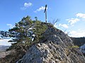
Deutsch: Ruine Bännlifels ist eine Ansammlung von Ruinen auf dem Bännlifels, einem Berg an der Grenze zwischen den beiden schweizerischen Kantonen Basel-Landschaft und Solothurn. Die Reste der Bauwerke werden als Burg gedeutet, jeweils auf der Seite von Grindel als auch auf der Seite von Wahlen
archaeological site and castle ruins in Wahlen in the canton of Basel-Landschaft, Switzerland  | |||||
| Upload media | |||||
| Instance of | |||||
|---|---|---|---|---|---|
| Part of | |||||
| Location | |||||
| Heritage designation | |||||
| Different from | |||||
 | |||||
Media in category "Ruine Bännlifels"
The following 2 files are in this category, out of 2 total.
-
 Bännlifels mit dem Gipfelkreuz.jpg 2,048 × 1,536; 1.24 MB
-
 Ruine Bännlifels - hintere Burg - Mauerreste.jpg 2,048 × 1,536; 1.66 MB
