Category:Ruins in South Lanarkshire
Council areas (municipalities) of Scotland: Aberdeenshire · Angus · Argyll and Bute · Dumfries and Galloway · East Ayrshire · East Dunbartonshire · East Lothian · East Renfrewshire · Edinburgh · Fife · Glasgow · Highland · Inverclyde · Midlothian · Moray · North Ayrshire · North Lanarkshire · Outer Hebrides · Orkney Islands · Perth and Kinross · Renfrewshire · Scottish Borders · Shetland Islands · South Ayrshire · South Lanarkshire · Stirling · West Dunbartonshire · West Lothian
Wikimedia category | |||||
| Upload media | |||||
| Instance of | |||||
|---|---|---|---|---|---|
| |||||
Subcategories
This category has the following 5 subcategories, out of 5 total.
Media in category "Ruins in South Lanarkshire"
The following 79 files are in this category, out of 79 total.
-
 An Oak tree from William Gordon's Earlston home, Glassford's Old Kirk, South Lanarkshire.jpg 3,436 × 3,461; 3.02 MB
-
 Auchenheath Post Office - geograph.org.uk - 606258.jpg 640 × 480; 78 KB
-
 Bidhouse ruin - geograph.org.uk - 726861.jpg 640 × 480; 142 KB
-
 Culvert for the Ryeland Burn, Darvel and Strathaven Railway. South Lanarkshire.jpg 4,896 × 2,752; 5.42 MB
-
 Gable end and belfy, Glassford's Old Kirk, South Lanarkshire.jpg 3,456 × 4,608; 5.1 MB
-
 Greenhall Viaduct abutment, Greenhall Park, Blantyre, South Lanarkshire.jpg 4,896 × 2,752; 3.25 MB
-
 Greenhall Viaduct pier, Greenhall Park, Blantyre, South Lanarkshire. Sport Climbing pier.jpg 4,896 × 2,752; 6.86 MB
-
 Greenhall Viaduct pier, Greenhall Park, Blantyre, South Lanarkshire. Sport Climbing site.jpg 4,896 × 2,752; 5.48 MB
-
 Greenhall Viaduct pier, Greenhall Park, Blantyre, South Lanarkshire. Sport Climbing.jpg 4,896 × 2,752; 5.37 MB
-
 Greenhall Viaduct pier, Greenhall Park, Blantyre, South Lanarkshire.jpg 3,369 × 2,619; 2.73 MB
-
 Greenhall Viaduct piers, Greenhall Park, Blantyre, South Lanarkshire.jpg 4,896 × 2,752; 6.89 MB
-
 Greenhall Viaduct, Greenhall Park, Blantyre, South Lanarkshire. Sport Climbing pier.jpg 4,896 × 2,752; 4.64 MB
-
 Hallside Newhouse farm (Derelict) (2) - geograph.org.uk - 4875741.jpg 1,024 × 683; 205 KB
-
 Hyndford Mill and Tinto Hill - geograph.org.uk - 355775.jpg 640 × 480; 37 KB
-
 Looking west from Coulter Motte - geograph.org.uk - 729175.jpg 640 × 480; 128 KB
-
 Milheugh House. Ruins of bridge over the Rotten Calder. Blantyre, South Lanarkshire.jpg 4,896 × 2,752; 2.96 MB
-
 Milheugh House. Ruins of greenhouse ranges. Blantyre, South Lanarkshire.jpg 4,896 × 2,752; 3.3 MB
-
 Milheugh House. Ruins of greenhouses. Blantyre, South Lanarkshire.jpg 4,896 × 2,752; 4.1 MB
-
 Mill floor site, Spectacle E'e Mill, Sandford, South Lanarkshire.jpg 4,896 × 2,752; 8.15 MB
-
 Miller's House site at Spectacle E'e Mill, Sandford, South Lanarkshire.jpg 4,896 × 2,752; 7.9 MB
-
 Old Calder Bridge, Calder Water, Caldermill, South Lanarkshire. View towards Strathaven.jpg 4,896 × 2,752; 3.09 MB
-
 Old Calder Bridge, Calder Water, Caldermill, South Lanarkshire.jpg 4,896 × 2,752; 3.8 MB
-
 Old Calder Mill millpond, South Lanarkshire.jpg 4,540 × 2,752; 3.29 MB
-
 Old Calder Mill weir site, Calder Water, South Lanarkshire.jpg 4,896 × 2,752; 6.01 MB
-
 Old gable end, shed and belfry ruins, Glassford's Old Kirk.South Lanarkshire.jpg 3,456 × 4,608; 4.44 MB
-
 Old mill pond, Calder Mill, South Lanarkshire.jpg 4,896 × 2,752; 5.67 MB
-
 Old Shed - geograph.org.uk - 120558.jpg 640 × 480; 136 KB
-
 Old Stonehouse Railway Viaduct piers, South Lanarkshire.jpg 3,536 × 2,542; 1.32 MB
-
 Old Stonehouse Railway Viaduct west pier, South Lanarkshire.jpg 4,896 × 2,752; 1.88 MB
-
 Old Strathaven line trackbed, Manse Road overbridge view. Stonehouse. South Lanarkshire.jpg 4,896 × 2,752; 3.01 MB
-
 Old Thinacre Muir railway embankment, Quarter, South Lanarkshire.jpg 4,143 × 2,211; 1.77 MB
-
 Old Thinacre Muir railway over bridge, Quarter, South Lanarkshire.jpg 4,896 × 2,752; 2.13 MB
-
 Ruin on Ryeflat Road - geograph.org.uk - 230088.jpg 640 × 480; 64 KB
-
 Ryeland Bridge and Ryeland Burn culvert. South Lanarkshire.jpg 4,530 × 2,562; 2.72 MB
-
 Smithwood ruin - geograph.org.uk - 719772.jpg 640 × 480; 172 KB
-
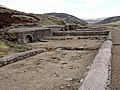
 Spectacle E'e mill on the Kype Water, Sandford, Lanarkshire. Ruins.jpg 4,896 × 2,752; 7.34 MB
-
 Spectacle E'e mill ruins on the Kype Water, Sandford, Lanarkshire.jpg 4,896 × 2,752; 8.48 MB
-
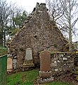
 St Ninian's Church gable end, Stonehouse, South Lanarkshire.jpg 3,923 × 2,705; 1.81 MB
-
 St Ninian's Church ruins and graveyard view, Stonehouse, South Lanarkshire.jpg 4,896 × 2,752; 2.18 MB
-
 St Ninian's Church ruins and the graveyard view, Stonehouse, South Lanarkshire.jpg 4,896 × 2,752; 2.48 MB
-
 St Ninian's Church west gable end, Stonehouse, South Lanarkshire.jpg 3,486 × 2,637; 1.61 MB
-
 St Ninian's Church's gable end, Stonehouse, South Lanarkshire.jpg 4,896 × 2,752; 2.79 MB
-
 St Ninian's Kirk and graveyard, Stonehouse, South Lanarkshire.jpg 4,896 × 2,752; 2.72 MB
-
-
 Stonehouse Railway Viaduct. central piers. South Lanarkshire.jpg 4,875 × 2,202; 2.2 MB
-
 Stonehouse Railway Viaduct. East abutment. South Lanarkshire.jpg 4,896 × 2,752; 2.18 MB
-
 Stonehouse station site approach, Stonehouse, South Lanarkshire.jpg 4,896 × 2,752; 5.92 MB
-
 Stonehouse Viaduct Pier, Avondale, South Lanarkshire.jpg 4,428 × 2,489; 2.2 MB
-
 Stonehouse Viaduct Piers, Avondale, South Lanarkshire. View East.jpg 4,009 × 2,597; 1.7 MB
-
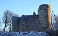 Strathaven Castle. View from the north-west. Lanarkshire.jpg 4,042 × 2,503; 2.28 MB
-
 Strathaven Castle. View from the north. South Lanarkshire.jpg 3,402 × 2,269; 1.71 MB
-
 Sundial at Glassford's Old Kirk, South Lanarkshire.jpg 3,321 × 3,378; 2.54 MB
-
 The Bower of Wandel - geograph.org.uk - 1805077.jpg 640 × 427; 157 KB
-
 The Gable end and belfy, Glassford's Old Kirk, South Lanarkshire.jpg 3,434 × 4,134; 3.43 MB
-
 The Gable end, belfy and shed ruins, Glassford's Old Kirk, South Lanarkshire.jpg 3,435 × 3,700; 4.29 MB
-
 The old Calder Brig, Calder Water, Caldermill, South Lanarkshire. View upstream.jpg 4,470 × 2,281; 2.69 MB
-
 The old hearse hoose ruins, Gateside Road, Crawfordjohn, South Lanarkshire.jpg 1,920 × 1,080; 1.03 MB
-
 The Spectacle E'e mill ruins on the Kype Water, Sandford, Lanarkshire.jpg 4,896 × 2,752; 8.28 MB
-
 Thinacre Muir railway over bridge, Quarter, South Lanarkshire.jpg 4,896 × 2,752; 2.58 MB
-
-
 View towards old Ryeland Station, Darvel and Strathaven Railway. South Lanarkshire.jpg 3,921 × 2,049; 2.26 MB
-
 Waterwheel pit site, Spectacle E'e Mill, Sandford, South Lanarkshire.jpg 4,896 × 2,752; 8.1 MB
-
 Birnock Ruin - geograph.org.uk - 409863.jpg 640 × 480; 186 KB
-
 Blackhill Ruin - geograph.org.uk - 1465439.jpg 640 × 480; 122 KB
-
 Burngrange - geograph.org.uk - 120551.jpg 640 × 480; 83 KB
-
 Des res rural retreat - geograph.org.uk - 190396.jpg 640 × 480; 118 KB
-
 Greenburn ruin - geograph.org.uk - 190811.jpg 640 × 480; 103 KB
-
 New Mains ruins - geograph.org.uk - 581143.jpg 640 × 480; 178 KB
-
 North Bottom ruin - geograph.org.uk - 619454.jpg 640 × 480; 174 KB
-
 Old shed, detail - geograph.org.uk - 120565.jpg 480 × 640; 127 KB
-
 Remains of a building - geograph.org.uk - 120589.jpg 640 × 480; 106 KB
-
 Ruin Beside Southern Upland Way - geograph.org.uk - 158398.jpg 640 × 480; 185 KB
-
 Ruin Near Muttonhole Road - geograph.org.uk - 99521.jpg 640 × 480; 149 KB
-
 Ruin Near Rutherend Toll - geograph.org.uk - 95024.jpg 640 × 480; 132 KB
-
 Ruin, by Lowthers - geograph.org.uk - 590359.jpg 640 × 480; 113 KB
-
 Ruined Cottage at Snarhead - geograph.org.uk - 12807.jpg 540 × 360; 58 KB
-
 Ruined cottage near Elsrickle - geograph.org.uk - 168881.jpg 640 × 480; 60 KB
-
 Shieldholm - geograph.org.uk - 191856.jpg 640 × 480; 86 KB
-
 Smelting Mill Remains - geograph.org.uk - 158406.jpg 640 × 480; 200 KB


_(2)_-_geograph.org.uk_-_4875741.jpg)


