Category:Ruländer Hof (Trier)
| Object location | | View all coordinates using: OpenStreetMap |
|---|
Building in Trier  | |||||
| Upload media | |||||
| Instance of | |||||
|---|---|---|---|---|---|
| Location | Trier, Rhineland-Palatinate, Germany | ||||
| Heritage designation | |||||
 | |||||
Media in category "Ruländer Hof (Trier)"
The following 9 files are in this category, out of 9 total.
-
 Trier Kalenfelsstraße Spolia Ruländer Hof (2).jpg 3,470 × 3,514; 3.81 MB
-
 Trier Kalenfelsstraße Spolia Ruländer Hof.jpg 5,037 × 3,791; 4.77 MB
-
 Trier Ruländer Hof Ansicht NO.jpg 5,939 × 3,007; 3.48 MB
-
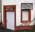
 Trier Ruländer Hof Gartenpavillon.jpg 4,967 × 3,434; 2.52 MB
-
 Trier Ruländer Hof Hieronymus Jaegen.jpg 1,901 × 2,721; 845 KB
-
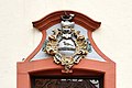 Trier Ruländer Hof Wappen (1).jpg 3,993 × 2,647; 2.16 MB
-
 Trier Ruländer Hof Wappen (2).jpg 2,259 × 2,413; 1.07 MB
-
 Trier Ruländer Hof zwei Wappen.jpg 3,447 × 3,088; 1.86 MB
-
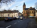 Trier, Blick von der Windmühlenstraße zur St.-Paulus-Kirche 20121206.jpg 3,264 × 2,448; 3.38 MB
.jpg)


.jpg)
.jpg)

