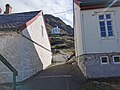
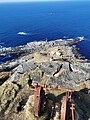
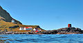
Category:Runde fyr
| Object location | | View all coordinates using: OpenStreetMap |
|---|
English: Runde Lighthouse
lighthouse in Norway  | |||||
| Upload media | |||||
| Instance of |
| ||||
|---|---|---|---|---|---|
| Location | Herøy Municipality, Møre og Romsdal, Norway | ||||
| Heritage designation |
| ||||
| Service entry |
| ||||
| Inception |
| ||||
| Significant event |
| ||||
| Height |
| ||||
 | |||||
Media in category "Runde fyr"
The following 17 files are in this category, out of 17 total.
-
 2012-06-09 Runde fyr01.jpg 5,184 × 3,456; 6.97 MB
-
 2012-06-09 Runde fyr02.jpg 5,184 × 3,456; 5.11 MB
-
 2012-06-09 Runde fyr03.jpg 3,881 × 2,421; 3.81 MB
-
 Fyrstasjonen på Runde.jpg 2,592 × 3,888; 3.25 MB
-
 Runde Fyr - Herøy, Norway 2022-07-07.jpg 5,827 × 3,278; 16.81 MB
-
 Runde Fyr - Herøy, Norway I 2023-04-16.jpg 5,184 × 3,456; 8.06 MB
-
 Runde Fyr - Herøy, Norway II 2023-04-16.jpg 5,184 × 3,456; 5.23 MB
-
 Runde Fyr - Herøy, Norway III 2023-04-16.jpg 5,184 × 3,456; 7.44 MB
-
 Runde Fyr - Herøy, Norway IV 2023-04-16.jpg 3,648 × 2,736; 5.25 MB
-
 Runde Fyr - Herøy, Norway V 2023-04-16.jpg 3,648 × 2,736; 3.25 MB
-
 Runde Fyr - Herøy, Norway VI 2023-04-16.jpg 3,648 × 2,736; 4.73 MB
-
 Runde Fyr, old cable winch - Herøy, Norway 2023-04-21.jpg 2,736 × 3,648; 5.92 MB
-
 Runde Fyr, old remains - Herøy, Norway, 2023-04-16.jpg 3,648 × 2,736; 4.95 MB
-
 Runde fyr.jpg 700 × 369; 66 KB
-
 Runde, Herøy - S-1602U2 055.jpg 4,000 × 3,067; 5.13 MB
-
 Runde, Herøy - S-1602U2 056.jpg 4,000 × 3,023; 3.81 MB
-
 Rundø gamle fyr, Rundø, Goksør, Romsdals amt - fo30141511190025.jpg 9,837 × 7,168; 33.69 MB


