Category:SVG labeled maps of administrative divisions of Kazakhstan (location map scheme)


.svg)


_(Paris_zoom).svg)
.svg)
,_administrative_divisions_-_de_-_colored_(multizoom).svg)
_-_colored.svg)
.svg)
,_administrative_divisions_-_Nmbrs_(multizoom).svg)
,_administrative_divisions_-_de_-_colored.svg)
_-_de_-_colored.svg)

.svg)

.svg)
Media in category "SVG labeled maps of administrative divisions of Kazakhstan (location map scheme)"
The following 29 files are in this category, out of 29 total.
-
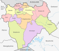
 Akmola, administrative divisions - de - colored.svg 896 × 572; 279 KB
-
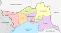
 Aktobe, administrative divisions - de - colored.svg 889 × 770; 217 KB
-
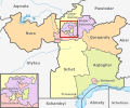
 Almaty, administrative divisions - de - colored.svg 892 × 789; 336 KB
-
 Atyrau, administrative divisions - de - colored.svg 996 × 541; 155 KB
-
 División política y límites de la Prov. de Kazajistán Occidental.svg 2,293 × 1,067; 8.7 MB
-
 División política y límites de Reg. Aktobé.svg 3,021 × 1,797; 12.72 MB
-
 División política y límites de Reg. Atirau.svg 2,541 × 968; 10.7 MB
-
 División política y límites de Reg. Karagandá.svg 3,072 × 1,605; 10.02 MB
-
 División política y límites de Reg. Kyzylorda.svg 2,728 × 1,581; 5.97 MB
-
 División política y límites de Reg. Mangystau.svg 1,957 × 1,531; 1.21 MB
-
 División política y límites de Reg. Turkestán.svg 1,451 × 1,579; 35.4 MB
-
 División política y límites de Reg. Ulytau.svg 2,672 × 1,179; 2.18 MB
-
 East Kazakhstan, administrative divisions - de - colored.svg 892 × 768; 263 KB
-
 Jambyl, administrative divisions - de - colored.svg 897 × 748; 138 KB
-
 Karaganda, administrative divisions - de - colored.svg 892 × 522; 331 KB
-
 Kazakhstan, administrative divisions - de - colored.svg 1,984 × 1,134; 959 KB
-
 Kazakhstan, administrative divisions - de.svg 1,984 × 1,134; 912 KB
-
 Kazakhstan, administrative divisions - et - colored.svg 1,984 × 1,134; 1.08 MB
-
 Kazakhstan, administrative divisions - he - colored.svg 1,984 × 1,134; 918 KB
-
 Kazakhstan, administrative divisions - Nmbrs - colored.svg 2,646 × 1,512; 902 KB
-
 Kazakhstan, administrative divisions - Nmbrs.svg 512 × 293; 629 KB
-
 Kazakhstan, administrative divisions - pl - colored.svg 512 × 293; 555 KB
-
 Kazakhstan, administrative divisions - th - colored.svg 1,984 × 1,134; 1.49 MB
-
 Kostanay, administrative divisions - de - colored.svg 895 × 1,074; 264 KB
-
 Kyzylorda, administrative divisions - de - colored.svg 892 × 772; 212 KB
-
 Mangystau, administrative divisions - de - colored.svg 881 × 1,013; 165 KB
-
 North Kazakhstan, administrative divisions - de - colored.svg 887 × 565; 178 KB
-
 Pavlodar, administrative divisions - de - colored.svg 881 × 979; 175 KB
-
 West Kazakhstan, administrative divisions - de - colored.svg 892 × 643; 144 KB


