Category:SVG labeled maps of former administrative divisions of the Democratic Republic of the Congo (location map scheme)
Media in category "SVG labeled maps of former administrative divisions of the Democratic Republic of the Congo (location map scheme)"
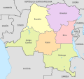
The following 3 files are in this category, out of 3 total.
-
 Congo DemRep, administrative divisions - es - colored (1960).svg 1,150 × 1,095; 426 KB
-
 Congo DemRep, administrative divisions - es - colored (1988).svg 1,150 × 1,095; 481 KB
-
 Congo DemRep, administrative divisions - es - colored (2015).svg 1,150 × 1,095; 907 KB
.svg)
.svg)
.svg)