Category:SVG locator maps of regions in the Philippines (location map scheme)

|
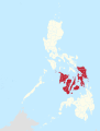
SVG maps in this category are part of a locator map series applying the (de) widespread location map scheme. Please see root category to browse for more. |
.svg)
.svg)
.svg)
.svg)
.svg)
.svg)
.svg)
Locator maps design recommendations ▼ | |
|---|---|
Principles
Design Guidelines are based on ▸location map design of the German map shop (in German). It's preferable to derive new locator maps from existing location maps. Please keep both size and ratio in this case. Thus the new locator maps may still be applied as location map (▸Guide). Marker color is supposed to be darkred. Waterbodies may be transparent, to show other objects better. Please be aware that this guide is only a recommendation. It’s not an inevitable law!
Highlight small areas
“Remote” areas and mini maps
Mini maps show where the depicted area actually is situated. Check out ▸Vorlage:Positionskarte+ (in German) and ▸Modèle:Carte en coin (in French) of how to insert a mini map in virtually every map.
Disputed areas
Greyed special objects
Backgrounds
|

-en.svg)

.svg)
.svg)
.svg)

_(US48).svg)
_(small_islands_magnified)_(-mini_map_-rivers).svg)
.svg)
_(extra_close)_(US48).svg)
.svg)
_(zoom).svg)

.svg)


_(UNMIK).svg)
.svg)
_(disputed_hatched).svg)
_(claimed_and_disputed_hatched).svg)
.svg)
.svg)
_(%2Ball_claims_hatched).svg)

.svg)
_(shade).svg)
_(shade)_(special_marker).svg)
_(-mini_map).svg)
_(-mini_map).svg)
_(-mini_map).svg)


.svg)

.svg)
Media in category "SVG locator maps of regions in the Philippines (location map scheme)"
The following 24 files are in this category, out of 24 total.
-
 Autonomous Region in Muslim Mindanao in Philippines (special marker).svg 1,871 × 2,468; 2.74 MB
-
 Autonomous Region in Muslim Mindanao in Philippines.svg 1,871 × 2,468; 2.74 MB
-
 Bangsamoro Autonomous Region in Muslim Mindanao in Philippines.svg 1,871 × 2,468; 1.41 MB
-
 Bicol Region in Philippines.svg 1,871 × 2,468; 1.38 MB
-
 Cagayan Valley in Philippines.svg 1,871 × 2,468; 1.38 MB
-
 CALABARZON in Philippines.svg 1,871 × 2,468; 1.38 MB
-
 Caraga Region in Philippines.svg 1,871 × 2,468; 1.38 MB
-
 Central Luzon in Philippines.svg 1,871 × 2,468; 1.38 MB
-
 Central Visayas in Philippines.svg 1,871 × 2,468; 1.38 MB
-
 Cordillera Administrative Region in Philippines.svg 1,871 × 2,468; 1.38 MB
-
 Davao Region in Philippines.svg 1,871 × 2,468; 1.38 MB
-
 Eastern Visayas in Philippines.svg 1,871 × 2,468; 1.38 MB
-
 Ilocos Region in Philippines.svg 1,871 × 2,468; 1.38 MB
-
 Luzon in Philippines.svg 1,871 × 2,468; 1.38 MB
-
 MIMAROPA in Philippines (special marker).svg 1,871 × 2,468; 2.82 MB
-
 MIMAROPA in Philippines.svg 1,871 × 2,468; 1.38 MB
-
 Mindanao in Philippines.svg 1,871 × 2,468; 1.38 MB
-
 National Capital Region in Philippines (special marker).svg 1,871 × 2,468; 1.38 MB
-
 National Capital Region in Philippines.svg 1,871 × 2,468; 1.38 MB
-
 Northern Mindanao in Philippines.svg 1,871 × 2,468; 1.38 MB
-
 SOCCSKSARGEN in Philippines.svg 1,871 × 2,468; 1.38 MB
-
 Visayas in Philippines.svg 1,871 × 2,468; 1.38 MB
-
 Western Visayas in Philippines.svg 1,871 × 2,468; 1.38 MB
-
 Zamboanga Peninsula in Philippines.svg 1,871 × 2,468; 1.38 MB
.svg)


.svg)


.svg)


