Category:SVG maps of borders of Colombia
Media in category "SVG maps of borders of Colombia"
The following 27 files are in this category, out of 27 total.
-
 Mapa de Colombia (fronteras y tratados).svg 2,237 × 2,847; 3.46 MB
-
 Caribbean maritime boundaries map zh.svg 3,561 × 2,221; 2.87 MB
-
 Caribbean maritime boundaries map.svg 3,561 × 2,221; 2.78 MB
-
 Caribbean maritime boundaries map mk.svg 3,561 × 2,221; 5.52 MB
-
 Mapa das Caraíbas (fronteiras marítimas).svg 3,561 × 2,221; 2.86 MB
-
 Mapa del Caribe (límites marinos).svg 5,340 × 3,660; 3.02 MB
-
 Mapa del Mar Caribe (límites marinos)-fr.svg 3,587 × 2,221; 1.91 MB
-
 Mapa del Mar Caribe (límites marinos).svg 3,587 × 2,221; 1.98 MB
-
 Colombia adm location map (colored).svg 2,027 × 2,294; 734 KB
-
 Colombia location map.svg 512 × 579; 1.07 MB
-
 Colombia location map2.svg 2,027 × 2,294; 735 KB
-
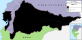
 Colombia Political Locator.svg 1,002 × 1,137; 506 KB
-
 Diferendo Golfo de Venezuela.svg 1,030 × 919; 34 KB
-

-

-
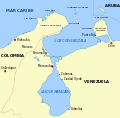 Lake Maracaibo map-es.svg 1,100 × 1,085; 46 KB
-
 Map of the disputed territory by Gran Colombia-Peru.svg 1,728 × 830; 558 KB
-
 Mapa A Fallo Litigio Nicaragua-Colombia.svg 1,057 × 996; 273 KB
-
 Mapa B Fallo Litigio Nicaragua-Colombia.svg 1,057 × 996; 297 KB
-
 Mapa de Colombia (fronteras y tratados)-fr.svg 2,273 × 2,863; 4 MB
-
 Mapa de Colombia (relieve-ríos).svg 1,024 × 1,138; 825 KB
-
 Mapa de la frontera Brasil-Colombia.svg 464 × 777; 257 KB
-
 Mapa de la frontera Colombia-Ecuador.svg 1,009 × 424; 434 KB
-
 Mapa de la frontera Colombia-Panamá.svg 1,503 × 938; 600 KB
-
 Mapa de la frontera Colombia-Perú.svg 719 × 550; 280 KB
-
 Mapa de la frontera Colombia-Venezuela.svg 828 × 1,360; 553 KB
-
 Mapa del Mar de Balboa (límites marinos).svg 2,177 × 2,006; 530 KB
.svg)


.svg)
.svg)
-fr.svg)
.svg)
.svg)


_Course_of_the_maritime_boundary_(es).svg)
_Course_of_the_maritime_boundary.svg)


-fr.svg)
.svg)


.svg)