Category:SVG maps of fictional places or locations
English: SVG maps that are of fictional places or locations. Maps with the {{Fictitious map|1=SVG}} on their image description pages are automatically included in this category. For non-SVG-maps use {{Fictitious map}}.
Media in category "SVG maps of fictional places or locations"
The following 30 files are in this category, out of 30 total.
-
 1984 fictious world map v2.svg 2,212 × 1,123; 1.28 MB
-
 Dragon World.svg 800 × 600; 62 KB
-
 Farneti Arabian Federation Attacco Occidente.svg 350 × 300; 106 KB
-
 Farneti USA Nuovo Impero Occidente.svg 500 × 542; 45 KB
-
 Gor-map-simplified de.svg 580 × 600; 125 KB
-
 Gor-map-simplified fr.svg 580 × 600; 118 KB
-
 Gor-map-simplified.svg 580 × 600; 62 KB
-
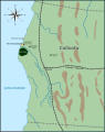 Localisation de Donaldville.svg 612 × 771; 70 KB
-
 Map of Duckburg.svg 612 × 771; 47 KB
-
 Map of the Twelve Colonies.svg 600 × 977; 349 KB
-
 Mappa Repubblica lombarda (proposta 1797).svg 1,666 × 1,150; 74 KB
-
 Maps-sodor-railways-amoswolfe.svg 803 × 591; 626 KB
-
 Mega-city One according to The Apocalypse War.svg 564 × 482; 102 KB
-
 Metro Loco.svg 1,052 × 1,488; 1.45 MB
-
 Naruto World Map.svg 1,500 × 882; 213 KB
-
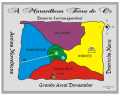 Oz Mapa.svg 755 × 602; 363 KB
-
 Oz-and-surrounding-countries-HE.svg 7,087 × 4,961; 163 KB
-
 RTS map.svg 1,145 × 645; 13 KB
-
 Simplified-Narnia-map.svg 540 × 600; 96 KB
-
 Star Trek map.svg 1,417 × 1,243; 272 KB
-
 Stati Liberi d'Italia (proposta 1797).svg 3,635 × 4,292; 613 KB
-
 Stationsquaremapsa.svg 640 × 480; 20 KB
-
 The Forest map.svg 619 × 543; 1.13 MB
-
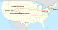 The Last of Us crossing USA es.svg 512 × 267; 316 KB
-
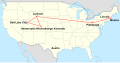
 The Last of Us crossing USA fr.svg 1,859 × 968; 762 KB
-
 The Last of Us crossing USA pl.svg 1,859 × 968; 733 KB
-
 The Last of Us crossing USA zh-hans.svg 1,859 × 968; 695 KB
-
 Wisteria Lane map, season 1.svg 1,056 × 622; 32 KB
-
 WisteriaLane.svg 561 × 321; 74 KB
-
 Worldmap of Valvrave.svg 940 × 477; 1.57 MB


.svg)


.svg)


