Category:SVG maps of the Society Islands
Media in category "SVG maps of the Society Islands"
The following 19 files are in this category, out of 19 total.
-
 Bora Bora Kingdom.svg 711 × 250; 68 KB
-
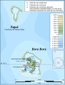 BoraBora topographic map-fr.svg 714 × 923; 531 KB
-
 BoraBora topographic map-mk.svg 714 × 923; 536 KB
-
 Huahine Kingdom.svg 711 × 250; 68 KB
-
 Huahine topographic map - with communes associées.svg 714 × 830; 332 KB
-
 Huahine topographic map-fr.svg 714 × 830; 536 KB
-
 Huahine topographic map-mk.svg 714 × 830; 538 KB
-
 Leeward Islands (Society Islands) topographic map-de.svg 2,000 × 1,000; 1.57 MB
-
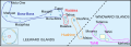
 Leeward Islands (Society Islands) topographic map-fr.svg 2,000 × 1,000; 1.6 MB
-
 Leeward Islands (Society Islands) topographic map-mk.svg 2,000 × 1,000; 1.6 MB
-
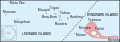
 Maupiti topographic map-fr.svg 469 × 611; 1.68 MB
-
 Maupiti topographic map-mk.svg 469 × 611; 1.68 MB
-
 Raiatea Kingdom.svg 711 × 250; 67 KB
-
 Society kingdoms.svg 711 × 250; 75 KB
-
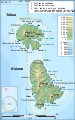
 Tahaa and Raiatea topographic map - with communes et communes associées.svg 714 × 1,143; 333 KB
-
 Tahaa and Raiatea topographic map-de.svg 714 × 1,143; 496 KB
-
 Tahaa and Raiatea topographic map-fr.svg 714 × 1,143; 533 KB
-
 Tahaa and Raiatea topographic map-mk.svg 714 × 1,143; 536 KB
-
 Tahiti Kingdom.svg 711 × 250; 68 KB


_topographic_map-de.svg)
_topographic_map-fr.svg)
_topographic_map-mk.svg)


