Category:SVG political maps of Asia
Temperate regions: North America · South America · Africa · Europe · Asia · – Polar regions: – Other regions: Afro-Eurasia ·
| NO WIKIDATA ID FOUND! Search for SVG political maps of Asia on Wikidata | |
| Upload media |

Countries of Asia: Afghanistan · Armenia‡ · Azerbaijan‡ · Bahrain · Bangladesh · Bhutan · Brunei · Cambodia · the China ≈ China · Cyprus‡ · East Timor · Egypt‡ · Georgia‡ · India · Indonesia‡ · Iran · Iraq · Israel · Japan · Jordan · Kazakhstan‡ · Kuwait · Kyrgyzstan · Laos · Lebanon · Malaysia · the Maldives ≈ Maldives · Mongolia · Myanmar · Nepal · North Korea · Oman · Pakistan · the Philippines ≈ Philippines · Qatar · Russia‡ · Saudi Arabia · Singapore · South Korea · Sri Lanka · Syria · Tajikistan · Thailand · Turkey‡ · Turkmenistan · the United Arab Emirates ≈ United Arab Emirates · Uzbekistan · Vietnam · Yemen
Limited recognition: Abkhazia‡ · the Taiwan ≈ Taiwan · Northern Cyprus‡ · the State of Palestine ≈ State of Palestine · South Ossetia‡ – Other territories: Akrotiri and Dhekelia‡ · the British Indian Ocean Territory ≈ British Indian Ocean Territory · Hong Kong · Macau
‡: partly located in Asia
Limited recognition: Abkhazia‡ · the Taiwan ≈ Taiwan · Northern Cyprus‡ · the State of Palestine ≈ State of Palestine · South Ossetia‡ – Other territories: Akrotiri and Dhekelia‡ · the British Indian Ocean Territory ≈ British Indian Ocean Territory · Hong Kong · Macau
‡: partly located in Asia
Subcategories
This category has the following 3 subcategories, out of 3 total.
*
I
M
Media in category "SVG political maps of Asia"
The following 19 files are in this category, out of 19 total.
-
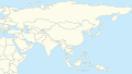 Asia location map.svg 360 × 204; 268 KB
-
 Asia location map2.svg 290 × 204; 263 KB
-
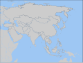 Asia whole.svg 1,100 × 837; 581 KB
-
 Asia98.svg 8,000 × 4,390; 2.65 MB
-
 Asie-color.svg 1,100 × 837; 963 KB
-
 Asie.svg 1,100 × 837; 567 KB
-
 Blank rivers lakes boundries asia.svg 970 × 981; 708 KB
-
 Caucasus regions map blank.svg 2,006 × 1,618; 229 KB
-
 Central Asia - political map 2008 -hi.svg 996 × 790; 167 KB
-
 Central Asia with national borders.svg 984 × 746; 203 KB
-
 Central Kurdish Blank map.svg 1,000 × 750; 247 KB
-
 Iwate-ken géolocalisation.svg 1,720 × 2,852; 3.71 MB
-
 Les pays asiatiques - Blank.svg 748 × 481; 481 KB
-
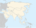
 Location Map Asia.svg 1,100 × 837; 899 KB
-
 Map of ASEAN member states.svg 534 × 427; 590 KB
-
 Map of Korea-blank.svg 1,655 × 2,892; 1.04 MB
-
 Primary Administrative Subdivisions of the Korean Peninsula.svg 1,655 × 2,892; 575 KB
-
 Treaty of Shimonoseki Territory Changes Map-zh.svg 794 × 1,123; 33 KB
-
 Treaty of Shimonoseki Territory Changes Map.svg 744 × 1,052; 33 KB


