Category:Saint-Plantaire
| Object location | | View all coordinates using: OpenStreetMap |
|---|
commune in Indre, France .JPG)  | |||||
| Upload media | |||||
| Instance of | |||||
|---|---|---|---|---|---|
| Location | |||||
| Located in or next to body of water | |||||
| Population |
| ||||
| Area |
| ||||
| official website | |||||
 | |||||
English: Saint-Plantaire is a french city, located in the Indre department, in the region Centre-Val de Loire.
Français : Saint-Plantaire est une commune française, située dans le département de l'Indre, en région Centre-Val de Loire.
Subcategories
This category has the following 8 subcategories, out of 8 total.
Media in category "Saint-Plantaire"
The following 11 files are in this category, out of 11 total.
-
 36207-Saint-Plantaire-Sols.png 3,270 × 2,598; 3.57 MB
-
 Campingplatz de Fourgeres in F 36190 St Plantaire - panoramio - Karl-Heinz Böhm (1).jpg 3,072 × 2,304; 3.57 MB
-
 Campingplatz de Fourgeres in F 36190 St Plantaire - panoramio.jpg 3,072 × 2,304; 3.38 MB
-
 Map commune FR insee code 36207.png 756 × 605; 76 KB
-
 Population - Municipality code 36207.svg 475 × 355; 13 KB
-
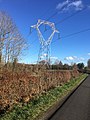 Pylône HTB 400 000 V - Poste RTE Éguzon - Poste RTE Marmagne.jpg 3,024 × 4,032; 5.01 MB
-
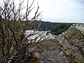
 Ruisseau du lac de Chambon 1.jpg 3,024 × 4,032; 3.22 MB
-
 Ruisseau du lac de Chambon.jpg 4,032 × 3,024; 3.09 MB
-
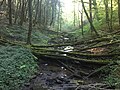 Ruisseau du Moulin Ratet - 1.jpg 4,032 × 3,024; 2.94 MB
-
 Ruisseau du Moulin Ratet.jpg 4,032 × 3,024; 3.37 MB
-
 Saint-Plantaire - Pierre-là - Mieusement.jpg 696 × 512; 81 KB

.jpg)


