Category:Satellite pictures of Baden-Württemberg
| Category Satellite pictures of Baden-Württemberg on sister projects: | |||||||||
|---|---|---|---|---|---|---|---|---|---|
Federal states of Germany:
Satellite pictures of Baden-Württemberg.
Subcategories
This category has the following 2 subcategories, out of 2 total.
B
S
Media in category "Satellite pictures of Baden-Württemberg"
The following 15 files are in this category, out of 15 total.
-
 Alb-Pfinz-Plateau Satellitenfoto.jpg 657 × 700; 148 KB
-
 Altrheinärme.jpg 392 × 457; 115 KB
-
 Austria Bavaria 2000-08-14 PIA03417.jpg 1,292 × 1,044; 2.05 MB
-
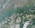 Austria Bavaria 2000-08-14 PIA03417.tif 1,292 × 1,044; 4.25 MB
-
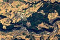 Herbst in Hohenlohe - 2.jpg 5,568 × 3,712; 4.66 MB
-
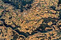 Herbst in Hohenlohe - 3.jpg 5,568 × 3,712; 4.46 MB
-
 Herbst in Hohenlohe.jpg 5,568 × 3,712; 3.46 MB
-
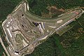
 Hockenheimring, April 29, 2018 SkySat (crop).jpg 2,592 × 1,600; 1.42 MB
-
 Hockenheimring, April 29, 2018 SkySat (cropped).jpg 2,160 × 1,440; 1.05 MB
-
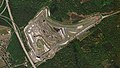 Hockenheimring, April 29, 2018 SkySat.jpg 3,185 × 1,792; 1.98 MB
-
 ISS057-E-51354 - View of Germany.jpg 5,568 × 3,712; 2.54 MB
-
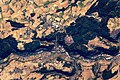
 Künzelsau from ISS.jpg 5,568 × 3,712; 3.64 MB
-
 RiesSteinheim-SW.png 1,080 × 712; 1.56 MB
-
 Swiss german border NASA.png 992 × 653; 1.4 MB
-
 Überlinger See with Mainau Island, Germany by Planet Labs.jpg 3,701 × 2,777; 3.2 MB


.jpg)
.jpg)


