Category:Satellite pictures of Cape Fold Belt
Media in category "Satellite pictures of Cape Fold Belt"
The following 11 files are in this category, out of 11 total.
-
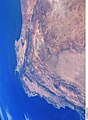
 ISS-38 Prince Albert, South Africa, rotated and enhanced.jpg 4,256 × 2,832; 1.63 MB
-
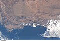
 ISS-38 Prince Albert, South Africa.jpg 4,256 × 2,832; 1.05 MB
-
 ISS006-E-18972 - View of South Africa.jpg 3,032 × 2,064; 1.07 MB
-
 ISS006-E-23333 - View of South Africa.jpg 2,064 × 2,824; 1.22 MB
-
 ISS006-E-36990 - View of South Africa.jpg 3,032 × 2,064; 1.25 MB
-
 ISS006-E-36991 - View of South Africa.jpg 3,032 × 2,064; 1.45 MB
-
 ISS006-E-37975 - View of South Africa.jpg 3,032 × 2,064; 1.26 MB
-
 ISS052-E-2624 - View of South Africa.jpg 4,928 × 3,280; 1.93 MB
-
 ISS059-E-91096 - View of South Africa.jpg 5,568 × 3,712; 4.57 MB
-
 Satellite image of Cape peninsula, Babilonstoring.jpg 475 × 411; 109 KB
-
 Satellite image of Cape peninsula, Kleinriviersberge.jpg 410 × 394; 70 KB


