Category:Satellite pictures of Lake Winnipeg
Media in category "Satellite pictures of Lake Winnipeg"
The following 13 files are in this category, out of 13 total.
-
 AlgaeLW.jpg 334 × 400; 27 KB
-
 ISS059-E-19273 - View of Manitoba.jpg 5,568 × 3,712; 4.83 MB
-
 Lake Winnepeg (MODIS 2020-08-09).jpg 3,096 × 2,568; 1.04 MB
-
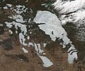
 Lake Winnipeg (MODIS 2016-04-28).jpg 3,188 × 2,452; 1.13 MB
-
 Lake Winnipeg (MODIS 2018-05-10).jpg 1,264 × 1,054; 250 KB
-
 Lake Winnipeg (MODIS 2018-12-12).jpg 2,812 × 2,349; 1.28 MB
-
 Lakewinnipeg oli2 2023268 Algae in Lake Winnipeg.jpg 720 × 1,000; 252 KB
-
 Lakewinnipeg oli2 2023268 lrg Algae in Lake Winnipeg.jpg 1,856 × 2,578; 1.09 MB
-
 Long Point, Lake Winnipeg, from orbit, Dec. 30, 2012.'.jpeg 1,020 × 679; 234 KB
-
 Playgreen Lake in Manitoba.jpg 517 × 397; 62 KB
-
 Reindeer Island ESA388436.jpg 3,000 × 2,329; 6.51 MB
-
 Reindeer Island ESA388436.tiff 6,590 × 5,115; 192.9 MB
-
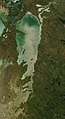 Satellite picture of Lake Winnipeg.jpg 1,125 × 2,066; 723 KB


.jpg)
.jpg)
.jpg)
.jpg)


